THE ADVENTURE COLLECTIVE® · Independent discovery and booking for outdoor travel

A full-day trek from Marrakech into the High Atlas that follows mule tracks, terraced fields and Berber hamlets around Imlil and Imnane Valley. Expect 6–12 km of hiking, cultural tea stops and panoramic ridge views.
A full-day trek from Marrakech into the High Atlas that follows mule tracks, terraced fields and Berber hamlets around Imlil and Imnane Valley. Expect 6–12 km of hiking, cultural tea stops and panoramic ridge views.
A crisp mountain light hits the red dust road as the van winds away from Marrakech toward the High Atlas. By the time the village of Imlil appears—perched at about 1,740 m—the air feels thinner and cooler; a handful of stone houses and mule tracks frame terraces that climb into rocky ridgelines. The day hike threads through Imnane Valley’s corn terraces, past Berber hamlets and warm tea stops, offering constant views of snow-capped ridges in winter and green gullies in spring.
Verified experiences and guided adventures in the surrounding area.
Operated by Maachou Mohamed · Imlil, Marrakech-Safi
A crisp mountain light hits the red dust road as the van winds away from Marrakech toward the High Atlas. By the time the village of Imlil appears—perched at about 1,740 m—the air feels thinner and cooler; a handful of stone houses and mule tracks frame terraces that climb into rocky ridgelines. The day hike threads through Imnane Valley’s corn terraces, past Berber hamlets and warm tea stops, offering constant views of snow-capped ridges in winter and green gullies in spring.
Geology here is granite and schist carved by millennia of meltwater; the valleys are narrow, steep and farmed on benches that reveal a human history of mountain agriculture. Culturally, the region is inhabited by Amazigh (Berber) communities who maintain seasonal grazing and terraced cultivation—expect friendly exchanges, local tea ceremonies and craft stalls in village squares.
Practically, the route is a full-day outing with roughly 6–12 km of walking depending on variant routes and 200–600 m of cumulative ascent. Trails range from packed dirt to rocky mule tracks and can be muddy after rain. Start early to avoid hottest hours in summer and to enjoy softer light for photos. Wear supportive hiking shoes, carry 2–3 liters of water, and bring layered clothing for rapid temperature swings. Guides often include pickup from Marrakech (about 1.5 hours driving each way), a local lunch and an introduction to tea-making. Respect private plots, ask before photographing people, and tip guides if service is good. The Atlas Day Hike is approachable for regular walkers and rewarding for anyone wanting a concrete glimpse into mountain life and landscape without technical climbing.
moderate.
6–8 hours (full-day including transfers).
Suitable for people who regularly walk 3–6 miles on uneven ground and can manage sustained uphill sections.
Approximately 60–90 minutes by road to Imlil depending on traffic and exact pickup point.
Imlil sits around 1,740 m—most visitors acclimatize quickly, but those sensitive to altitude should take it easy and hydrate.
Typical day trips include a local lunch and sometimes snacks and tea; confirm specifics with the operator before booking.
Children can participate if accustomed to walking several hours; they should be supervised and may need rest breaks on steeper sections.
The High Atlas valleys have been inhabited by Amazigh (Berber) communities for centuries; terracing and irrigation systems reflect long-standing mountain agriculture.
Trail erosion and water scarcity are local concerns—stick to established paths, avoid single-use plastics and support local guides to benefit the community.
Maachou Mohamed operates guided outdoor trips and adventures with an emphasis on safety, stewardship, and memorable experiences.
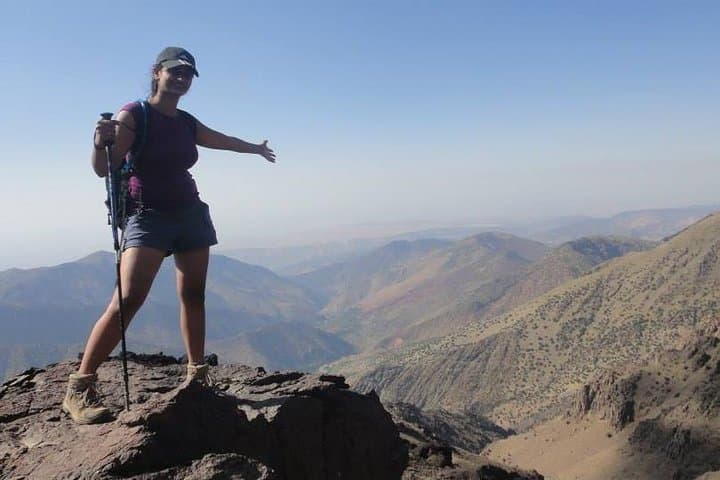
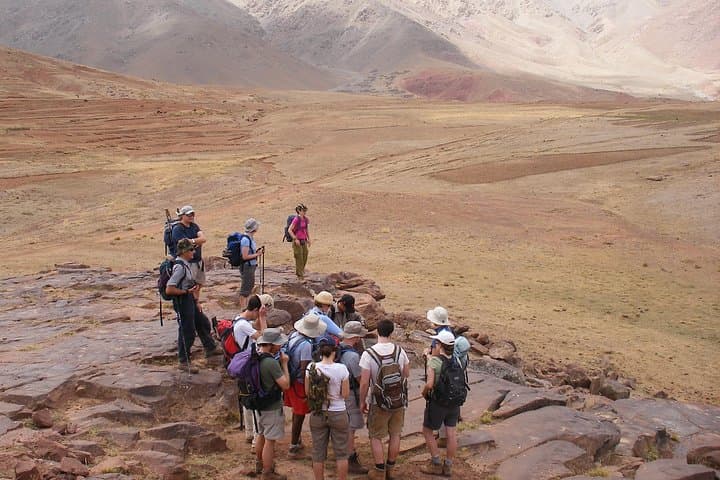
A crisp mountain light hits the red dust road as the van winds away from Marrakech toward the High Atlas. By the time the village of Imlil appears—perched at about 1,740 m—the air feels thinner and cooler; a handful of stone houses and mule tracks frame terraces that climb into rocky ridgelines. The day hike threads through Imnane Valley’s corn terraces, past Berber hamlets and warm tea stops, offering constant views of snow-capped ridges in winter and green gullies in spring.
A crisp mountain light hits the red dust road as the van winds away from Marrakech toward the High Atlas. By the time the village of Imlil appears—perched at about 1,740 m—the air feels thinner and cooler; a handful of stone houses and mule tracks frame terraces that climb into rocky ridgelines. The day hike threads through Imnane Valley’s corn terraces, past Berber hamlets and warm tea stops, offering constant views of snow-capped ridges in winter and green gullies in spring.
Geology here is granite and schist carved by millennia of meltwater; the valleys are narrow, steep and farmed on benches that reveal a human history of mountain agriculture. Culturally, the region is inhabited by Amazigh (Berber) communities who maintain seasonal grazing and terraced cultivation—expect friendly exchanges, local tea ceremonies and craft stalls in village squares.
Practically, the route is a full-day outing with roughly 6–12 km of walking depending on variant routes and 200–600 m of cumulative ascent. Trails range from packed dirt to rocky mule tracks and can be muddy after rain. Start early to avoid hottest hours in summer and to enjoy softer light for photos. Wear supportive hiking shoes, carry 2–3 liters of water, and bring layered clothing for rapid temperature swings. Guides often include pickup from Marrakech (about 1.5 hours driving each way), a local lunch and an introduction to tea-making. Respect private plots, ask before photographing people, and tip guides if service is good. The Atlas Day Hike is approachable for regular walkers and rewarding for anyone wanting a concrete glimpse into mountain life and landscape without technical climbing.