THE ADVENTURE COLLECTIVE® · Independent discovery and booking for outdoor travel

A short, scenic trail around the Arenal Observatory Lodge that rewards a 2–3 hour walk with dramatic volcano-and-lake viewpoints and rich birdlife. Ideal for casual hikers and photographers seeking sunset light and close-up volcanic scenery.
A short, scenic trail around the Arenal Observatory Lodge that rewards a 2–3 hour walk with dramatic volcano-and-lake viewpoints and rich birdlife. Ideal for casual hikers and photographers seeking sunset light and close-up volcanic scenery.
You step off the lodge path and the forest closes like a conversation — leaves whisper, a trogon calls, and the volcano watches, slow-breathing, across the valley.
Verified experiences and guided adventures in the surrounding area.
Operated by La Fortuna · La Fortuna, Alajuela
You step off the lodge path and the forest closes like a conversation — leaves whisper, a trogon calls, and the volcano watches, slow-breathing, across the valley.
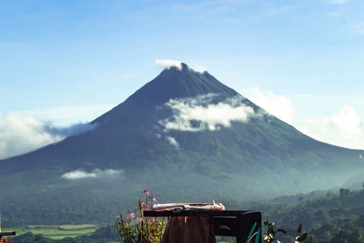
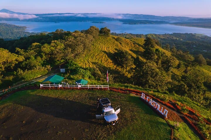
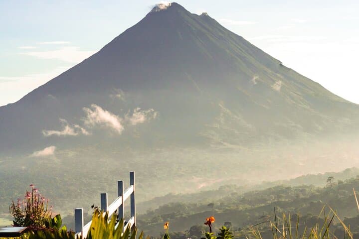
This 2–3 hour trail around the Arenal Observatory Lodge area weaves through secondary rainforest and open viewpoints that frame Arenal’s near-perfect cone and the spread of Lake Arenal below. Geologically, you’re walking on young volcanic soils laid down by eruptions that shaped this landscape over the last several thousand years; lava terraces and rich, fast-draining earth favor the dense, humid vegetation you move through. The area has long been part of local peasant and cattle-farming history; nearby villages like El Castillo have used these slopes for grazing and small-scale agriculture, which created the patchwork of forest and farmland you’ll see from the viewpoints.
Expect active birdlife — toucans and tanagers — and the occasional peccary rooting at the trail edge. The trail rises and falls gently: plan on roughly 3–6 km (2–4 miles) with modest elevation change, uneven packed-earth and occasional roots. Trails can be muddy after rains; sunsets often clear the air and magnify the volcano silhouette.
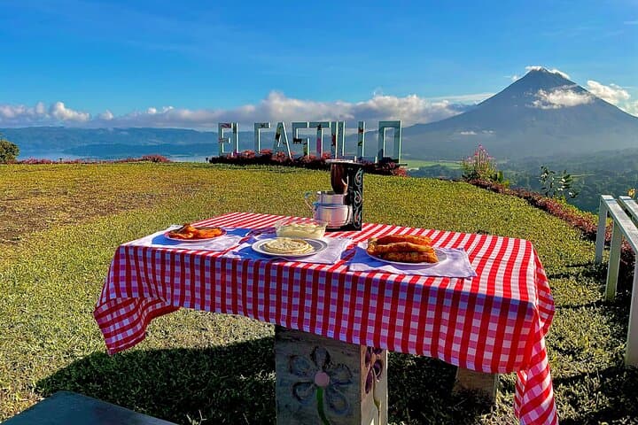
Practical guidance: start mid-afternoon for softer light, bring 1–2 liters of water, bug repellent and a lightweight rain jacket, and wear grippy shoes. Snacks are included at the main viewpoint, but carry personal provisions if you have special dietary needs. Respect wildlife distances and follow marked paths — the views are best when the trail stays intact.
easy.
2–3 hours.
Suitable for most fitness levels; can be completed by regular walkers and families comfortable with uneven paths.
The hike typically takes 2–3 hours and is rated easy with modest elevation change and some uneven terrain—suitable for most visitors.
The tour notes include local snacks at the main viewpoint, but bring personal snacks if you have dietary restrictions or need extra energy.
Late afternoon toward sunset gives the warmest light on Arenal and often the clearest views—mornings can be mistier but quieter for birds.
You may encounter tropical birds, toucans, tanagers and occasionally peccaries; sightings aren’t guaranteed but the area is biodiverse.
Local farms and ranches shaped the mosaic of pasture and forest around Arenal; the volcano’s eruptions in the 20th century dramatically changed land use and settlement patterns.
Stay on marked trails and pack out waste; the area relies on sustainable tourism and trail stewardship to protect soils and bird habitat.
La Fortuna operates guided outdoor trips and adventures with an emphasis on safety, stewardship, and memorable experiences.
You step off the lodge path and the forest closes like a conversation — leaves whisper, a trogon calls, and the volcano watches, slow-breathing, across the valley.
You step off the lodge path and the forest closes like a conversation — leaves whisper, a trogon calls, and the volcano watches, slow-breathing, across the valley.
This 2–3 hour trail around the Arenal Observatory Lodge area weaves through secondary rainforest and open viewpoints that frame Arenal’s near-perfect cone and the spread of Lake Arenal below. Geologically, you’re walking on young volcanic soils laid down by eruptions that shaped this landscape over the last several thousand years; lava terraces and rich, fast-draining earth favor the dense, humid vegetation you move through. The area has long been part of local peasant and cattle-farming history; nearby villages like El Castillo have used these slopes for grazing and small-scale agriculture, which created the patchwork of forest and farmland you’ll see from the viewpoints.
Expect active birdlife — toucans and tanagers — and the occasional peccary rooting at the trail edge. The trail rises and falls gently: plan on roughly 3–6 km (2–4 miles) with modest elevation change, uneven packed-earth and occasional roots. Trails can be muddy after rains; sunsets often clear the air and magnify the volcano silhouette.
Practical guidance: start mid-afternoon for softer light, bring 1–2 liters of water, bug repellent and a lightweight rain jacket, and wear grippy shoes. Snacks are included at the main viewpoint, but carry personal provisions if you have special dietary needs. Respect wildlife distances and follow marked paths — the views are best when the trail stays intact.