THE ADVENTURE COLLECTIVE® · Independent discovery and booking for outdoor travel

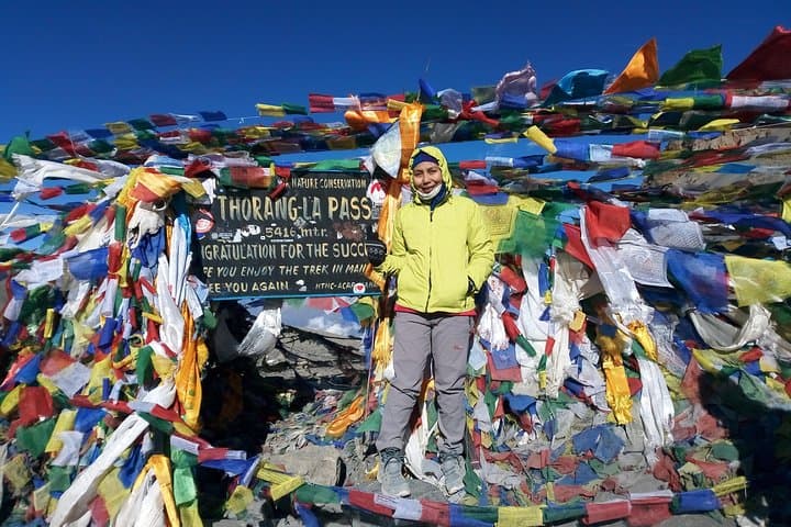
A classic 12-day traverse through the Annapurna region that combines high mountain passes, traditional villages, and tea-house stays. Expect long days, sharp elevation gain to Thorong La (5,416 m), and essential acclimatization in Manang.
A classic 12-day traverse through the Annapurna region that combines high mountain passes, traditional villages, and tea-house stays. Expect long days, sharp elevation gain to Thorong La (5,416 m), and essential acclimatization in Manang.
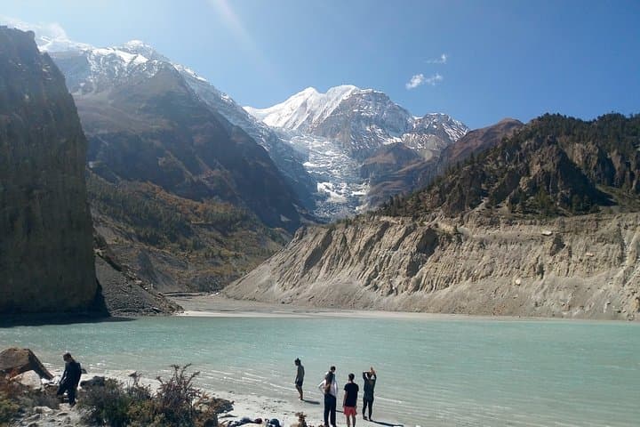
The trail opens like a long breath: terraced hills slip away below, pine-scented ridgelines fold into high, glinting glaciers, and the Annapurna massif keeps watch, its sharp teeth of rock and snow daring you onward.
Verified experiences and guided adventures in the surrounding area.
Operated by Nepal Himalayan Hiker (P) Ltd. · Pokhara, Gandaki Province
The trail opens like a long breath: terraced hills slip away below, pine-scented ridgelines fold into high, glinting glaciers, and the Annapurna massif keeps watch, its sharp teeth of rock and snow daring you onward.
This 12-day circuit threads decades-old mule tracks, Gurung and Thakali villages, and alpine meadows. Geologically the route traces faulted sedimentary terraces rising to the Thorong La (5,416 m), carrying trekkers from subtropical valleys through rhododendron forests into a brittle, high-altitude world. Culturally the trail passes mani walls, hilltop gompas, and the pilgrimage site of Muktinath—places where Hindu and Buddhist practices intersect and tea-house hospitality remains the backbone of the route.
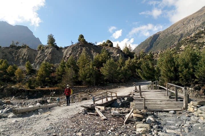
Expect mixed terrain: packed dirt, stone staircases, and exposed scree on higher passes. Typical daily hikes are 4–7 hours, with planned acclimatization in Manang; the hardest single day is the short but steep ascent to Thorong La and the descent to Muktinath. The region sits inside the Annapurna Conservation Area—conservation rules, permits, and local fees apply.
Practical guidance: carry layered insulation and a warm sleeping bag, pace for acclimatization, and use water-treatment methods; tea houses provide basic meals and lodgings but bring cash and small change. Weather changes quickly—mornings can be crystalline while afternoons bring wind or snow at altitude.
This route rewards persistence: expansive mountain panoramas, intimate village encounters, and the particular clarity that comes from moving steadily upward through one of the world’s most storied mountain circuits.
challenging.
12–13 days.
Good aerobic fitness; able to hike 4–7 hours daily with sustained elevation gain up to 5,400 m. Previous multi-day trekking experience recommended.
You need an Annapurna Conservation Area Permit (ACAP) and a TIMS card; these are obtained in Pokhara or Kathmandu and checked along the route.
Thorong La Pass is the highest point on the classic circuit at about 5,416 m (17,769 ft). Proper acclimatization is critical.
Yes—tea-house lodges line the route offering basic rooms and meals, but standards vary with remoteness; bring a warm sleeping bag and cash.
Fit beginners with prior day-hiking experience can succeed with careful pacing and acclimatization, but those unused to altitude should consider guided trips and extra rest days.
The Annapurna range is named for the Hindu goddess Annapurna; the area is managed by the Annapurna Conservation Area Project, a community-based conservation effort established in the 1980s.
Stay on marked trails, pack out waste when possible, and follow ACAP rules—local communities rely on sustainable tourism to protect fragile alpine ecosystems.
Nepal Himalayan Hiker (P) Ltd. operates guided outdoor trips and adventures with an emphasis on safety, stewardship, and memorable experiences.
The trail opens like a long breath: terraced hills slip away below, pine-scented ridgelines fold into high, glinting glaciers, and the Annapurna massif keeps watch, its sharp teeth of rock and snow daring you onward.
The trail opens like a long breath: terraced hills slip away below, pine-scented ridgelines fold into high, glinting glaciers, and the Annapurna massif keeps watch, its sharp teeth of rock and snow daring you onward.
This 12-day circuit threads decades-old mule tracks, Gurung and Thakali villages, and alpine meadows. Geologically the route traces faulted sedimentary terraces rising to the Thorong La (5,416 m), carrying trekkers from subtropical valleys through rhododendron forests into a brittle, high-altitude world. Culturally the trail passes mani walls, hilltop gompas, and the pilgrimage site of Muktinath—places where Hindu and Buddhist practices intersect and tea-house hospitality remains the backbone of the route.
Expect mixed terrain: packed dirt, stone staircases, and exposed scree on higher passes. Typical daily hikes are 4–7 hours, with planned acclimatization in Manang; the hardest single day is the short but steep ascent to Thorong La and the descent to Muktinath. The region sits inside the Annapurna Conservation Area—conservation rules, permits, and local fees apply.
Practical guidance: carry layered insulation and a warm sleeping bag, pace for acclimatization, and use water-treatment methods; tea houses provide basic meals and lodgings but bring cash and small change. Weather changes quickly—mornings can be crystalline while afternoons bring wind or snow at altitude.
This route rewards persistence: expansive mountain panoramas, intimate village encounters, and the particular clarity that comes from moving steadily upward through one of the world’s most storied mountain circuits.