THE ADVENTURE COLLECTIVE® · Independent discovery and booking for outdoor travel

A full-circuit trek around the Annapurna Massif that spans multiple climates and cultures. This 12–20 day Himalayan route combines high passes, teahouse nights and sweeping mountain views—plan for altitude and variable terrain.
A full-circuit trek around the Annapurna Massif that spans multiple climates and cultures. This 12–20 day Himalayan route combines high passes, teahouse nights and sweeping mountain views—plan for altitude and variable terrain.
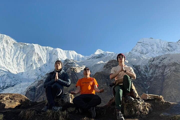
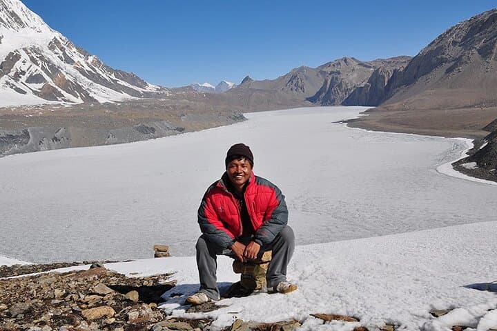
You step off the dusty jeep as a cool mountain wind pushes down the valley, rhododendron trunks dark against snow-capped ridgelines. The trail climbs out of terraced rice fields and folds through oak and pine, then opens onto brittle, high-altitude desert where Annapurna’s jagged faces sharpen the sky.
Verified experiences and guided adventures in the surrounding area.
Operated by Everest Trekking Routes Pvt. Ltd. · Pokhara, Gandaki Province
You step off the dusty jeep as a cool mountain wind pushes down the valley, rhododendron trunks dark against snow-capped ridgelines. The trail climbs out of terraced rice fields and folds through oak and pine, then opens onto brittle, high-altitude desert where Annapurna’s jagged faces sharpen the sky.
The Circuit traces a cultural and geological cross-section of Nepal: subtropical foothills, lush mid-elevation forests, alpine meadows, and the rain-shadow deserts above Manang. Geologically, the route skirts the massive thrusts that raised the Himalaya—rock changes from metamorphic schist to limestone slabs as elevation rises. Culturally, villages along the way reflect Gurung, Magar and Tibetan-influenced communities; teahouses, mani walls and gompas punctuate the path.
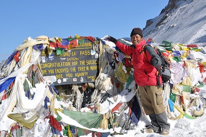
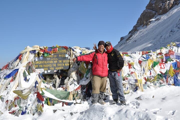
Expect distance of roughly 160–230 km (100–145 miles) depending on your route, and sustained elevation gain from ~800–1,300 m in the valleys up to Thorong La Pass at 5,416 m. Terrain alternates rocky switchbacks, dusty mule tracks and packed-soil village lanes. Weather shifts quickly: sun can blaze in the afternoon and thin air brings sharp nights.
Practical guidance: acclimatize—build in rest days in Manang or at High Camp, carry a water filter and layered clothing, and plan for tea-house stays or tented nights above the settlements. Permits (TIMS and ACAP) are required; professional guides and porters are common and advisable for high-altitude safety. Hydrate, pace your ascent, and watch for signs of altitude illness. When the valley wind bites, the mountains keep you honest—and the views repay the effort with long, hard-earned panoramas of Annapurna I, Dhaulagiri and Machapuchare.
challenging.
12–20 days.
High level of aerobic fitness and prior multi-day trekking experience recommended; able to hike 5–8 hours daily with a moderate pack.
Yes—trekkers require an ACAP permit and a TIMS card; these are typically arranged in Kathmandu or Pokhara or via your operator.
Thorong La Pass at roughly 5,416 meters is the highest and most exposed section; acclimatization is crucial before attempting it.
Yes—most of the circuit is serviced by teahouses providing beds and meals, though above certain elevations facilities become more basic.
Spring (March–May) and autumn (Sept–Nov) offer the most stable weather and clearer views; shoulder seasons are colder and monsoon months bring landslides and heavy rain.
The circuit follows traditional trade routes between Nepal’s valleys and Tibetan plateaus; villages retain Tibetan-influenced art, prayer wheels and mani stones.
The Annapurna Conservation Area (ACAP) manages permits and sustainable tourism; stick to trails, pack out waste where possible and support local teahouses to reduce impact.
Everest Trekking Routes Pvt. Ltd. operates guided outdoor trips and adventures with an emphasis on safety, stewardship, and memorable experiences.
You step off the dusty jeep as a cool mountain wind pushes down the valley, rhododendron trunks dark against snow-capped ridgelines. The trail climbs out of terraced rice fields and folds through oak and pine, then opens onto brittle, high-altitude desert where Annapurna’s jagged faces sharpen the sky.
You step off the dusty jeep as a cool mountain wind pushes down the valley, rhododendron trunks dark against snow-capped ridgelines. The trail climbs out of terraced rice fields and folds through oak and pine, then opens onto brittle, high-altitude desert where Annapurna’s jagged faces sharpen the sky.
The Circuit traces a cultural and geological cross-section of Nepal: subtropical foothills, lush mid-elevation forests, alpine meadows, and the rain-shadow deserts above Manang. Geologically, the route skirts the massive thrusts that raised the Himalaya—rock changes from metamorphic schist to limestone slabs as elevation rises. Culturally, villages along the way reflect Gurung, Magar and Tibetan-influenced communities; teahouses, mani walls and gompas punctuate the path.
Expect distance of roughly 160–230 km (100–145 miles) depending on your route, and sustained elevation gain from ~800–1,300 m in the valleys up to Thorong La Pass at 5,416 m. Terrain alternates rocky switchbacks, dusty mule tracks and packed-soil village lanes. Weather shifts quickly: sun can blaze in the afternoon and thin air brings sharp nights.
Practical guidance: acclimatize—build in rest days in Manang or at High Camp, carry a water filter and layered clothing, and plan for tea-house stays or tented nights above the settlements. Permits (TIMS and ACAP) are required; professional guides and porters are common and advisable for high-altitude safety. Hydrate, pace your ascent, and watch for signs of altitude illness. When the valley wind bites, the mountains keep you honest—and the views repay the effort with long, hard-earned panoramas of Annapurna I, Dhaulagiri and Machapuchare.