THE ADVENTURE COLLECTIVE® · Independent discovery and booking for outdoor travel

Follow the Marsyangdi Valley into the heart of the Annapurna massif on a 17-day trek that crosses Thorung La Pass and threads high villages, teahouses and pilgrimage sites. Expect long days, sharp elevation gain and essential acclimatization.
Follow the Marsyangdi Valley into the heart of the Annapurna massif on a 17-day trek that crosses Thorung La Pass and threads high villages, teahouses and pilgrimage sites. Expect long days, sharp elevation gain and essential acclimatization.
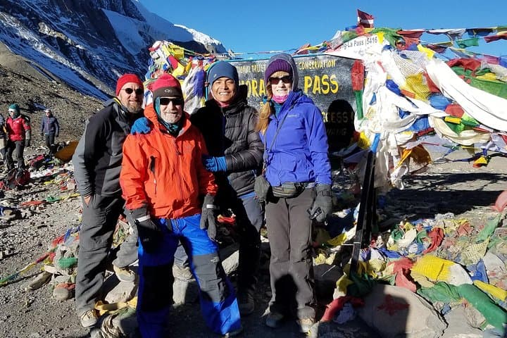
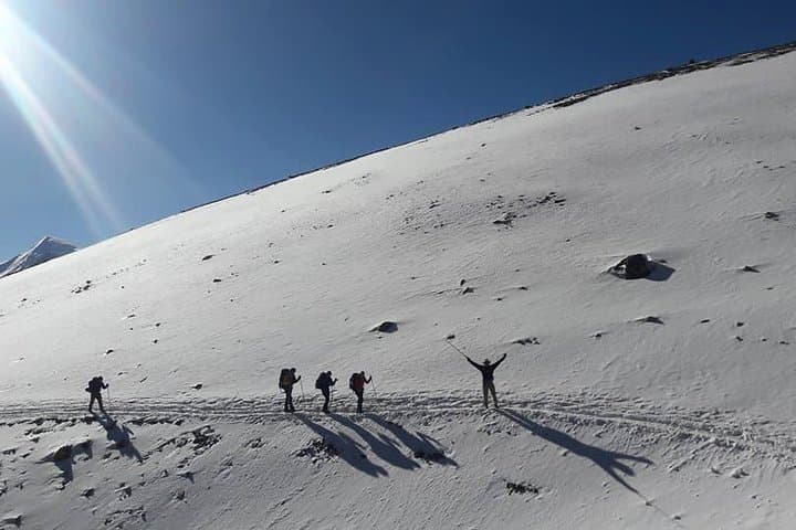
The trail opens on the lip of the Marsyangdi Valley, where terraced fields fall away and the river below dares you to follow. Early mornings are cold and clear; prayer flags snap in the wind while distant peaks—Gangapurna, Annapurna II and IV—loom like geological pages turned by time.
Verified experiences and guided adventures in the surrounding area.
Operated by Annapurna Foothills Treks Expedition Pvt. Ltd. · Manang, Gandaki Province
The trail opens on the lip of the Marsyangdi Valley, where terraced fields fall away and the river below dares you to follow. Early mornings are cold and clear; prayer flags snap in the wind while distant peaks—Gangapurna, Annapurna II and IV—loom like geological pages turned by time.
This route traces an ancient trans-Himalayan trade corridor that once linked Nepal with Tibet. The Annapurna massif is the result of the Indian and Eurasian plates colliding, uplifted into jagged granite and metamorphic ridges. Villages you pass—filled with Gurung and Thakali communities—feature stone teahouses, mani walls and cuisine adapted for altitude: barley, yak butter tea, and simple dal bhat.
Practical details matter here. The full itinerary covers roughly 17 days with daily stages from short 7 km walks to long 27 km days; highest altitude is Thorung La Pass at 5,416 m (17,769 ft). Key nights include Manang (acclimatization), Yak Kharka and Muktinath; plan an acclimatization day in Manang and expect one 9–10 hour summit day over Thorung La. Lodging is teahouse-style—basic rooms, communal dining. Permits required include TIMS and Annapurna Conservation Area fees. Weather windows: spring (March–May) and fall (Sept–Nov) offer the most stable conditions; monsoon brings mud and leeches, winter brings snow on the pass.
Gear for layered cold, sturdy boots, and sun protection is non-negotiable. Hire a porter if you want lighter days. Hydrate, monitor for AMS symptoms, and leave no trace—local communities and the Annapurna Conservation Area rely on responsible visitation.
challenging.
17 days.
Requires high aerobic fitness and experience with multi-day high-altitude hiking; ability to hike 4–9 hours on steep, rocky terrain.
Spring (March–May) and fall (September–November) offer the most stable weather, clearer mountain views and warmer teahouse conditions; monsoon brings mud and cloudy skies, winter brings heavy snow on Thorung La.
You need the TIMS card and an Annapurna Conservation Area Permit (ACAP); guides or operators typically arrange these before the trek begins.
The route reaches 5,416 m at Thorung La, so altitude sickness is a real risk; follow a paced acclimatization schedule, stay hydrated, and descend immediately if severe symptoms develop.
Yes—licensed Sherpa guides and porters are available and commonly recommended for safety, navigation and to ease the physical load.
The circuit follows old trade routes between Nepal and Tibet; Muktinath remains an important pilgrimage site for Hindus and Buddhists.
The Annapurna Conservation Area manages permits and community programs—travelers should stick to trails, avoid single-use plastics and support local teahouses.
Annapurna Foothills Treks Expedition Pvt. Ltd. operates guided outdoor trips and adventures with an emphasis on safety, stewardship, and memorable experiences.


The trail opens on the lip of the Marsyangdi Valley, where terraced fields fall away and the river below dares you to follow. Early mornings are cold and clear; prayer flags snap in the wind while distant peaks—Gangapurna, Annapurna II and IV—loom like geological pages turned by time.
The trail opens on the lip of the Marsyangdi Valley, where terraced fields fall away and the river below dares you to follow. Early mornings are cold and clear; prayer flags snap in the wind while distant peaks—Gangapurna, Annapurna II and IV—loom like geological pages turned by time.
This route traces an ancient trans-Himalayan trade corridor that once linked Nepal with Tibet. The Annapurna massif is the result of the Indian and Eurasian plates colliding, uplifted into jagged granite and metamorphic ridges. Villages you pass—filled with Gurung and Thakali communities—feature stone teahouses, mani walls and cuisine adapted for altitude: barley, yak butter tea, and simple dal bhat.
Practical details matter here. The full itinerary covers roughly 17 days with daily stages from short 7 km walks to long 27 km days; highest altitude is Thorung La Pass at 5,416 m (17,769 ft). Key nights include Manang (acclimatization), Yak Kharka and Muktinath; plan an acclimatization day in Manang and expect one 9–10 hour summit day over Thorung La. Lodging is teahouse-style—basic rooms, communal dining. Permits required include TIMS and Annapurna Conservation Area fees. Weather windows: spring (March–May) and fall (Sept–Nov) offer the most stable conditions; monsoon brings mud and leeches, winter brings snow on the pass.
Gear for layered cold, sturdy boots, and sun protection is non-negotiable. Hire a porter if you want lighter days. Hydrate, monitor for AMS symptoms, and leave no trace—local communities and the Annapurna Conservation Area rely on responsible visitation.