THE ADVENTURE COLLECTIVE® · Independent discovery and booking for outdoor travel

A 12-day teahouse trek from Nayapul via Ghorepani and Machhapuchhre Base Camp to Annapurna Base Camp. Expect forest stairways, sunrise at Poon Hill and high-mountain vistas above 4,000 m.
A 12-day teahouse trek from Nayapul via Ghorepani and Machhapuchhre Base Camp to Annapurna Base Camp. Expect forest stairways, sunrise at Poon Hill and high-mountain vistas above 4,000 m.
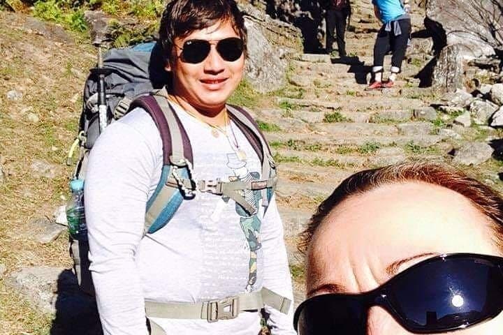
Dawn breaks over Kathmandu as the trek begins: a dusty drive to Pokhara, then the narrow road to Nayapul. The first steps drop into valley light, stairways of stone rising through rhododendron and oak as you climb to Ulleri. Each day alternates forested ascents and open ridgelines; Poon Hill offers a sunrise that pushes the clouds aside and reveals the serrated profile of Annapurna I.
Verified experiences and guided adventures in the surrounding area.
Operated by nepal tourism adventure kathmandu · Pokhara, Gandaki Pradesh
Dawn breaks over Kathmandu as the trek begins: a dusty drive to Pokhara, then the narrow road to Nayapul. The first steps drop into valley light, stairways of stone rising through rhododendron and oak as you climb to Ulleri. Each day alternates forested ascents and open ridgelines; Poon Hill offers a sunrise that pushes the clouds aside and reveals the serrated profile of Annapurna I.
This route threads cultural and geological chapters. Villages are largely Gurung and Magar communities where stone houses and terraced fields cling to steep slopes. Geologically the trail moves from subtropical river valleys into the high Himalayan amphitheatre carved by glaciers — you finish inside a cirque under the Annapurna massif and Machhapuchhre (Fishtail).
Expect a teahouse-style trek: shared lodges, simple meals, and steady uphill miles. Elevations commonly covered in this itinerary: Ghorepani ~2,860 m, Poon Hill ~3,210 m, Machhapuchhre Base Camp ~3,700 m and Annapurna Base Camp ~4,130 m. Terrain is mixed — packed dirt, stone staircases, some muddy sections in wet months and loose scree approaching the high camps.
Practical guidance: pace the ascent to reduce altitude effects, carry water purification and layered insulation, and plan for early mornings for the best weather windows. Allow for 10–14 days depending on acclimatization; local guides manage permits and logistics through the Annapurna Conservation Area Project. Bring cash for teahouses, expect basic facilities above 2,500 m, and reserve contingency time for weather or trail delays.
challenging.
10–14 days.
Good aerobic fitness with experience on multi-day hikes; able to walk 4–8 hours/day on uneven terrain.
Trekking in the Annapurna region requires TIMS and an Annapurna Conservation Area permit; guides or agencies normally arrange these before departure.
Physically fit beginners can complete it with proper pacing and acclimatization, but prior multi-day hiking experience is helpful.
Night temperatures at ABC can drop below -5°C (23°F) outside summer; bring warm layers and a good sleeping bag if staying in high-altitude lodges.
Yes — the route is serviced by teahouses offering basic rooms and meals, though facilities become simpler above 3,000 m and cash-only.
The Annapurna massif was the objective of 1950s Himalayan expeditions; local Gurung and Magar communities have long maintained trans-Himalayan trails and hospitality traditions.
The trek crosses the Annapurna Conservation Area — follow Leave No Trace, dispose waste at marked points, and respect tea-house composting and water use guidelines.
nepal tourism adventure kathmandu operates guided outdoor trips and adventures with an emphasis on safety, stewardship, and memorable experiences.

Dawn breaks over Kathmandu as the trek begins: a dusty drive to Pokhara, then the narrow road to Nayapul. The first steps drop into valley light, stairways of stone rising through rhododendron and oak as you climb to Ulleri. Each day alternates forested ascents and open ridgelines; Poon Hill offers a sunrise that pushes the clouds aside and reveals the serrated profile of Annapurna I.
Dawn breaks over Kathmandu as the trek begins: a dusty drive to Pokhara, then the narrow road to Nayapul. The first steps drop into valley light, stairways of stone rising through rhododendron and oak as you climb to Ulleri. Each day alternates forested ascents and open ridgelines; Poon Hill offers a sunrise that pushes the clouds aside and reveals the serrated profile of Annapurna I.
This route threads cultural and geological chapters. Villages are largely Gurung and Magar communities where stone houses and terraced fields cling to steep slopes. Geologically the trail moves from subtropical river valleys into the high Himalayan amphitheatre carved by glaciers — you finish inside a cirque under the Annapurna massif and Machhapuchhre (Fishtail).
Expect a teahouse-style trek: shared lodges, simple meals, and steady uphill miles. Elevations commonly covered in this itinerary: Ghorepani ~2,860 m, Poon Hill ~3,210 m, Machhapuchhre Base Camp ~3,700 m and Annapurna Base Camp ~4,130 m. Terrain is mixed — packed dirt, stone staircases, some muddy sections in wet months and loose scree approaching the high camps.
Practical guidance: pace the ascent to reduce altitude effects, carry water purification and layered insulation, and plan for early mornings for the best weather windows. Allow for 10–14 days depending on acclimatization; local guides manage permits and logistics through the Annapurna Conservation Area Project. Bring cash for teahouses, expect basic facilities above 2,500 m, and reserve contingency time for weather or trail delays.