THE ADVENTURE COLLECTIVE® · Independent discovery and booking for outdoor travel

A compact three-day route that drops from high Andean calderas to the thunder of Amazon tributaries. Expect crater rims, volcanic vistas, hot springs and a curtain of waterfalls on the road to the Pastaza basin.
A compact three-day route that drops from high Andean calderas to the thunder of Amazon tributaries. Expect crater rims, volcanic vistas, hot springs and a curtain of waterfalls on the road to the Pastaza basin.
Morning light slices across the Avenue of the Volcanoes as a private vehicle climbs away from Quito and into thin, clean air. On day one the group stands at the rim of Quilotoa — a 3 km-wide water-filled caldera (~3,900–3,950 m) — where wind and clouds trade colors over a glassy lake. The route then drops hundreds of meters in elevation toward Baños, a bustling mountain town whose steam and hot springs promise recovery.
Verified experiences and guided adventures in the surrounding area.
Operated by Neotropical Nature and Birding Trips · Baños de Agua Santa, Tungurahua
Morning light slices across the Avenue of the Volcanoes as a private vehicle climbs away from Quito and into thin, clean air. On day one the group stands at the rim of Quilotoa — a 3 km-wide water-filled caldera (~3,900–3,950 m) — where wind and clouds trade colors over a glassy lake. The route then drops hundreds of meters in elevation toward Baños, a bustling mountain town whose steam and hot springs promise recovery.
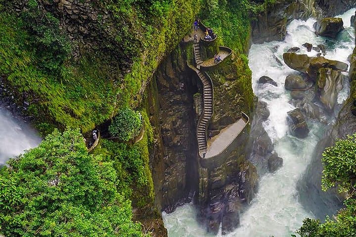
The itinerary stitches together distinct landscapes: high volcanic páramo sculpted by glaciers, the steep forested drainage feeding the Pastaza, and finally the humid edge of the Amazon Basin. Quilotoa formed after a catastrophic eruption; Cotopaxi (5,897 m) is one of the world’s highest active volcanos and dominates the skyline above Limpiopungo Lagoon. Baños’ Ruta de las Cascadas showcases Pailón del Diablo — a thunderous 60–80 m fall — and a network of smaller cascades that carved the valley toward Puyo.
Local culture slides between highland indigenous markets and the warm, river-side communities in Pastaza Province; guides often include visits to community reserves like Hola Vida that focus on sustainable development.
Practical guidance: plan for wide temperature swings and altitude changes of 1,500–2,000 m over the trip. Quilotoa rim hikes range up to ~8–10 km if you loop the crater; descending to the lake is steep (≈300–500 m elevation change) and loose underfoot. Expect uneven trails, river viewpoints on variable roads, and hot, humid conditions when you reach the Pastaza lowlands.
Hydration, layered clothing, and sturdy boots make the difference between a taxing day and a memorable one.
moderate.
3 days.
Moderate fitness: able to hike 3–10 km on uneven terrain and handle altitude changes
Altitudes range from ~1,800 m (Baños) to ~3,900 m (Quilotoa) and up to park areas near 3,700–3,900 m; acetazolamide can help but consult a physician—pacing, hydration and rest are first-line measures.
Most trails are non-technical but uneven; short children should be accompanied on steep descents and waterfall viewpoints which have slippery sections.
This itinerary includes private transport: expect 3–4 hour drives (Quito–Quilotoa, Quilotoa–Baños, Baños–Cotopaxi) depending on stops and road conditions.
Quilotoa has kayak rentals at the lake but conditions are cold and wind-exposed; Baños offers thermal baths and river swimming in controlled areas, while waterfalls are for viewing rather than swimming near strong currents.
The Avenue of the Volcanoes was named by early explorers including Humboldt; these routes link pre-Columbian highland communities and volcanic landscapes shaped over millennia.
High-altitude páramo and lowland rainforest are fragile—stick to trails, avoid single-use plastics, and support community conservation projects like Hola Vida.
Neotropical Nature and Birding Trips operates guided outdoor trips and adventures with an emphasis on safety, stewardship, and memorable experiences.
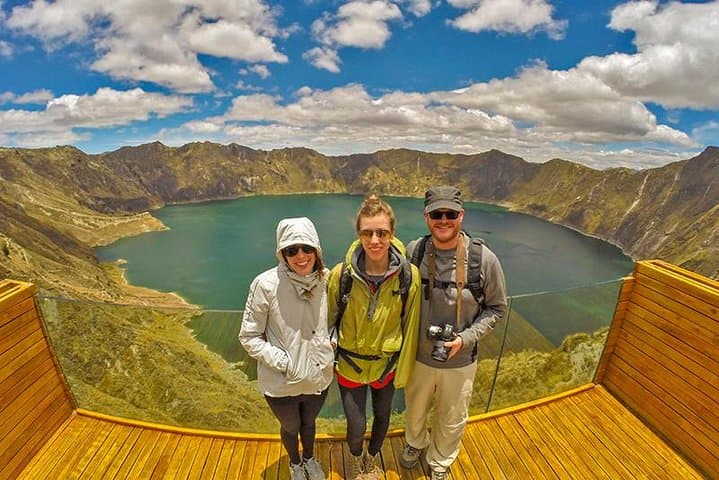
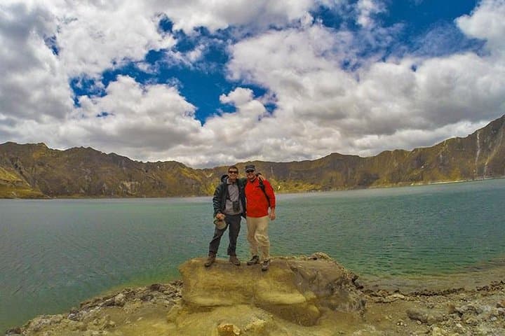
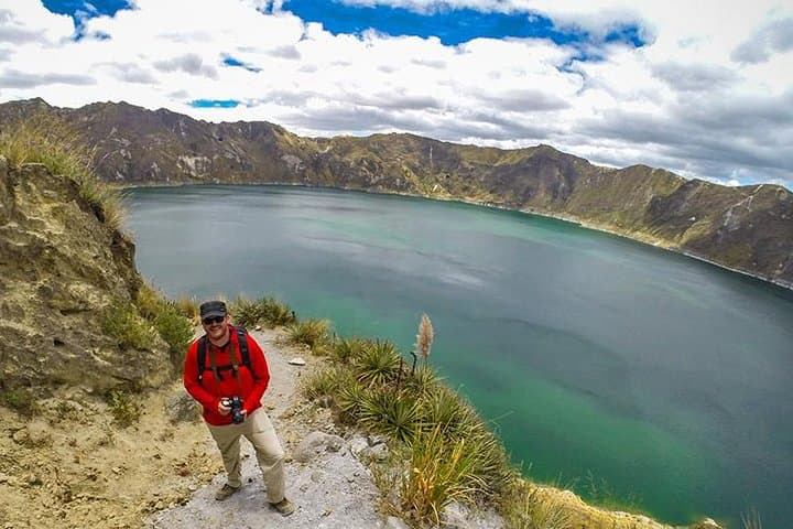
Morning light slices across the Avenue of the Volcanoes as a private vehicle climbs away from Quito and into thin, clean air. On day one the group stands at the rim of Quilotoa — a 3 km-wide water-filled caldera (~3,900–3,950 m) — where wind and clouds trade colors over a glassy lake. The route then drops hundreds of meters in elevation toward Baños, a bustling mountain town whose steam and hot springs promise recovery.
Morning light slices across the Avenue of the Volcanoes as a private vehicle climbs away from Quito and into thin, clean air. On day one the group stands at the rim of Quilotoa — a 3 km-wide water-filled caldera (~3,900–3,950 m) — where wind and clouds trade colors over a glassy lake. The route then drops hundreds of meters in elevation toward Baños, a bustling mountain town whose steam and hot springs promise recovery.
The itinerary stitches together distinct landscapes: high volcanic páramo sculpted by glaciers, the steep forested drainage feeding the Pastaza, and finally the humid edge of the Amazon Basin. Quilotoa formed after a catastrophic eruption; Cotopaxi (5,897 m) is one of the world’s highest active volcanos and dominates the skyline above Limpiopungo Lagoon. Baños’ Ruta de las Cascadas showcases Pailón del Diablo — a thunderous 60–80 m fall — and a network of smaller cascades that carved the valley toward Puyo.
Local culture slides between highland indigenous markets and the warm, river-side communities in Pastaza Province; guides often include visits to community reserves like Hola Vida that focus on sustainable development.
Practical guidance: plan for wide temperature swings and altitude changes of 1,500–2,000 m over the trip. Quilotoa rim hikes range up to ~8–10 km if you loop the crater; descending to the lake is steep (≈300–500 m elevation change) and loose underfoot. Expect uneven trails, river viewpoints on variable roads, and hot, humid conditions when you reach the Pastaza lowlands.
Hydration, layered clothing, and sturdy boots make the difference between a taxing day and a memorable one.