THE ADVENTURE COLLECTIVE® · Independent discovery and booking for outdoor travel

A short forest hike up Altabakken delivers wide views over Alta—cruise port, river and airport—on a compact 2 km route. Expect a single ascent/descent, private transport, snacks and quick photo stops.
A short forest hike up Altabakken delivers wide views over Alta—cruise port, river and airport—on a compact 2 km route. Expect a single ascent/descent, private transport, snacks and quick photo stops.
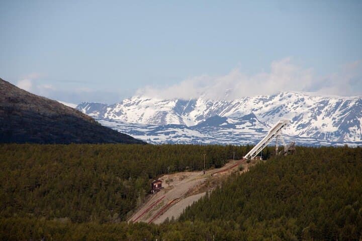
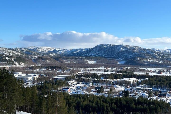
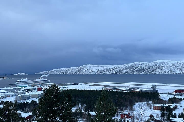
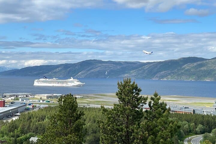
You push through a stand of stunted birch and pine, the trail soft with needle and thaw, and then the town of Alta opens below—cruise port glinting, the river threading silver, runways and neighborhoods stepping back into the tundra.
Verified experiences and guided adventures in the surrounding area.
Operated by Altatour · Alta, Troms og Finnmark
You push through a stand of stunted birch and pine, the trail soft with needle and thaw, and then the town of Alta opens below—cruise port glinting, the river threading silver, runways and neighborhoods stepping back into the tundra.
Altabakken sits on the slopes above Alta and has long been a local lookout: wartime observers and post-war skiers used the rise to read weather and watch shipping. Geologically the ridge is part of Finnmark's low plateaus carved by glacial scouring; rocky outcrops give way to thin soils and hardy vegetation that frame long northern light.
On clear days you can pick out Aronnes, Elvebakken, Bukta and the airport, and in winter the scene shifts—lights and long shadows replace the summer spread. Culture here is practical and outdoor-minded; locals use the same tracks for commuting, training and kid play, so tread respectfully and expect shared-use etiquette.
The activity itself is straightforward: a roughly 2 km forest hike with one steady ascent and descent, usually completed in about 2–3 hours including stops. The outing includes private transport, light snacks and hot coffee, but plan for variable weather—wind can change quickly and footing can be uneven. Bring sturdy footwear, layers, water and a compact camera or phone with extra battery for cold snaps. Note health restrictions: not advised for those pregnant or with certain spinal or heart conditions. Aim for morning or late-afternoon for softer light and fewer people. Whether you come for a brisk workout or an easy viewpoint, Altabakken rewards with a clear sense of place: a town, a river and a northern coast laid out below, daring you to take it all in.
moderate.
2–3 hours.
Suitable for reasonably active people comfortable with a steady short ascent and descent; not technical but some stamina required
The walking portion is about 2 km with one ascent and descent; total experience with transport and stops typically lasts 2–3 hours.
Yes. The outing includes private transportation to and from the trailhead as noted in the inclusions.
The route is short and accessible for many ages, but not recommended for those with spinal, cardiovascular issues, or pregnancy per provider guidance.
Light snacks and hot coffee or tea are provided; bring water and extra layers for weather protection.
Altabakken has been used historically as a lookout and ski hill; local tracks grew from practical routes between settlements and the coast.
Stay on marked tracks to protect thin tundra soils and lichens; pack out waste and avoid disturbing nesting birds along the coast.
Altatour operates guided outdoor trips and adventures with an emphasis on safety, stewardship, and memorable experiences.
You push through a stand of stunted birch and pine, the trail soft with needle and thaw, and then the town of Alta opens below—cruise port glinting, the river threading silver, runways and neighborhoods stepping back into the tundra.
You push through a stand of stunted birch and pine, the trail soft with needle and thaw, and then the town of Alta opens below—cruise port glinting, the river threading silver, runways and neighborhoods stepping back into the tundra.
Altabakken sits on the slopes above Alta and has long been a local lookout: wartime observers and post-war skiers used the rise to read weather and watch shipping. Geologically the ridge is part of Finnmark's low plateaus carved by glacial scouring; rocky outcrops give way to thin soils and hardy vegetation that frame long northern light.
On clear days you can pick out Aronnes, Elvebakken, Bukta and the airport, and in winter the scene shifts—lights and long shadows replace the summer spread. Culture here is practical and outdoor-minded; locals use the same tracks for commuting, training and kid play, so tread respectfully and expect shared-use etiquette.
The activity itself is straightforward: a roughly 2 km forest hike with one steady ascent and descent, usually completed in about 2–3 hours including stops. The outing includes private transport, light snacks and hot coffee, but plan for variable weather—wind can change quickly and footing can be uneven. Bring sturdy footwear, layers, water and a compact camera or phone with extra battery for cold snaps. Note health restrictions: not advised for those pregnant or with certain spinal or heart conditions. Aim for morning or late-afternoon for softer light and fewer people. Whether you come for a brisk workout or an easy viewpoint, Altabakken rewards with a clear sense of place: a town, a river and a northern coast laid out below, daring you to take it all in.