THE ADVENTURE COLLECTIVE® · Independent discovery and booking for outdoor travel

An 11‑day high‑altitude trek from Huaraz to Alpamayo’s north base camp that combines remote glacial valleys, high passes to ~4,850 m, and a community‑support day where part of your fee funds local aid. Expect long days, tented camps, and stark alpine scenery.
An 11‑day high‑altitude trek from Huaraz to Alpamayo’s north base camp that combines remote glacial valleys, high passes to ~4,850 m, and a community‑support day where part of your fee funds local aid. Expect long days, tented camps, and stark alpine scenery.
Dawn breaks thin and bright over the Cordillera Blanca as you shoulder your pack and step into the high puna. Wind scrapes across moraines, and a pyramidal wall of ice—Alpamayo’s north face—holds the light like a white cliff. Daylight reveals terraces of bofedales and the thread of a mountain river that will guide you from Pomabamba up through Garampayoc and across a series of 4,400–4,850 m passes.
Verified experiences and guided adventures in the surrounding area.
Operated by First Class Huaraz · Huaraz, Ancash
Dawn breaks thin and bright over the Cordillera Blanca as you shoulder your pack and step into the high puna. Wind scrapes across moraines, and a pyramidal wall of ice—Alpamayo’s north face—holds the light like a white cliff. Daylight reveals terraces of bofedales and the thread of a mountain river that will guide you from Pomabamba up through Garampayoc and across a series of 4,400–4,850 m passes.
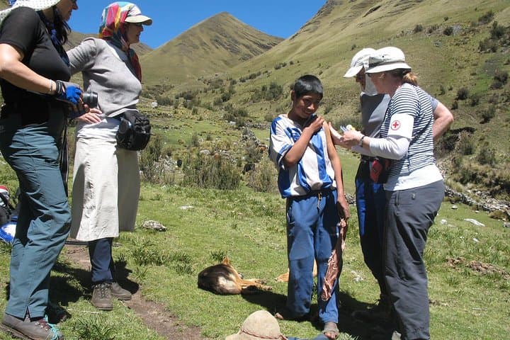
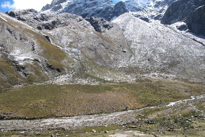
This route moves through landscapes carved by recent glaciation: steep cirques, turquoise moraine lakes such as Garampayoc and Cullicocha, and broad high valleys where pastoral Quechua communities graze llamas and tend native crops. The Cordillera Blanca is young, uplifted granite punctured by vertical glacial ice; culturally, the route passes villages where Catholic and Andean traditions overlap and community-based tourism funds local projects.
Expect long walking days—most stages are 7–9 hours with cumulative elevation gains of several hundred metres per day—and nights in two-person tents from ~3,800–4,250 m. Weather shifts fast: dry, sunny mornings can give way to afternoon showers in the wet season. Hydration, steady pace, and conservative altitude management are essential.
Practical guidance: plan for an 11-day itinerary with multiple high passes to ~4,850 m, bring an insulated sleeping bag, warm layers, and waterproof shell, and use trekking poles to protect knees on descents. The tour includes local meals and a community-support day where a portion of fees funds direct aid; be prepared to walk on mixed terrain—animal trails, scree, and mule tracks—and to respect local customs when visiting villages.
challenging.
11 days.
Good aerobic fitness with prior multi‑day hiking experience; comfortable with sustained daily hikes of 7–9 hours and moderate altitude exposure.
No technical climbing skills are required—the route is a high‑altitude trek with camping; however, good fitness and previous multi‑day hiking experience are recommended.
The itinerary crosses passes up to about 4,850 m; prepare by acclimatizing in Huaraz, hydrating, sleeping well, and pacing your ascent conservatively.
Formal entry to Huascarán National Park is commonly required for parts of the Cordillera Blanca; your operator typically handles park fees and logistics—confirm during booking.
The tour includes breakfast, lunch and dinner on most days and two‑person tents; expect simple, high‑calorie mountain meals prepared by support staff.
The valleys are inhabited by Quechua communities whose pastoral cycles and potato terraces predate the Spanish era; many villages maintain textile and weaving traditions tied to local identity.
The Cordillera Blanca’s fragile puna and glacial systems are sensitive to foot traffic and climate change—practice Leave No Trace and follow local rules; community‑support components of some tours channel fee revenue directly to local needs.
First Class Huaraz operates guided outdoor trips and adventures with an emphasis on safety, stewardship, and memorable experiences.
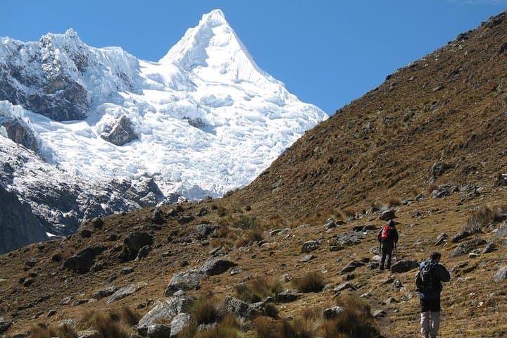
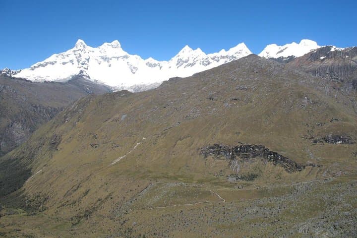
Dawn breaks thin and bright over the Cordillera Blanca as you shoulder your pack and step into the high puna. Wind scrapes across moraines, and a pyramidal wall of ice—Alpamayo’s north face—holds the light like a white cliff. Daylight reveals terraces of bofedales and the thread of a mountain river that will guide you from Pomabamba up through Garampayoc and across a series of 4,400–4,850 m passes.
Dawn breaks thin and bright over the Cordillera Blanca as you shoulder your pack and step into the high puna. Wind scrapes across moraines, and a pyramidal wall of ice—Alpamayo’s north face—holds the light like a white cliff. Daylight reveals terraces of bofedales and the thread of a mountain river that will guide you from Pomabamba up through Garampayoc and across a series of 4,400–4,850 m passes.
This route moves through landscapes carved by recent glaciation: steep cirques, turquoise moraine lakes such as Garampayoc and Cullicocha, and broad high valleys where pastoral Quechua communities graze llamas and tend native crops. The Cordillera Blanca is young, uplifted granite punctured by vertical glacial ice; culturally, the route passes villages where Catholic and Andean traditions overlap and community-based tourism funds local projects.
Expect long walking days—most stages are 7–9 hours with cumulative elevation gains of several hundred metres per day—and nights in two-person tents from ~3,800–4,250 m. Weather shifts fast: dry, sunny mornings can give way to afternoon showers in the wet season. Hydration, steady pace, and conservative altitude management are essential.
Practical guidance: plan for an 11-day itinerary with multiple high passes to ~4,850 m, bring an insulated sleeping bag, warm layers, and waterproof shell, and use trekking poles to protect knees on descents. The tour includes local meals and a community-support day where a portion of fees funds direct aid; be prepared to walk on mixed terrain—animal trails, scree, and mule tracks—and to respect local customs when visiting villages.