THE ADVENTURE COLLECTIVE® · Independent discovery and booking for outdoor travel

A six-day guided trek from Marrakech that combines Berber villages, Lake Ifni’s high basin and a summit push to Jbel Toubkal (4,167 m). Expect steep passes, loose scree, guided mule support and immersive mountain culture.
A six-day guided trek from Marrakech that combines Berber villages, Lake Ifni’s high basin and a summit push to Jbel Toubkal (4,167 m). Expect steep passes, loose scree, guided mule support and immersive mountain culture.
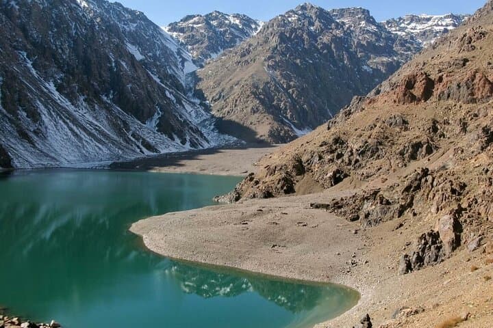
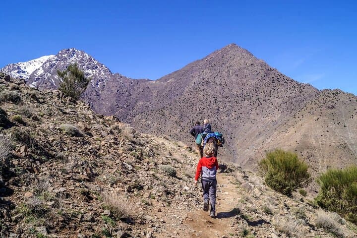
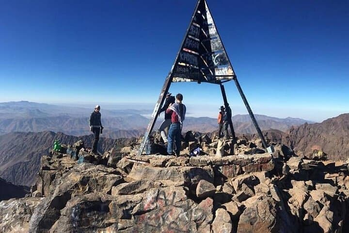
Dawn in the High Atlas arrives cool and sharp: headlamps bob along the trail out of Imlil, mules clatter and the valley exhales. Over six days you move from cedar forests and village terraces to wind-swept scree and the still bowl of Lake Ifni, finally standing on North Africa’s highest point, Jbel Toubkal (4,167 m).
Verified experiences and guided adventures in the surrounding area.
Operated by Atlas Discovery Tours · Imlil, Marrakesh-Safi
Dawn in the High Atlas arrives cool and sharp: headlamps bob along the trail out of Imlil, mules clatter and the valley exhales. Over six days you move from cedar forests and village terraces to wind-swept scree and the still bowl of Lake Ifni, finally standing on North Africa’s highest point, Jbel Toubkal (4,167 m).
The range is young, tectonic uplift carved by snow and flash floods into steep ridges and boulder fields. Berber villages along the route—Tacheddirt, Azib Likemt, Amsouzert—carry a long mountain pastoral history; stone houses, mule tracks and guesthouse hospitality are living elements of that culture. Geologically the massif is granitic with extensive talus slopes; glacier action in the Pleistocene left the high cols and basins that now hold Ifni’s lake.
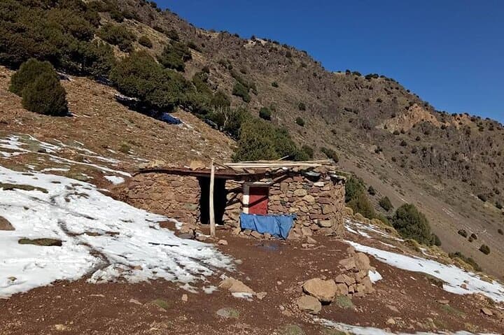
Expect varied terrain: forested river trails near Imlil, long ascents to passes above 3,500 m, loose scree fields and narrow cols (Tizi Likemt ~3,555 m; Tizi n’Ouanoums ~3,664 m). Daily distances range from 8–12 km with significant elevation gain on key days; summit day is an early start and 2–3 hours from the high hut.
Practical guidance: acclimatize, sleep well the night before summit push, pack layered insulation and a waterproof shell, and use trekking poles for steep scree. Guided groups use mules and local guides; drinking water should be treated above treeline. Aim for spring or fall for stable weather; winter requires crampons and mountaineering experience. With preparation this route is a demanding but approachable high-mountain trek that pairs cultural contact with alpine exposure.
challenging.
6 days.
Should be comfortable hiking 6–8 hours on consecutive days with sustained uphill sections and carrying a daypack; prior multi-day hiking experience recommended.
You should be able to hike 6–8 hours a day on uneven terrain and manage ascents of 800–1,800 m on key days; guided support and mules reduce load but a good aerobic base is important.
No technical climbing equipment is required during normal conditions—it's a steep hike with loose scree; winter ascents require crampons and ice tools and experienced guides.
Late spring (May–June) and early fall (September–October) offer stable weather and milder temperatures; winter brings snow and requires mountaineering skills.
Yes, local teams typically provide mules/porters to carry heavy equipment and luggage while you carry a daypack.
The High Atlas has been home to Berber (Amazigh) communities for millennia; mule tracks and terraced fields reflect a long tradition of mountain transhumance.
Trail traffic is concentrated; stick to established paths, carry out waste and support local guesthouses to ensure tourism benefits communities and reduces environmental impact.
Atlas Discovery Tours operates guided outdoor trips and adventures with an emphasis on safety, stewardship, and memorable experiences.
Dawn in the High Atlas arrives cool and sharp: headlamps bob along the trail out of Imlil, mules clatter and the valley exhales. Over six days you move from cedar forests and village terraces to wind-swept scree and the still bowl of Lake Ifni, finally standing on North Africa’s highest point, Jbel Toubkal (4,167 m).
Dawn in the High Atlas arrives cool and sharp: headlamps bob along the trail out of Imlil, mules clatter and the valley exhales. Over six days you move from cedar forests and village terraces to wind-swept scree and the still bowl of Lake Ifni, finally standing on North Africa’s highest point, Jbel Toubkal (4,167 m).
The range is young, tectonic uplift carved by snow and flash floods into steep ridges and boulder fields. Berber villages along the route—Tacheddirt, Azib Likemt, Amsouzert—carry a long mountain pastoral history; stone houses, mule tracks and guesthouse hospitality are living elements of that culture. Geologically the massif is granitic with extensive talus slopes; glacier action in the Pleistocene left the high cols and basins that now hold Ifni’s lake.
Expect varied terrain: forested river trails near Imlil, long ascents to passes above 3,500 m, loose scree fields and narrow cols (Tizi Likemt ~3,555 m; Tizi n’Ouanoums ~3,664 m). Daily distances range from 8–12 km with significant elevation gain on key days; summit day is an early start and 2–3 hours from the high hut.
Practical guidance: acclimatize, sleep well the night before summit push, pack layered insulation and a waterproof shell, and use trekking poles for steep scree. Guided groups use mules and local guides; drinking water should be treated above treeline. Aim for spring or fall for stable weather; winter requires crampons and mountaineering experience. With preparation this route is a demanding but approachable high-mountain trek that pairs cultural contact with alpine exposure.