THE ADVENTURE COLLECTIVE® · Independent discovery and booking for outdoor travel

A 5‑day loop from Bishkek into the high pastures and remote lakes of Naryn province. Combine yurt stays, horseback approaches and scenic drives across mountain passes to reach Song‑Kol and the dramatic Kel‑Suu basin.
A 5‑day loop from Bishkek into the high pastures and remote lakes of Naryn province. Combine yurt stays, horseback approaches and scenic drives across mountain passes to reach Song‑Kol and the dramatic Kel‑Suu basin.
Morning light peels across the Tian Shan as the van leaves Bishkek and the city noise thins into high‑altitude quiet. By the time you crest Kalmak Ashuu, the steppe opens in broad, wind‑cut strokes and yurts dot the grass like punctuation. Song‑Kol sits above 3,000 m — a flat, bright lake rimmed by grazing horses; Kel‑Suu is rawer, wedged between limestone cliffs where emerald water can appear and disappear with the season.
Verified experiences and guided adventures in the surrounding area.
Operated by Nomads Area · Naryn, Naryn Region
Morning light peels across the Tian Shan as the van leaves Bishkek and the city noise thins into high‑altitude quiet. By the time you crest Kalmak Ashuu, the steppe opens in broad, wind‑cut strokes and yurts dot the grass like punctuation. Song‑Kol sits above 3,000 m — a flat, bright lake rimmed by grazing horses; Kel‑Suu is rawer, wedged between limestone cliffs where emerald water can appear and disappear with the season.
This itinerary threads cultural stops and geography: the 11th‑century Burana Tower hints at Silk Road fragments, Kochkor’s felt workshops show living craft traditions, and Naryn is the practical hub for passes like Dolon and the 33 Parrots switchbacks. Geologically, you’ll move from rolling alpine meadows to steep canyon and karst limestone near Kel‑Suu — terrain that shapes sudden weather and variable trails.
Expect a mix of transport, short walks, horseback approaches and one full day to reach Kel‑Suu on foot or horse (roughly 2.5–3 hours one way across uneven, high‑alpine ground). Nights in guesthouses and yurts are basic but warm; power and hot water may be limited in remote camps.
Practical tips: allow time to acclimatize, carry cash for remote purchases, layer for high‑altitude temperature swings, and book with guides who hold the border permissions needed for Kel‑Suu. Photographers should bring spare batteries — cold drains cells fast. Pack to be self‑sufficient on the trail: water, snacks, and a simple first‑aid kit will make transitions between villages and camps smoother.
This is a hands‑on tour for travelers who value cultural contact, wide horizons and rugged mountain travel over luxury — an accessible, high‑altitude loop that rewards preparation with quiet, unforgettable landscapes.
moderate.
5 days.
Should be comfortable walking 2–4 hours in a day and able to handle short uphill sections at high altitude; basic horseback riding experience helps but isn’t required.
No — basic horseback riding is suitable for beginners, guides will match mounts to rider ability, but you should tell the operator about any concerns.
At 3,000–3,400 m, nights can drop near freezing even in summer; most yurt camps provide blankets and a stove but bring a warm sleeping layer.
Visas depend on your nationality — many countries enjoy visa‑free entry for short stays; check current government guidance before travel.
Yes — mountain weather and remote border zone permissions can force route or timing changes; flexible planning and travel insurance are recommended.
The route moves through places tied to nomadic Kyrgyz culture and Silk Road fragments — Burana Tower near Tokmok is an 11th‑century remnant of that past.
High‑altitude grasslands are ecologically fragile; follow leave‑no‑trace principles, minimize campfire use and support local guides and yurt camps that practice sustainable grazing.
Nomads Area operates guided outdoor trips and adventures with an emphasis on safety, stewardship, and memorable experiences.
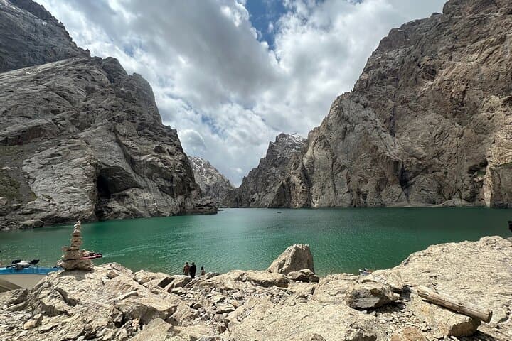
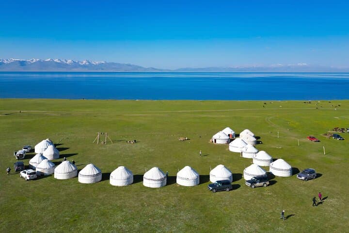
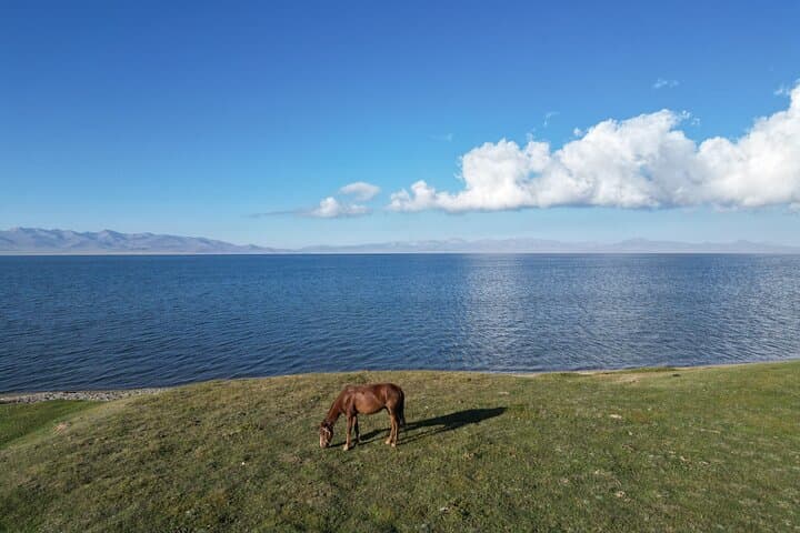
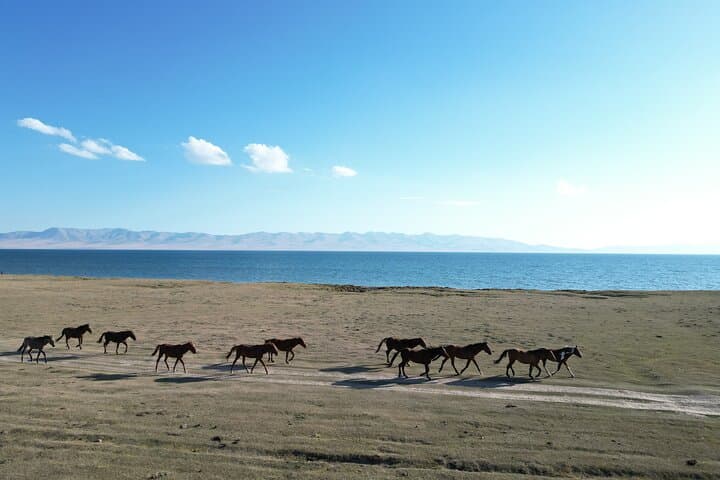
Morning light peels across the Tian Shan as the van leaves Bishkek and the city noise thins into high‑altitude quiet. By the time you crest Kalmak Ashuu, the steppe opens in broad, wind‑cut strokes and yurts dot the grass like punctuation. Song‑Kol sits above 3,000 m — a flat, bright lake rimmed by grazing horses; Kel‑Suu is rawer, wedged between limestone cliffs where emerald water can appear and disappear with the season.
Morning light peels across the Tian Shan as the van leaves Bishkek and the city noise thins into high‑altitude quiet. By the time you crest Kalmak Ashuu, the steppe opens in broad, wind‑cut strokes and yurts dot the grass like punctuation. Song‑Kol sits above 3,000 m — a flat, bright lake rimmed by grazing horses; Kel‑Suu is rawer, wedged between limestone cliffs where emerald water can appear and disappear with the season.
This itinerary threads cultural stops and geography: the 11th‑century Burana Tower hints at Silk Road fragments, Kochkor’s felt workshops show living craft traditions, and Naryn is the practical hub for passes like Dolon and the 33 Parrots switchbacks. Geologically, you’ll move from rolling alpine meadows to steep canyon and karst limestone near Kel‑Suu — terrain that shapes sudden weather and variable trails.
Expect a mix of transport, short walks, horseback approaches and one full day to reach Kel‑Suu on foot or horse (roughly 2.5–3 hours one way across uneven, high‑alpine ground). Nights in guesthouses and yurts are basic but warm; power and hot water may be limited in remote camps.
Practical tips: allow time to acclimatize, carry cash for remote purchases, layer for high‑altitude temperature swings, and book with guides who hold the border permissions needed for Kel‑Suu. Photographers should bring spare batteries — cold drains cells fast. Pack to be self‑sufficient on the trail: water, snacks, and a simple first‑aid kit will make transitions between villages and camps smoother.
This is a hands‑on tour for travelers who value cultural contact, wide horizons and rugged mountain travel over luxury — an accessible, high‑altitude loop that rewards preparation with quiet, unforgettable landscapes.