THE ADVENTURE COLLECTIVE® · Independent discovery and booking for outdoor travel

A five-day trek from Marrakech up to North Africa’s highest peak, Jbel Toubkal (4,167 m). Expect village trails, high mountain ridges, and a demanding summit day with local guides and mule support.
A five-day trek from Marrakech up to North Africa’s highest peak, Jbel Toubkal (4,167 m). Expect village trails, high mountain ridges, and a demanding summit day with local guides and mule support.
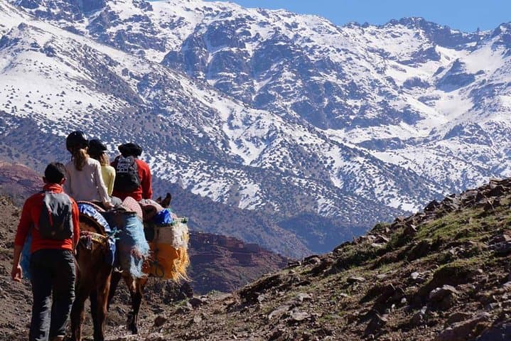
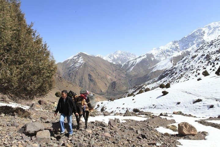
The trail opens before dawn on cracked mountain tracks, a long line of mules and guides tracing switchbacks that climb out of the Imlil valley. Cold air bites at 3,000 metres; prayer flags flap on ridgelines and the village roofs below shrink to a patchwork of red clay and terraces. Over five days the route moves from walnut groves and irrigated fields into juniper stands and finally the barren, glacial-scoured ridges that guard Jbel Toubkal (4,167 m).
Verified experiences and guided adventures in the surrounding area.
Operated by Morocco Tours Services · Marrakech, Marrakech-Safi
The trail opens before dawn on cracked mountain tracks, a long line of mules and guides tracing switchbacks that climb out of the Imlil valley. Cold air bites at 3,000 metres; prayer flags flap on ridgelines and the village roofs below shrink to a patchwork of red clay and terraces. Over five days the route moves from walnut groves and irrigated fields into juniper stands and finally the barren, glacial-scoured ridges that guard Jbel Toubkal (4,167 m).
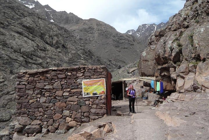
Geology here is raw: folded volcanic and metamorphic rock shaped by Pleistocene glaciers, forming steep cols and sharp arêtes. The route threads through Berber villages—Tiziane, D’knt, Tamsoult—where ancient terrace agriculture and hand-built dry-stone walls still define daily life. Pilgrims stop at the shrine of Sidi Chamharouch near a waterfall, a cultural waypoint that reflects the area’s layered history of local spiritual practice and pre-Islamic rites.
Practically, the itinerary balances long valley approaches with a summit push from the Toubkal refuge. Expect 4–8 hours of walking on most days, a demanding 3–4 hour pre-dawn ascent to the summit, and steep, rocky descents. Weather changes quickly at altitude: warm sun can flip to high wind and snow even in late spring. Guides and mule crews handle logistics and luggage; clients should carry a daypack with water, layers, and snacks.
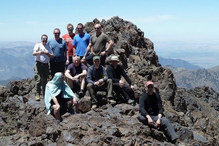
Plan for moderate to strong fitness, sturdy boots, and incremental acclimatization. Hydrate early, move deliberately on steep sections, and consult guides about pacing for the summit day. The payoff is a high, expansive panorama across the High Atlas back to the plains around Marrakech.
challenging.
5 days.
Suitable for hikers with good cardiovascular fitness who can manage 4–8 hours of walking daily and steep elevation gain.
Expect a steep 3–4 hour ascent from the refuge with loose scree near the top; the effort is mainly endurance rather than technical climbing.
Guides are recommended for logistics, route-finding, and safety—many itineraries include mule crews and local guides.
Late spring to early autumn offers stable conditions; winter brings snow and requires mountaineering experience and equipment.
This itinerary includes guesthouses, bivouac/riads, and a night at the Toubkal refuge; specifics vary by operator.
The High Atlas has been inhabited for millennia by Berber communities; many villages on the route still practice terraced agriculture and pastoralism.
Trails are fragile and water is scarce—stick to established paths, pack out waste, and minimize campfire impact to protect fragile alpine vegetation.
Morocco Tours Services operates guided outdoor trips and adventures with an emphasis on safety, stewardship, and memorable experiences.
The trail opens before dawn on cracked mountain tracks, a long line of mules and guides tracing switchbacks that climb out of the Imlil valley. Cold air bites at 3,000 metres; prayer flags flap on ridgelines and the village roofs below shrink to a patchwork of red clay and terraces. Over five days the route moves from walnut groves and irrigated fields into juniper stands and finally the barren, glacial-scoured ridges that guard Jbel Toubkal (4,167 m).
The trail opens before dawn on cracked mountain tracks, a long line of mules and guides tracing switchbacks that climb out of the Imlil valley. Cold air bites at 3,000 metres; prayer flags flap on ridgelines and the village roofs below shrink to a patchwork of red clay and terraces. Over five days the route moves from walnut groves and irrigated fields into juniper stands and finally the barren, glacial-scoured ridges that guard Jbel Toubkal (4,167 m).
Geology here is raw: folded volcanic and metamorphic rock shaped by Pleistocene glaciers, forming steep cols and sharp arêtes. The route threads through Berber villages—Tiziane, D’knt, Tamsoult—where ancient terrace agriculture and hand-built dry-stone walls still define daily life. Pilgrims stop at the shrine of Sidi Chamharouch near a waterfall, a cultural waypoint that reflects the area’s layered history of local spiritual practice and pre-Islamic rites.
Practically, the itinerary balances long valley approaches with a summit push from the Toubkal refuge. Expect 4–8 hours of walking on most days, a demanding 3–4 hour pre-dawn ascent to the summit, and steep, rocky descents. Weather changes quickly at altitude: warm sun can flip to high wind and snow even in late spring. Guides and mule crews handle logistics and luggage; clients should carry a daypack with water, layers, and snacks.
Plan for moderate to strong fitness, sturdy boots, and incremental acclimatization. Hydrate early, move deliberately on steep sections, and consult guides about pacing for the summit day. The payoff is a high, expansive panorama across the High Atlas back to the plains around Marrakech.