THE ADVENTURE COLLECTIVE® · Independent discovery and booking for outdoor travel

A five-day private circuit from Hanoi that threads the Ha Giang Loop, Ma Pi Leng Pass and Hoang Su Phi terraces—big limestone views, market mornings and two nights in homestays. Read on for what to expect on the road, plus practical packing and timing tips.
A five-day private circuit from Hanoi that threads the Ha Giang Loop, Ma Pi Leng Pass and Hoang Su Phi terraces—big limestone views, market mornings and two nights in homestays. Read on for what to expect on the road, plus practical packing and timing tips.
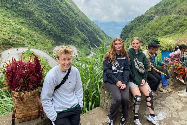
You wake before dawn in Hanoi and slide onto a shared coach, the city’s hum giving way to a ribbon of highway that climbs into limestone ridges and deep, terraced valleys. By day two you’re on the famed Ha Giang “Happiness” road, curving over Ma Pi Leng Pass (around 1,200–1,500 m at its highs) with the Nho Que River daring you from the gorge below. A short boat ride along the emerald river tightens the sense of scale.
Verified experiences and guided adventures in the surrounding area.
Operated by Local Tours Ha Giang · Ha Giang, Ha Giang Province
You wake before dawn in Hanoi and slide onto a shared coach, the city’s hum giving way to a ribbon of highway that climbs into limestone ridges and deep, terraced valleys. By day two you’re on the famed Ha Giang “Happiness” road, curving over Ma Pi Leng Pass (around 1,200–1,500 m at its highs) with the Nho Que River daring you from the gorge below. A short boat ride along the emerald river tightens the sense of scale.
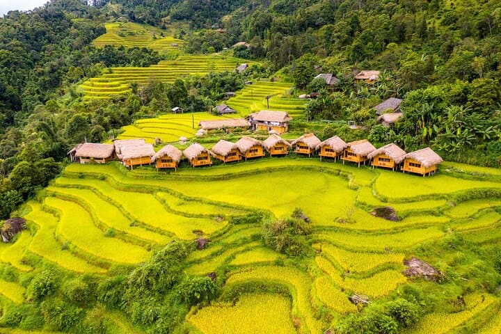
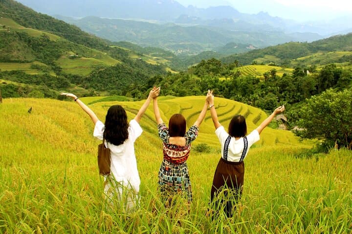
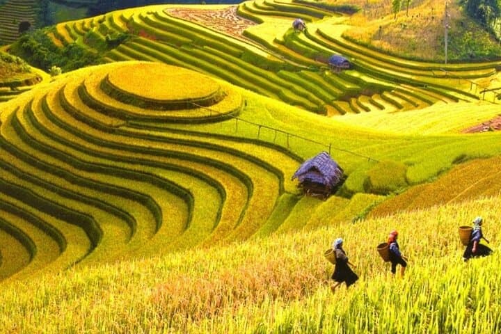
This route crosses the Dong Van Karst Plateau GeoPark, a landscape carved from ancient limestone faulting and uplift, and threaded with communities of Hmong, Dao, Tay and Lo Lo people. Dong Van’s old quarter keeps traces of regional trade with China; Lung Cu’s flag marks Vietnam’s northern tip. Hoang Su Phi, by contrast, is agricultural theatre—terraced rice fields that turn wet and reflective in April–May and burn gold in September–October, plus centuries-old tea trees clinging to Tay Con Linh slopes.
Expect long driving days (the itinerary includes legs of 110–350 km), short cultural walks, a boat visit on the Nho Que, and two nights in homestays where local meals and simple rooms are the norm. Practical tips: bring layered rain gear for high passes, carry Vietnamese dong for remote markets and small-entry sites, and allow extra time for photography at overlooks. If you want to walk terraces, choose sturdy shoes and plan morning light for the best views. The trip is equal parts geology, culture and road—pack patience and a camera with good zoom.
moderate.
5 days, 4 nights.
Suitable for travelers in average fitness: mostly road travel with short village walks and some stair/steep-path sections.
The tour is road-intensive with short, moderate walks; no technical hiking is required, so average fitness is sufficient.
Carry Vietnamese dong for markets, homestays and small fees; major towns accept cards but remote areas are cash-only.
A mix of simple hotels in Ha Giang/Dong Van and local homestays in Hoang Su Phi; facilities are basic but comfortable with home-cooked meals.
Late April–May shows wet, reflective terraces; September–October is harvest season when terraces turn golden.
This corridor has long been a trade link between northern Vietnam and Yunnan; Dong Van’s vernacular architecture and markets reflect centuries of cross-border commerce and minority cultures.
The Dong Van Karst Plateau is a UNESCO Global Geopark—visitors should stick to paths, avoid disturbing terraced fields and support local homestays to benefit community-led conservation.
Local Tours Ha Giang operates guided outdoor trips and adventures with an emphasis on safety, stewardship, and memorable experiences.
You wake before dawn in Hanoi and slide onto a shared coach, the city’s hum giving way to a ribbon of highway that climbs into limestone ridges and deep, terraced valleys. By day two you’re on the famed Ha Giang “Happiness” road, curving over Ma Pi Leng Pass (around 1,200–1,500 m at its highs) with the Nho Que River daring you from the gorge below. A short boat ride along the emerald river tightens the sense of scale.
You wake before dawn in Hanoi and slide onto a shared coach, the city’s hum giving way to a ribbon of highway that climbs into limestone ridges and deep, terraced valleys. By day two you’re on the famed Ha Giang “Happiness” road, curving over Ma Pi Leng Pass (around 1,200–1,500 m at its highs) with the Nho Que River daring you from the gorge below. A short boat ride along the emerald river tightens the sense of scale.
This route crosses the Dong Van Karst Plateau GeoPark, a landscape carved from ancient limestone faulting and uplift, and threaded with communities of Hmong, Dao, Tay and Lo Lo people. Dong Van’s old quarter keeps traces of regional trade with China; Lung Cu’s flag marks Vietnam’s northern tip. Hoang Su Phi, by contrast, is agricultural theatre—terraced rice fields that turn wet and reflective in April–May and burn gold in September–October, plus centuries-old tea trees clinging to Tay Con Linh slopes.
Expect long driving days (the itinerary includes legs of 110–350 km), short cultural walks, a boat visit on the Nho Que, and two nights in homestays where local meals and simple rooms are the norm. Practical tips: bring layered rain gear for high passes, carry Vietnamese dong for remote markets and small-entry sites, and allow extra time for photography at overlooks. If you want to walk terraces, choose sturdy shoes and plan morning light for the best views. The trip is equal parts geology, culture and road—pack patience and a camera with good zoom.