THE ADVENTURE COLLECTIVE® · Independent discovery and booking for outdoor travel

Take a four-day 4x4 loop through Huehuetenango’s highland lagoons, volcano lookouts and working haciendas. This private tour mixes short hikes, boat rides to hidden cenotes and hands-on community visits for an off-grid view of Guatemala’s northern highlands.
Take a four-day 4x4 loop through Huehuetenango’s highland lagoons, volcano lookouts and working haciendas. This private tour mixes short hikes, boat rides to hidden cenotes and hands-on community visits for an off-grid view of Guatemala’s northern highlands.
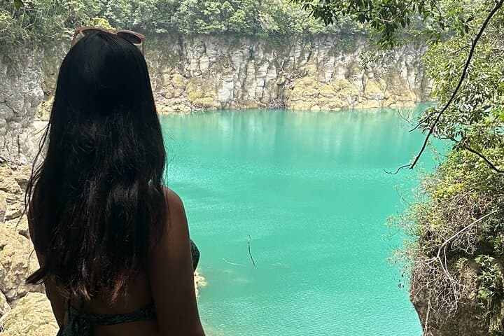
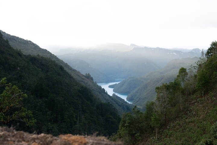
Dawn breaks over the highland road and the 4x4 crunches along a rutted track, dust lifting to reveal turquoise water framed by volcanic shoulders. On day one you climb to Mirador Juan Diéguez Olaverri and watch Tacaná, Tajumulco and Santa María puncture the sky—volcanoes that mark the tectonic edge of Guatemala’s western spine.
Verified experiences and guided adventures in the surrounding area.
Operated by Outstanding Guatemala · Huehuetenango, Huehuetenango Department
Dawn breaks over the highland road and the 4x4 crunches along a rutted track, dust lifting to reveal turquoise water framed by volcanic shoulders. On day one you climb to Mirador Juan Diéguez Olaverri and watch Tacaná, Tajumulco and Santa María puncture the sky—volcanoes that mark the tectonic edge of Guatemala’s western spine.
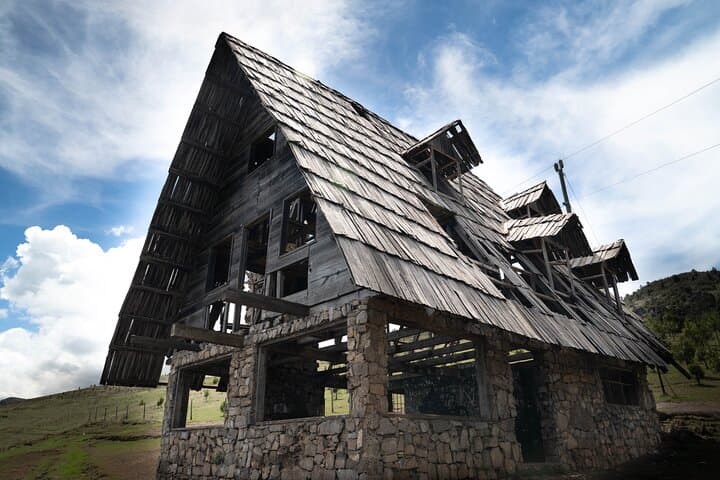
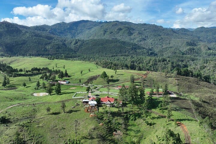
The itinerary threads geology, culture and rural life. Huehuetenango sits in the northern highlands where uplifted volcanic rock meets eroded limestone basins; lagoons like Magdalena and Brava collect runoff in basins that sometimes open into cenotes—deep sinkholes that hold unexpectedly clear water. The hacienda visit links colonial-era landholdings and contemporary agriculture: horses, sheep and cattle remain part of daily life while local projects breed llamas and alpacas to sustain livelihoods.
Expect trails through mixed pine and cloud forest, short hikes of gentle to moderate grade, steep lookout steps, and uneven farm tracks best suited to a 4x4. Boat rides on Laguna Brava reveal hidden cenotes—bring a swimsuit and reef-safe sunscreen.
Practical guidance: altitude reaches roughly 1,900–2,500 m—move slowly your first day, hydrate, and wear layered clothing for warm sun and chilly nights. Roads can be rough; opt for the private transport included if you prefer comfort and local knowledge. Carry cash for small purchases, pack insect repellent, and respect private farms and community projects by asking before photographing. Timing your visit in the dry season (November–April) reduces mud and maximizes visibility of the volcanic skyline.
moderate.
4 days.
Suitable for travelers comfortable with short hikes (30–90 minutes), uneven terrain and moderate altitude; basic mobility required.
Roads range from paved highways to rutted dirt tracks; the 4x4 vehicle is included to handle rough stretches and remote access.
The tour is rated physically easy to moderate; children and older travelers can participate but should be comfortable with bumpy rides and short hikes.
Access is arranged by the operator and included in the itinerary—no additional permits required, but respect private property rules and local guidelines.
Local guides and staff commonly speak Spanish and some indigenous languages; an English-speaking guide is typically provided when requested in advance.
Huehuetenango sits in the Mam Maya highlands; the region’s communities maintain traditional agriculture and textile practices that predate colonial reorganization.
Highland lagoons and cenotes are sensitive to runoff and pollution—stick to trails, use biodegradable sunscreen and support community-run projects to ensure sustainable tourism.
Outstanding Guatemala operates guided outdoor trips and adventures with an emphasis on safety, stewardship, and memorable experiences.
Dawn breaks over the highland road and the 4x4 crunches along a rutted track, dust lifting to reveal turquoise water framed by volcanic shoulders. On day one you climb to Mirador Juan Diéguez Olaverri and watch Tacaná, Tajumulco and Santa María puncture the sky—volcanoes that mark the tectonic edge of Guatemala’s western spine.
Dawn breaks over the highland road and the 4x4 crunches along a rutted track, dust lifting to reveal turquoise water framed by volcanic shoulders. On day one you climb to Mirador Juan Diéguez Olaverri and watch Tacaná, Tajumulco and Santa María puncture the sky—volcanoes that mark the tectonic edge of Guatemala’s western spine.
The itinerary threads geology, culture and rural life. Huehuetenango sits in the northern highlands where uplifted volcanic rock meets eroded limestone basins; lagoons like Magdalena and Brava collect runoff in basins that sometimes open into cenotes—deep sinkholes that hold unexpectedly clear water. The hacienda visit links colonial-era landholdings and contemporary agriculture: horses, sheep and cattle remain part of daily life while local projects breed llamas and alpacas to sustain livelihoods.
Expect trails through mixed pine and cloud forest, short hikes of gentle to moderate grade, steep lookout steps, and uneven farm tracks best suited to a 4x4. Boat rides on Laguna Brava reveal hidden cenotes—bring a swimsuit and reef-safe sunscreen.
Practical guidance: altitude reaches roughly 1,900–2,500 m—move slowly your first day, hydrate, and wear layered clothing for warm sun and chilly nights. Roads can be rough; opt for the private transport included if you prefer comfort and local knowledge. Carry cash for small purchases, pack insect repellent, and respect private farms and community projects by asking before photographing. Timing your visit in the dry season (November–April) reduces mud and maximizes visibility of the volcanic skyline.