THE ADVENTURE COLLECTIVE® · Independent discovery and booking for outdoor travel

A compact four-day route that climbs a 4,650 m pass before descending through cloud forest to Machu Picchu. This guide covers terrain, history, and practical tips—what to pack, how to acclimatize, and what to expect on the trail.
A compact four-day route that climbs a 4,650 m pass before descending through cloud forest to Machu Picchu. This guide covers terrain, history, and practical tips—what to pack, how to acclimatize, and what to expect on the trail.
Dawn breaks over a serrated skyline as trekkers load horses and shoulder packs in Mollepata. Cold air bites at 3,800 m while the Salkantay massif—a 6,271 m granite wall—dominates the horizon, daring each step to climb higher.
Verified experiences and guided adventures in the surrounding area.
Operated by Andes Peru Tour & Adventure · Cusco, Cusco
Dawn breaks over a serrated skyline as trekkers load horses and shoulder packs in Mollepata. Cold air bites at 3,800 m while the Salkantay massif—a 6,271 m granite wall—dominates the horizon, daring each step to climb higher.
The four-day route pushes up to a high pass at about 4,650 m before dropping through puna and then into the humid cloud forest, a dramatic elevation change of roughly 2,600 m. Geologically, the route traces glacial valleys carved by Pleistocene ice and younger, steep-sided rivers that now cut toward the Amazon basin. Culturally, the corridor threads Andean farming communities and Inca-era waystations; the final approach follows original Inca trail sections toward Llactapata, where early views of Machu Picchu first appear.
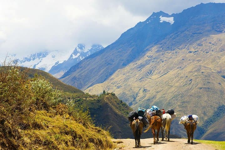
Expect mixed terrain: rocky moraine and steep switchbacks above tree line, muddy singletrack and coffee plantations lower down, plus a few stretches along the hydroelectric rail before the train to Aguas Calientes. Horses carry camp gear, making the route more accessible than longer classical circuits, but altitude and sustained climbs are the main challenges.
Practical guidance: spend 48–72 hours in Cusco to acclimatize, carry layers for night-to-day swings, bring a good pair of waterproof boots and trekking poles, and budget time for coffee stops in Lucmabamba. Permit-free for the trail itself, but Machu Picchu entrance and optional Huayna Picchu tickets are limited—book in advance. Hydrate early, watch for acute altitude illness, and stay on established trails to protect fragile highland ecosystems.
challenging.
4 days.
Good aerobic fitness with prior multi-day hiking experience and acclimatization; able to hike 6–8 hours on steep terrain.
No special trekking permit is required for the Salkantay route, but you must buy timed entrance tickets for Machu Picchu separately and train/bus seats are limited.
It’s comparable to slightly harder in terms of elevation gain—reaching ~4,650 m—but uses horses for gear and spends more time crossing alpine terrain than the classic Inca Trail.
This itinerary typically includes breakfast, lunch and dinner on trek days and camping on nights 1–2, with a final hotel night in Aguas Calientes; confirm specifics with your operator.
Fit beginners can complete it with proper acclimatization and pacing, but those with cardiovascular issues or pregnancy are not recommended to attempt the route.
Salkantay is a sacred peak in Quechua tradition; the corridor connects pre‑Inca and Inca agricultural terraces and waystations that fed routes toward the Vilcanota watershed and Machu Picchu.
Tourism pressure near Machu Picchu has prompted strict ticketing and trail-management; stick to trails, pack out waste, and support operators that use horses and ethical porter practices.
Andes Peru Tour & Adventure operates guided outdoor trips and adventures with an emphasis on safety, stewardship, and memorable experiences.
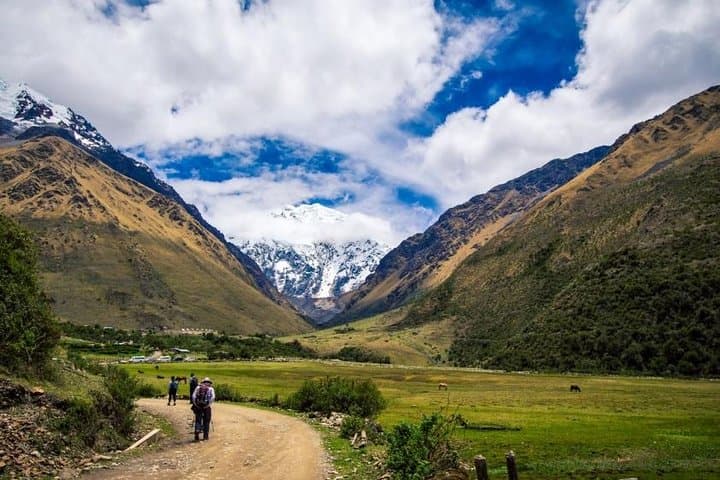
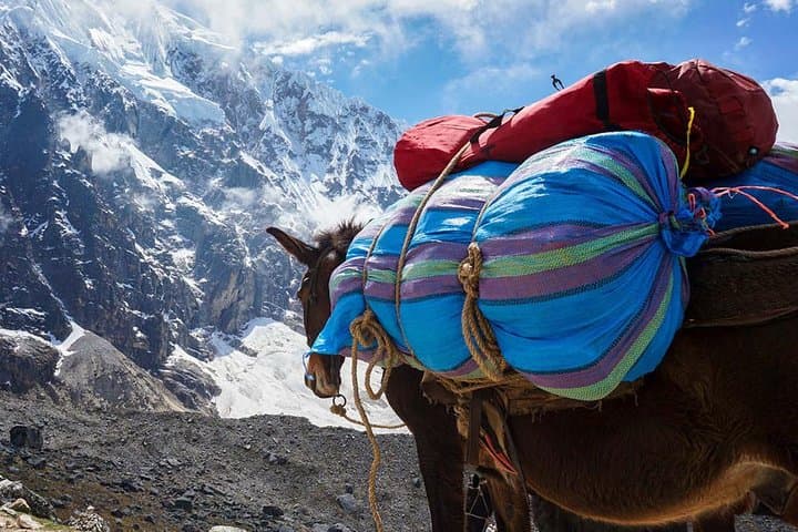
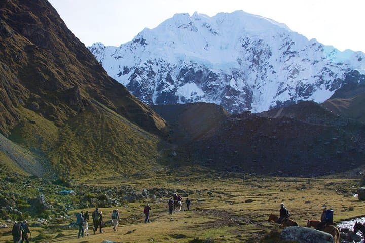
Dawn breaks over a serrated skyline as trekkers load horses and shoulder packs in Mollepata. Cold air bites at 3,800 m while the Salkantay massif—a 6,271 m granite wall—dominates the horizon, daring each step to climb higher.
Dawn breaks over a serrated skyline as trekkers load horses and shoulder packs in Mollepata. Cold air bites at 3,800 m while the Salkantay massif—a 6,271 m granite wall—dominates the horizon, daring each step to climb higher.
The four-day route pushes up to a high pass at about 4,650 m before dropping through puna and then into the humid cloud forest, a dramatic elevation change of roughly 2,600 m. Geologically, the route traces glacial valleys carved by Pleistocene ice and younger, steep-sided rivers that now cut toward the Amazon basin. Culturally, the corridor threads Andean farming communities and Inca-era waystations; the final approach follows original Inca trail sections toward Llactapata, where early views of Machu Picchu first appear.
Expect mixed terrain: rocky moraine and steep switchbacks above tree line, muddy singletrack and coffee plantations lower down, plus a few stretches along the hydroelectric rail before the train to Aguas Calientes. Horses carry camp gear, making the route more accessible than longer classical circuits, but altitude and sustained climbs are the main challenges.
Practical guidance: spend 48–72 hours in Cusco to acclimatize, carry layers for night-to-day swings, bring a good pair of waterproof boots and trekking poles, and budget time for coffee stops in Lucmabamba. Permit-free for the trail itself, but Machu Picchu entrance and optional Huayna Picchu tickets are limited—book in advance. Hydrate early, watch for acute altitude illness, and stay on established trails to protect fragile highland ecosystems.