THE ADVENTURE COLLECTIVE® · Independent discovery and booking for outdoor travel

A compact four-day ascent of Mount Kenya via the Sirimon Route, offering forested approaches, high moorland, and a dawn summit at Point Lenana. Expect long hiking days, simple camps, and striking high-alpine scenery.
A compact four-day ascent of Mount Kenya via the Sirimon Route, offering forested approaches, high moorland, and a dawn summit at Point Lenana. Expect long hiking days, simple camps, and striking high-alpine scenery.
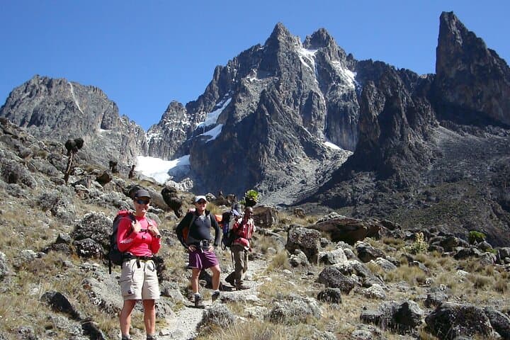
Dawn pulls a cool blue over the ridges as you leave Nanyuki and drive toward Sirimon Gate, the road dropping you into a highland that smells of wet grass and pine. The Sirimon Route begins in a moss-draped forest, climbs through heath and moorland, and finally opens onto the stone scree of the alpine zone where Point Lenana keeps a sharp silhouette against the sky.
Verified experiences and guided adventures in the surrounding area.
Operated by Muringa Kenya Tours & Safaris Ltd · Nanyuki, Laikipia County
Dawn pulls a cool blue over the ridges as you leave Nanyuki and drive toward Sirimon Gate, the road dropping you into a highland that smells of wet grass and pine. The Sirimon Route begins in a moss-draped forest, climbs through heath and moorland, and finally opens onto the stone scree of the alpine zone where Point Lenana keeps a sharp silhouette against the sky.
Mount Kenya’s volcanic core is an eroded remnant of a million-year-old stratovolcano; glaciers carved the central peaks into jagged horns. The Sirimon flank sits on the drier northwest side, offering clearer walking and panoramic views into Mackinders Valley and the peaks above. Local Kikuyu and Meru communities historically used lower slopes for grazing and sacred rituals tied to water sources that originate on the mountain.
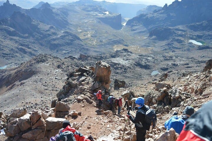
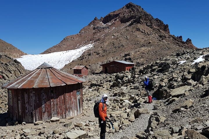
Practical guidance: this is a four-day, non-technical climb best approached with an overnight in Nanyuki to acclimatize. Expect daily hikes of 6–10 hours and a 3am summit push to reach Point Lenana by sunrise. Trails vary from packed earth and root-strewn forest to boggy moorland and stony scree; gaiters and trekking poles help on the descent. Altitude is the main risk—watch for headaches, reduced appetite, and changes in breathing. Hydrate regularly, eat small frequent meals, and keep moving at a steady pace. Camps (Judmier/Shipton/Old Moses) offer basic bunkhouse or tented accommodation and hot meals.
Timing your summit for clear mornings increases the chance of views of Batian and Nelion, while leaving flexibility for weather keeps the plan realistic and safe.
challenging.
4 days.
Good cardiovascular fitness with experience on multi-day hikes; able to walk 6–10 hours on consecutive days at altitude.
No — the Sirimon Route to Point Lenana is non-technical; crampons/ice axes are not required for the standard 4-day itinerary.
The itinerary is tight; an extra night in Nanyuki or an added acclimatization day on lower slopes reduces altitude risk and improves summit odds.
Accommodations are basic bunkhouses or tented camps with communal dining—expect simple bedding and shared facilities.
The drier months (roughly January–February and July–September) offer more stable weather and clearer summit views, though climbs occur year-round with variable conditions.
Mount Kenya has cultural significance for local Kikuyu and Meru peoples and was first surveyed by European explorers in the late 19th century; its peaks were once glaciated and the range shaped by volcanic activity.
Mount Kenya National Park is a UNESCO Biosphere Reserve—stay on trails, pack out waste, and use local guides to support conservation and community livelihoods.
Muringa Kenya Tours & Safaris Ltd operates guided outdoor trips and adventures with an emphasis on safety, stewardship, and memorable experiences.

Dawn pulls a cool blue over the ridges as you leave Nanyuki and drive toward Sirimon Gate, the road dropping you into a highland that smells of wet grass and pine. The Sirimon Route begins in a moss-draped forest, climbs through heath and moorland, and finally opens onto the stone scree of the alpine zone where Point Lenana keeps a sharp silhouette against the sky.
Dawn pulls a cool blue over the ridges as you leave Nanyuki and drive toward Sirimon Gate, the road dropping you into a highland that smells of wet grass and pine. The Sirimon Route begins in a moss-draped forest, climbs through heath and moorland, and finally opens onto the stone scree of the alpine zone where Point Lenana keeps a sharp silhouette against the sky.
Mount Kenya’s volcanic core is an eroded remnant of a million-year-old stratovolcano; glaciers carved the central peaks into jagged horns. The Sirimon flank sits on the drier northwest side, offering clearer walking and panoramic views into Mackinders Valley and the peaks above. Local Kikuyu and Meru communities historically used lower slopes for grazing and sacred rituals tied to water sources that originate on the mountain.
Practical guidance: this is a four-day, non-technical climb best approached with an overnight in Nanyuki to acclimatize. Expect daily hikes of 6–10 hours and a 3am summit push to reach Point Lenana by sunrise. Trails vary from packed earth and root-strewn forest to boggy moorland and stony scree; gaiters and trekking poles help on the descent. Altitude is the main risk—watch for headaches, reduced appetite, and changes in breathing. Hydrate regularly, eat small frequent meals, and keep moving at a steady pace. Camps (Judmier/Shipton/Old Moses) offer basic bunkhouse or tented accommodation and hot meals.
Timing your summit for clear mornings increases the chance of views of Batian and Nelion, while leaving flexibility for weather keeps the plan realistic and safe.