THE ADVENTURE COLLECTIVE® · Independent discovery and booking for outdoor travel

Spend four days on the Sirimon Route to Point Lenana, moving from montane forest to high alpine desert. This practical guide outlines what to expect—terrain, elevation gain, culture, and gear—to help you plan a safe, successful summit attempt.
Spend four days on the Sirimon Route to Point Lenana, moving from montane forest to high alpine desert. This practical guide outlines what to expect—terrain, elevation gain, culture, and gear—to help you plan a safe, successful summit attempt.
Dawn breaks cool above the tree line and the Sirimon trail unfurls like a ribbon of soil and stone toward the knife-edge of the peaks. You move through a layered landscape—moss-draped forest, bamboo thickets that cough with sunlight, then the open afro-alpine heaths where lobelias stand like sentries—each step taking you higher and the air thinner.
Verified experiences and guided adventures in the surrounding area.
Operated by Game Africa Safaris · Nanyuki, Laikipia County
Dawn breaks cool above the tree line and the Sirimon trail unfurls like a ribbon of soil and stone toward the knife-edge of the peaks. You move through a layered landscape—moss-draped forest, bamboo thickets that cough with sunlight, then the open afro-alpine heaths where lobelias stand like sentries—each step taking you higher and the air thinner.
Mount Kenya is Kenya’s highest peak and Africa’s second after Kilimanjaro. Geologically it’s an ancient shield volcano eroded into jagged summits; the central peaks (Batia, Nelion, Lenana) are glacially sculpted granite. The mountain is culturally significant to the Kikuyu and neighbouring peoples, long considered sacred and woven into local oral history. The upper slopes fall within Mount Kenya National Park and a UNESCO Biosphere Reserve, protecting fragile habitats and endemic plants.
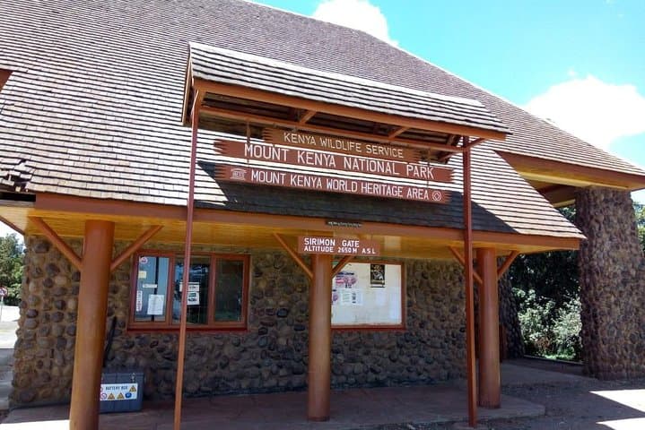
The Sirimon route approaches from the northwest and is prized for its gradual grades and forest-to-alpine transition. Expect roughly 2,200–2,400 m of elevation gain from the Sirimon gate to Point Lenana (4,985 m), spread over four days and about 25–35 km round-trip depending on side trips. Terrain varies: packed dirt, rocky switchbacks, and loose scree near the summit.
Practically, plan for early starts, steady pacing for acclimatization, and layered clothing for dramatic temperature swings. Guides and porters handle camp logistics; bring a warm sleeping bag rated to at least -5°C, sturdy boots with ankle support, a headlamp for summit pushes, and hydration systems. Weather can change fast—move conservatively above 3,800 m and prioritize rest nights. Successful summits are more often about pace, sleep, and hydration than speed.
challenging.
4 days.
Good aerobic fitness and experience with multi-day hikes; ability to handle sustained uphill walking and 4,500–5,000 m altitudes.
Sirimon is considered one of the easier approaches because it gains altitude more gradually and offers good campsites, but the summit still requires strong fitness and altitude readiness.
You don’t need technical mountaineering skills, but prior multi-day hiking or previous high-altitude exposure helps with pacing and acclimatization.
Permits and park regulations typically require hiring guides; porters are highly recommended to carry tents and bulk gear to reduce fatigue and aid acclimatization.
Dry seasons (roughly January–March and July–October) offer more stable weather and clearer summit conditions, though mountain weather can change anytime.
Mount Kenya has long cultural significance for the Kikuyu people and was a landmark for colonial explorers; the national park was established in 1949 to protect its unique ecology.
Stay on marked trails, pack out all waste, and support local guides and community-run conservation projects; the high-altitude flora recovers slowly from trampling.
Game Africa Safaris operates guided outdoor trips and adventures with an emphasis on safety, stewardship, and memorable experiences.
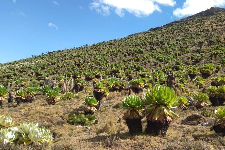
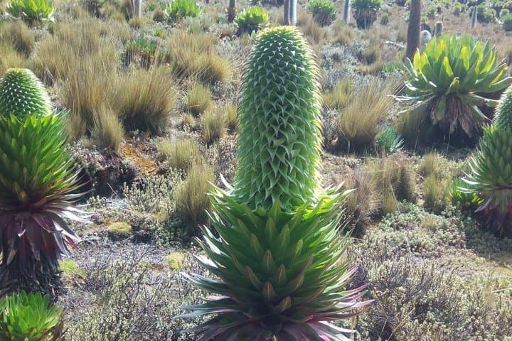
Dawn breaks cool above the tree line and the Sirimon trail unfurls like a ribbon of soil and stone toward the knife-edge of the peaks. You move through a layered landscape—moss-draped forest, bamboo thickets that cough with sunlight, then the open afro-alpine heaths where lobelias stand like sentries—each step taking you higher and the air thinner.
Dawn breaks cool above the tree line and the Sirimon trail unfurls like a ribbon of soil and stone toward the knife-edge of the peaks. You move through a layered landscape—moss-draped forest, bamboo thickets that cough with sunlight, then the open afro-alpine heaths where lobelias stand like sentries—each step taking you higher and the air thinner.
Mount Kenya is Kenya’s highest peak and Africa’s second after Kilimanjaro. Geologically it’s an ancient shield volcano eroded into jagged summits; the central peaks (Batia, Nelion, Lenana) are glacially sculpted granite. The mountain is culturally significant to the Kikuyu and neighbouring peoples, long considered sacred and woven into local oral history. The upper slopes fall within Mount Kenya National Park and a UNESCO Biosphere Reserve, protecting fragile habitats and endemic plants.
The Sirimon route approaches from the northwest and is prized for its gradual grades and forest-to-alpine transition. Expect roughly 2,200–2,400 m of elevation gain from the Sirimon gate to Point Lenana (4,985 m), spread over four days and about 25–35 km round-trip depending on side trips. Terrain varies: packed dirt, rocky switchbacks, and loose scree near the summit.
Practically, plan for early starts, steady pacing for acclimatization, and layered clothing for dramatic temperature swings. Guides and porters handle camp logistics; bring a warm sleeping bag rated to at least -5°C, sturdy boots with ankle support, a headlamp for summit pushes, and hydration systems. Weather can change fast—move conservatively above 3,800 m and prioritize rest nights. Successful summits are more often about pace, sleep, and hydration than speed.