THE ADVENTURE COLLECTIVE® · Independent discovery and booking for outdoor travel

Four days of remote roads, limestone cliffs and ethnic markets bring travelers from Hanoi to the Dong Van Karst Plateau. Expect hairpin passes, the Ma Pi Leng viewpoint and a riverboat through Tu San canyon, plus local homestays and Dong Van’s old quarter.
Four days of remote roads, limestone cliffs and ethnic markets bring travelers from Hanoi to the Dong Van Karst Plateau. Expect hairpin passes, the Ma Pi Leng viewpoint and a riverboat through Tu San canyon, plus local homestays and Dong Van’s old quarter.
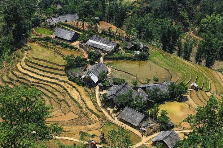
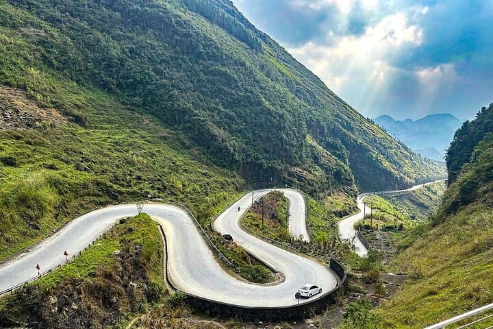
Dawn breaks over the high ridges as a minibus climbs away from Hanoi and the lowlands fall into mist. By midday the road opens onto limestone teeth and plateaus: steep, ribbed cliffs alternate with narrow valleys where ethnic villages press against stone. The trip threads through Quan Ba Heaven Gate (above 1,500 m), the hairpin sweep of Bac Sum slope, and the 21 km Ma Pi Leng Pass before settling at the Dong Van old quarter.
Verified experiences and guided adventures in the surrounding area.
Operated by Before2 · Ha Giang, Ha Giang
Dawn breaks over the high ridges as a minibus climbs away from Hanoi and the lowlands fall into mist. By midday the road opens onto limestone teeth and plateaus: steep, ribbed cliffs alternate with narrow valleys where ethnic villages press against stone. The trip threads through Quan Ba Heaven Gate (above 1,500 m), the hairpin sweep of Bac Sum slope, and the 21 km Ma Pi Leng Pass before settling at the Dong Van old quarter.
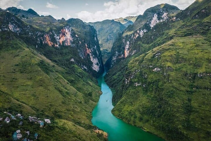
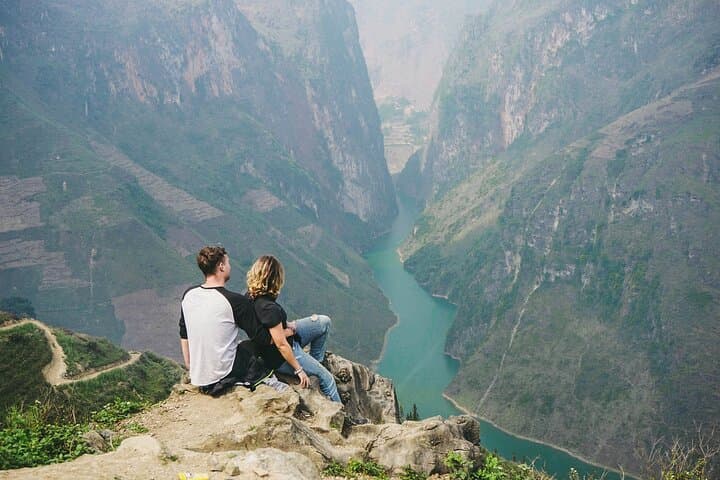
This corner of northern Vietnam is part of the Dong Van Karst Plateau Geopark (a UNESCO-recognized site) — a hard, ancient landscape carved from limestone over geological time into pinnacles, deep canyons and river-carved gorges. The area is home to H’Mong, Dao and other ethnic groups; their stone houses, woven textiles and markets at Dong Van give cultural texture to the scenery. Lung Cu Flag Tower marks Vietnam’s northern edge, and the Tu San (Nho Que) canyon plunges roughly 700–900 m deep, with cliffs towering near 1,500 m.
Practical guidance: expect long driving days, short village treks, and a morning boat on the Tu San river; carry layered clothing, a sturdy pair of hiking shoes and a 2–3 liter water capacity. Altitude and sun are real factors — mornings can be cool, afternoons warm. Plan for early starts to catch light on the passes, and keep small local currency for markets and entrance fees. The itinerary suits travelers in moderate shape who want a mix of road scenery, short hikes, cultural stops and a riverboat leg through one of Southeast Asia’s deepest gorges.
moderate.
4 days (daily transfers 6–10 hours).
Moderate fitness—able to handle long vehicle days, short hikes, stairs at viewpoints and an on-river boat transfer.
Most days involve 4–8 hours of driving with stops; plan for longer transfer periods on Day 1 and the return to Hanoi.
The Tu San boat section is on calm river water within a deep canyon; conditions are usually smooth but can be affected by seasonal rainfall.
Yes—hotels are provided (Ha Giang city and Dong Van town as noted); this tour does not require camping.
Not recommended for infants or pregnant travelers due to long vehicle transfers and uneven terrain; check tour operator age policies.
The plateau has long been a borderland of ethnic exchange and resistance; many passes were also strategic routes during 20th-century conflicts.
The geopark status focuses on protecting karst formations and local culture; visitors should stick to trails, avoid removing rock or artifacts, and use local guides to reduce impact.
Before2 operates guided outdoor trips and adventures with an emphasis on safety, stewardship, and memorable experiences.
Dawn breaks over the high ridges as a minibus climbs away from Hanoi and the lowlands fall into mist. By midday the road opens onto limestone teeth and plateaus: steep, ribbed cliffs alternate with narrow valleys where ethnic villages press against stone. The trip threads through Quan Ba Heaven Gate (above 1,500 m), the hairpin sweep of Bac Sum slope, and the 21 km Ma Pi Leng Pass before settling at the Dong Van old quarter.
Dawn breaks over the high ridges as a minibus climbs away from Hanoi and the lowlands fall into mist. By midday the road opens onto limestone teeth and plateaus: steep, ribbed cliffs alternate with narrow valleys where ethnic villages press against stone. The trip threads through Quan Ba Heaven Gate (above 1,500 m), the hairpin sweep of Bac Sum slope, and the 21 km Ma Pi Leng Pass before settling at the Dong Van old quarter.
This corner of northern Vietnam is part of the Dong Van Karst Plateau Geopark (a UNESCO-recognized site) — a hard, ancient landscape carved from limestone over geological time into pinnacles, deep canyons and river-carved gorges. The area is home to H’Mong, Dao and other ethnic groups; their stone houses, woven textiles and markets at Dong Van give cultural texture to the scenery. Lung Cu Flag Tower marks Vietnam’s northern edge, and the Tu San (Nho Que) canyon plunges roughly 700–900 m deep, with cliffs towering near 1,500 m.
Practical guidance: expect long driving days, short village treks, and a morning boat on the Tu San river; carry layered clothing, a sturdy pair of hiking shoes and a 2–3 liter water capacity. Altitude and sun are real factors — mornings can be cool, afternoons warm. Plan for early starts to catch light on the passes, and keep small local currency for markets and entrance fees. The itinerary suits travelers in moderate shape who want a mix of road scenery, short hikes, cultural stops and a riverboat leg through one of Southeast Asia’s deepest gorges.