THE ADVENTURE COLLECTIVE® · Independent discovery and booking for outdoor travel

A four-day, 42 km trek that follows an ancient Inca road through high Andean passes and cloud forest to Machu Picchu. This guide covers what to expect, key ruins on the route, altitude considerations and practical tips to help you prepare.
A four-day, 42 km trek that follows an ancient Inca road through high Andean passes and cloud forest to Machu Picchu. This guide covers what to expect, key ruins on the route, altitude considerations and practical tips to help you prepare.
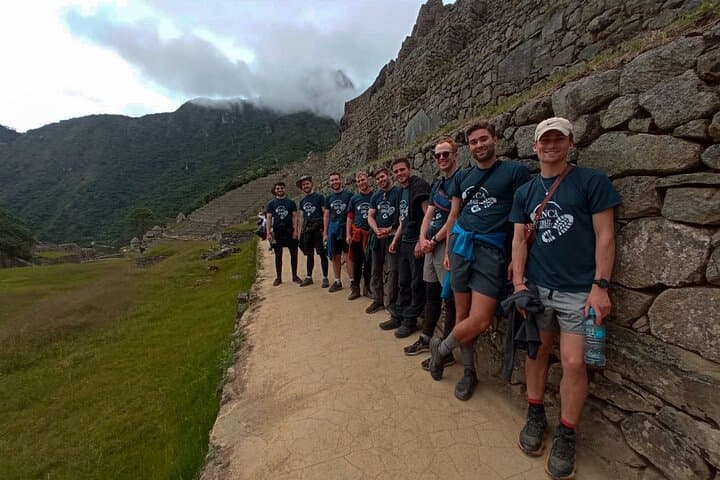
Dawn breaks over the Urubamba Valley as a column of hikers steps off at Kilometer 82, the trailhead where centuries of stone steps and switchbacks begin to climb. Cold air pushes at your face, cloud forest below humming like a living engine, and the path—originally an Inca road—pulls you through terraces and ruined outposts toward the Sun Gate.
Verified experiences and guided adventures in the surrounding area.
Operated by Inca Trail Machu · Cusco, Cusco
Dawn breaks over the Urubamba Valley as a column of hikers steps off at Kilometer 82, the trailhead where centuries of stone steps and switchbacks begin to climb. Cold air pushes at your face, cloud forest below humming like a living engine, and the path—originally an Inca road—pulls you through terraces and ruined outposts toward the Sun Gate.
The route covers roughly 42 km (26 miles) over four days, threading archaeological sites such as Llactapata, Runkurakay, Sayacmarca, Phuyupatamarca and Wiñay Wayna. Geologically the trail rides the spine of the eastern Andes where uplifted granite and volcanic soils create steep valleys and abrupt passes; Dead Woman’s Pass (Warmiwañusca) is the high point at 4,215 m (13,828 ft). Culturally this path was an imperial corridor—trade, ceremony and communication—and its stonework still channels rain and footfall as it did for the Incas.
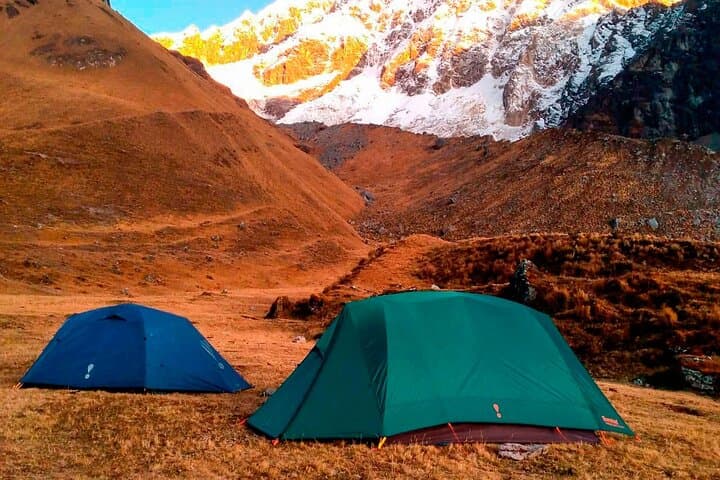
Expect a mix of high-altitude grasslands, cloud forest full of orchids and bromeliads, and terraces that once fed an empire. Guides interpret ruins, cooks handle camp logistics, and super-porters carry communal gear while you carry a personal duffel (up to 7 kg).
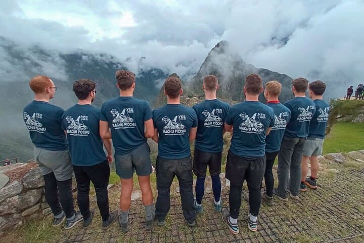
Practical guidance: prioritize at least 48–72 hours of acclimatization in Cusco, pace your ascent through the passes, use layered clothing for wide temperature swings, and hydrate deliberately—altitude changes make thirst deceptive. Permits are limited and required in advance. Finish at the Sun Gate for the first view of Machu Picchu, then descend to Aguas Calientes and return by train to Ollantaytambo and bus to Cusco.
challenging.
4 days.
Good aerobic fitness and experience with sustained uphill hiking at altitude; ability to hike 6–8 hours with breaks is recommended
Yes. Inca Trail permits are limited and tied to specific departure dates; book through an authorized operator well in advance.
It is the trail’s highest and most strenuous ascent (4,215 m); steep switchbacks and altitude make it a sustained effort—pace yourself and use poles.
This tour includes super-porters for shared gear and a professional trekking chef; a personal porter for up to 7 kg is also provided.
No. The trek is not recommended for those with serious heart, spine, or pregnancy concerns and requires a high level of physical fitness and altitude tolerance.
The trail is part of the Inca road network (Qhapaq Ñan) used for administration and pilgrimage; Hiram Bingham’s 1911 expedition later brought Machu Picchu to wider attention.
Peru limits daily permits to reduce erosion and visitor impact; operators supply composting toilets and many offer reforestation initiatives to offset tourism pressure.
Inca Trail Machu operates guided outdoor trips and adventures with an emphasis on safety, stewardship, and memorable experiences.
Dawn breaks over the Urubamba Valley as a column of hikers steps off at Kilometer 82, the trailhead where centuries of stone steps and switchbacks begin to climb. Cold air pushes at your face, cloud forest below humming like a living engine, and the path—originally an Inca road—pulls you through terraces and ruined outposts toward the Sun Gate.
Dawn breaks over the Urubamba Valley as a column of hikers steps off at Kilometer 82, the trailhead where centuries of stone steps and switchbacks begin to climb. Cold air pushes at your face, cloud forest below humming like a living engine, and the path—originally an Inca road—pulls you through terraces and ruined outposts toward the Sun Gate.
The route covers roughly 42 km (26 miles) over four days, threading archaeological sites such as Llactapata, Runkurakay, Sayacmarca, Phuyupatamarca and Wiñay Wayna. Geologically the trail rides the spine of the eastern Andes where uplifted granite and volcanic soils create steep valleys and abrupt passes; Dead Woman’s Pass (Warmiwañusca) is the high point at 4,215 m (13,828 ft). Culturally this path was an imperial corridor—trade, ceremony and communication—and its stonework still channels rain and footfall as it did for the Incas.
Expect a mix of high-altitude grasslands, cloud forest full of orchids and bromeliads, and terraces that once fed an empire. Guides interpret ruins, cooks handle camp logistics, and super-porters carry communal gear while you carry a personal duffel (up to 7 kg).
Practical guidance: prioritize at least 48–72 hours of acclimatization in Cusco, pace your ascent through the passes, use layered clothing for wide temperature swings, and hydrate deliberately—altitude changes make thirst deceptive. Permits are limited and required in advance. Finish at the Sun Gate for the first view of Machu Picchu, then descend to Aguas Calientes and return by train to Ollantaytambo and bus to Cusco.