THE ADVENTURE COLLECTIVE® · Independent discovery and booking for outdoor travel

A four-day circuit through Vietnam’s northernmost karst plateau, the Ha Giang Loop pairs dramatic mountain passes with intimate encounters with Hmong and Dao villages. Expect long driving days, short treks, and geology that steals the show.
A four-day circuit through Vietnam’s northernmost karst plateau, the Ha Giang Loop pairs dramatic mountain passes with intimate encounters with Hmong and Dao villages. Expect long driving days, short treks, and geology that steals the show.
You step off the VIP van and the air changes—cooler, drier, sifted through limestone ridges that rise like the ribs of the earth.
Verified experiences and guided adventures in the surrounding area.
Operated by Ha Giang Amazing Tours · Ha Giang, Ha Giang Province
You step off the VIP van and the air changes—cooler, drier, sifted through limestone ridges that rise like the ribs of the earth.
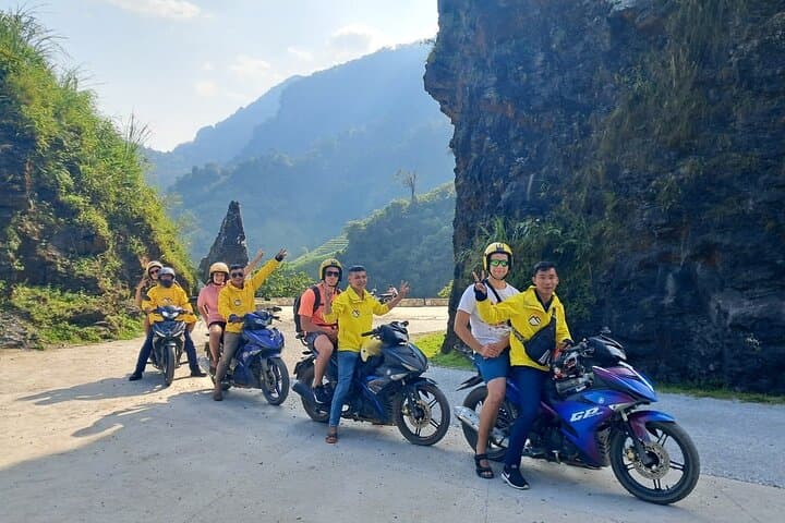
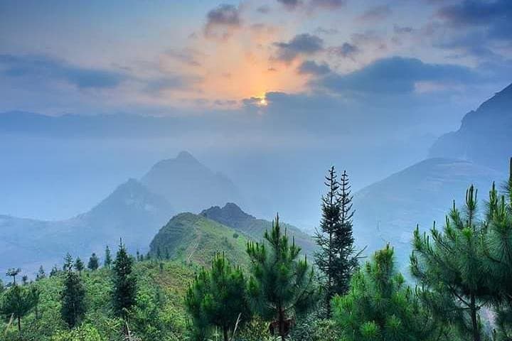
Over four days the Ha Giang Loop moves you through a raw northern edge of Vietnam: tight switchbacks, the razor spine of Mã Pì Lèng Pass, and the deep cut of the Nho Quế River far below. The Dong Van Karst Plateau is UNESCO-recognized for its fossil-rich limestone plateau; the landscape here is the work of uplift and erosion over millions of years, not polite scenery but geological argument.
Local culture is visible in doorways and markets—Hmong, Dao and Tay communities practice highland agriculture and brocade weaving that traces back generations. Historic trade routes and tension along the border with China shaped the towns you pass; small villages keep ceremonial songs and communal houses alive.
Expect varied terrain: paved mountain passes, gravel village tracks, and short rocky hikes like the Sky Path lookout. Daily driving and riding average 4–6 hours, with elevations up to about 1,500 m; short treks of 30–90 minutes test balance more than cardio. Weather can flip—sun to squall—so layers matter.
Practical tips: schedule early departures to avoid afternoon fog, carry at least 2 liters of water, and use a small daypack for camera, rain layers, and basic first aid. Respect local customs—ask before photographing people—and leave no trace on fragile karst fields. The reward is immediate: sweeping valley views, a close-up of highland life, and roads that dare you to look away.
moderate.
4 days.
Comfortable with several hours of daily sitting and short hikes of up to 1–2 hours; basic mobility required for homestays and uneven village paths.
No; the tour provides a motorbike with a driver/guide—guests can ride as passengers or travel by van when available.
Basic fitness is sufficient—most activity is road travel with short hikes that require steady footing rather than endurance.
Yes; homestays vary in comfort but generally accommodate families—advance requests for bedding or child arrangements are recommended.
Take it easy on ascent days, stay hydrated, eat light meals, and ask guides for frequent stops; medication for motion sickness helps if you are susceptible.
The Dong Van Karst Plateau has been shaped by geologic uplift and human settlement for centuries; trade routes and border dynamics influenced local architecture and clan ties.
The geopark faces pressure from tourism and informal agriculture—travelers should stick to trails, avoid littering, and support local guides and homestays to channel benefits into communities.
Ha Giang Amazing Tours operates guided outdoor trips and adventures with an emphasis on safety, stewardship, and memorable experiences.
You step off the VIP van and the air changes—cooler, drier, sifted through limestone ridges that rise like the ribs of the earth.
You step off the VIP van and the air changes—cooler, drier, sifted through limestone ridges that rise like the ribs of the earth.
Over four days the Ha Giang Loop moves you through a raw northern edge of Vietnam: tight switchbacks, the razor spine of Mã Pì Lèng Pass, and the deep cut of the Nho Quế River far below. The Dong Van Karst Plateau is UNESCO-recognized for its fossil-rich limestone plateau; the landscape here is the work of uplift and erosion over millions of years, not polite scenery but geological argument.
Local culture is visible in doorways and markets—Hmong, Dao and Tay communities practice highland agriculture and brocade weaving that traces back generations. Historic trade routes and tension along the border with China shaped the towns you pass; small villages keep ceremonial songs and communal houses alive.
Expect varied terrain: paved mountain passes, gravel village tracks, and short rocky hikes like the Sky Path lookout. Daily driving and riding average 4–6 hours, with elevations up to about 1,500 m; short treks of 30–90 minutes test balance more than cardio. Weather can flip—sun to squall—so layers matter.
Practical tips: schedule early departures to avoid afternoon fog, carry at least 2 liters of water, and use a small daypack for camera, rain layers, and basic first aid. Respect local customs—ask before photographing people—and leave no trace on fragile karst fields. The reward is immediate: sweeping valley views, a close-up of highland life, and roads that dare you to look away.