THE ADVENTURE COLLECTIVE® · Independent discovery and booking for outdoor travel

Four days of high-Atlas walking from Marrakech through Imnan, Azzaden and Imlil valleys, staying in Berber guesthouses. Expect 5–7 hours of hiking daily, mule support, steep passes near 2,400 m and vivid local culture.
Four days of high-Atlas walking from Marrakech through Imnan, Azzaden and Imlil valleys, staying in Berber guesthouses. Expect 5–7 hours of hiking daily, mule support, steep passes near 2,400 m and vivid local culture.
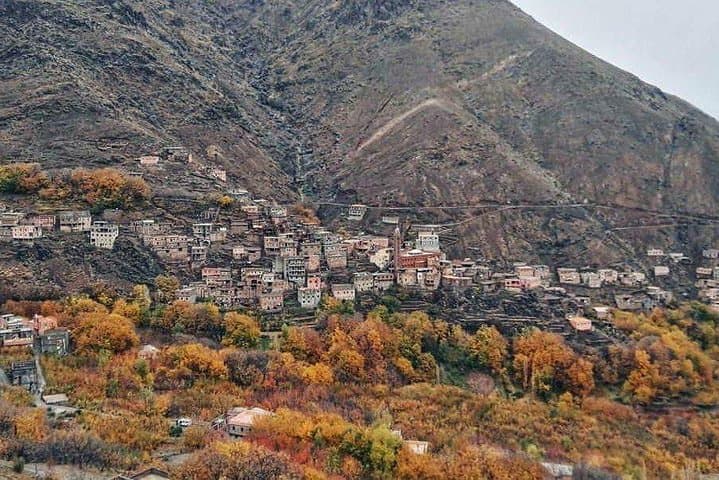
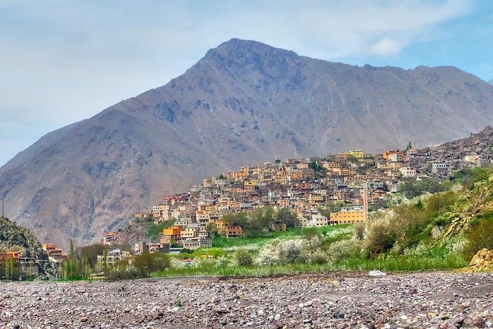
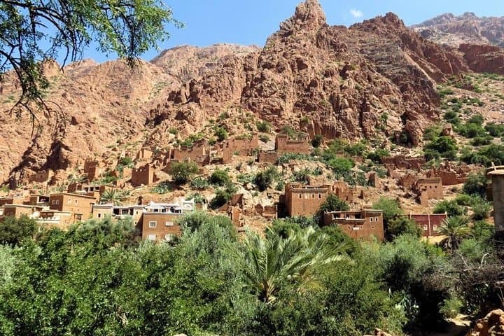
A dust-sliced road carries you from Marrakech up into a sharpening world of stone and terraced fields. By midmorning the city heat gives way to the cool pine-scented air of the High Atlas, and the path begins to climb past mule strings and flat-roofed Berber houses painted in sun-baked ochre.
Verified experiences and guided adventures in the surrounding area.
Operated by Morocco Tours Services · Imlil, Marrakech-Safi
A dust-sliced road carries you from Marrakech up into a sharpening world of stone and terraced fields. By midmorning the city heat gives way to the cool pine-scented air of the High Atlas, and the path begins to climb past mule strings and flat-roofed Berber houses painted in sun-baked ochre.
Over four days the route threads three distinct valleys—Imnan, Azzaden and Imlil—crossing Tizi passes near 2,300–2,500 m and finishing beside a broad waterfall above Imlil. The mountains here are folded and uplifted rock carved by winter snows and seasonal streams; you’ll pass age-old irrigation channels and fields whose rigging of stone walls hints at centuries of mountain agriculture. Villages are predominantly Berber (Amazigh) communities where guesthouses (gites) and local hammams offer concrete comforts after long days on trail.
Expect steady ascents of 500–800 m on single-track trails, rocky switchbacks and mule tracks with intermittent loose scree. Daily hikes average 5–7 hours with packed lunches and evenings in family-run riads. Local muleteers often carry luggage; the guides manage logistics and interpret cultural points along the way.
Practical tip: pace the ascent, carry 2–3 liters of water, and layer for large temperature swings—cold mornings, hot afternoons, cool nights. Good trekking boots with ankle support and trekking poles will make steep descents easier. Familiarize yourself with basic altitude awareness: symptoms are usually mild below 2,800 m but move deliberately and communicate with your guide if you feel off.
moderate.
4 days (approx. 5–7 hours hiking per day).
Good cardio and leg strength for sustained uphill and downhill hiking; comfortable carrying a daypack of 6–10 kg.
Days are generally 5–7 hours on trails with steady climbs and descents; fitness for continuous uphill walking is recommended.
Muleteers usually transport main luggage between guesthouses; you should carry only a comfortable daypack with essentials.
No special permits are required for this route; the local operator and guide handle logistics and entry where needed.
Nights are in family-run gites or riads with basic private or shared rooms and communal meals prepared from local ingredients.
The High Atlas has long been home to Amazigh (Berber) communities who developed terraced agriculture and mule-based trade routes connecting mountain villages to Marrakech.
Trails pass fragile alpine meadows and water channels; stay on marked paths, avoid single-use plastics, and support local guides and guesthouses to sustain the mountain economy.
Morocco Tours Services operates guided outdoor trips and adventures with an emphasis on safety, stewardship, and memorable experiences.
A dust-sliced road carries you from Marrakech up into a sharpening world of stone and terraced fields. By midmorning the city heat gives way to the cool pine-scented air of the High Atlas, and the path begins to climb past mule strings and flat-roofed Berber houses painted in sun-baked ochre.
A dust-sliced road carries you from Marrakech up into a sharpening world of stone and terraced fields. By midmorning the city heat gives way to the cool pine-scented air of the High Atlas, and the path begins to climb past mule strings and flat-roofed Berber houses painted in sun-baked ochre.
Over four days the route threads three distinct valleys—Imnan, Azzaden and Imlil—crossing Tizi passes near 2,300–2,500 m and finishing beside a broad waterfall above Imlil. The mountains here are folded and uplifted rock carved by winter snows and seasonal streams; you’ll pass age-old irrigation channels and fields whose rigging of stone walls hints at centuries of mountain agriculture. Villages are predominantly Berber (Amazigh) communities where guesthouses (gites) and local hammams offer concrete comforts after long days on trail.
Expect steady ascents of 500–800 m on single-track trails, rocky switchbacks and mule tracks with intermittent loose scree. Daily hikes average 5–7 hours with packed lunches and evenings in family-run riads. Local muleteers often carry luggage; the guides manage logistics and interpret cultural points along the way.
Practical tip: pace the ascent, carry 2–3 liters of water, and layer for large temperature swings—cold mornings, hot afternoons, cool nights. Good trekking boots with ankle support and trekking poles will make steep descents easier. Familiarize yourself with basic altitude awareness: symptoms are usually mild below 2,800 m but move deliberately and communicate with your guide if you feel off.