THE ADVENTURE COLLECTIVE® · Independent discovery and booking for outdoor travel

Travel from Cuenca to Quito across four or five days that stitch together volcano rims, highland markets and waterfall country. This compact circuit mixes short crater hikes, cultural markets and scenic stops with practical altitude considerations.
Travel from Cuenca to Quito across four or five days that stitch together volcano rims, highland markets and waterfall country. This compact circuit mixes short crater hikes, cultural markets and scenic stops with practical altitude considerations.
A thin mountain light cuts across the windshield as a small convoy leaves Cuenca, the city’s red-tiled roofs shrinking behind you and the Andes opening ahead. On this multi-day route the road becomes a travelogue: colonial plazas and train stations in Alausí, steaming falls around Baños, the green bowl of Quilotoa crater lake, and the stark volcanic slopes of Cotopaxi. The wind seems to push you from one landscape to the next, and at higher elevations the air itself asserts a brisk, sharp presence.
Verified experiences and guided adventures in the surrounding area.
Operated by Polylepis Tours · Cuenca, Azuay
A thin mountain light cuts across the windshield as a small convoy leaves Cuenca, the city’s red-tiled roofs shrinking behind you and the Andes opening ahead. On this multi-day route the road becomes a travelogue: colonial plazas and train stations in Alausí, steaming falls around Baños, the green bowl of Quilotoa crater lake, and the stark volcanic slopes of Cotopaxi. The wind seems to push you from one landscape to the next, and at higher elevations the air itself asserts a brisk, sharp presence.
These places carry layered histories — Spanish missions and the Balbanera Church mark early colonial settlement; highland trade routes shaped markets in Pujilí; and Quilotoa is a volcanic caldera formed by a violent collapse some 800 years ago. Local Quechua-speaking communities still tend fields and sell produce at markets, keeping agricultural rhythms older than modern roads.
Expect varied terrain: paved roads and village streets, short crater descents at Quilotoa (steep 300–400 m return climbs), easy boardwalks around Limpiopungo, and trails by waterfalls in Baños. Altitude is the practical constraint — you reach 3,000–4,800 m in parts of the itinerary, so pace and hydration matter more than technical gear.
Practical tips: layer for sun, wind and sudden rain; plan gentle activity the first day to acclimatize; carry water and peanuts for quick energy; and bring cash for small local purchases and optional horse rides at Quilotoa. This route balances cultural encounters with hands-on outdoor moments — walking markets, rim hikes, lake descents, and park strolls — making it an accessible Andes circuit for travelers comfortable with moderate activity and high-altitude conditions.
moderate.
4–5 days.
Moderate fitness: able to walk several hours across uneven ground and tolerate short, steep climbs at altitude.
Yes — parts of the tour reach 3,000–4,800 m. Move slowly, hydrate, avoid alcohol on arrival days and consider acetazolamide if you have prior susceptibility (consult your doctor).
Typical inclusions are breakfasts, one courtesy lunch, national park fees, four nights double-occupancy lodging, and pickup from hotels; check the voucher for exact items.
Hikes are mostly non-technical rim walks, short crater descents and easy park trails; a guide accompanies the group for logistics and local interpretation.
Yes — an optional fifth day can be added to visit Mindo Cloud Forest and the Middle of the World monument for an extra charge.
The route threads colonial-era sites like Balbanera Church with indigenous highland communities whose agricultural calendars and markets preserve centuries-old practices.
Highland ecosystems are fragile — stick to marked trails, pack out waste and avoid feeding wildlife; national park fees contribute to local conservation and visitor management.
Polylepis Tours operates guided outdoor trips and adventures with an emphasis on safety, stewardship, and memorable experiences.
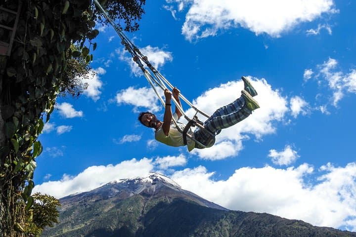
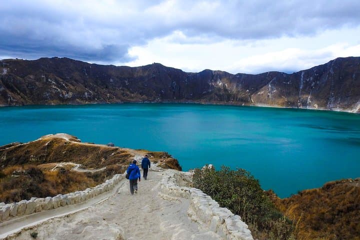
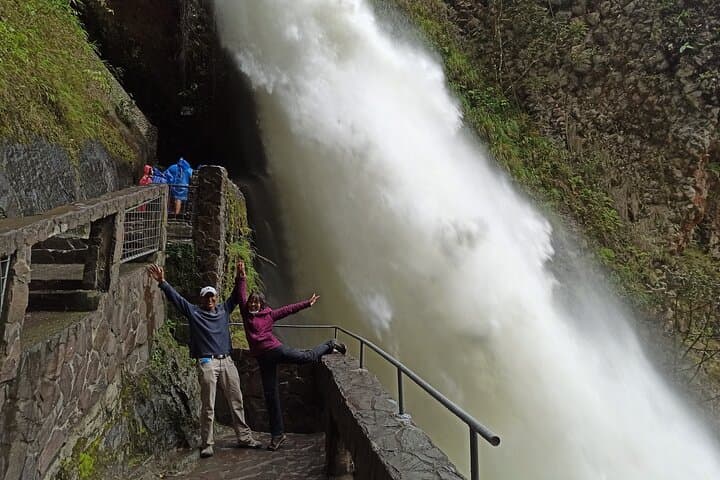
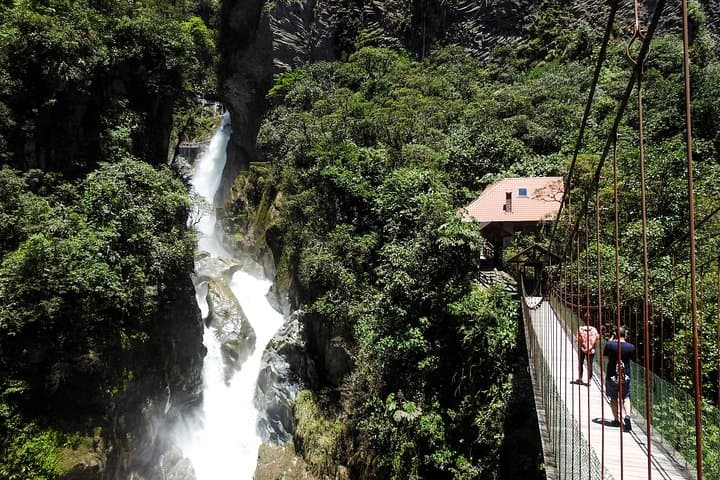
A thin mountain light cuts across the windshield as a small convoy leaves Cuenca, the city’s red-tiled roofs shrinking behind you and the Andes opening ahead. On this multi-day route the road becomes a travelogue: colonial plazas and train stations in Alausí, steaming falls around Baños, the green bowl of Quilotoa crater lake, and the stark volcanic slopes of Cotopaxi. The wind seems to push you from one landscape to the next, and at higher elevations the air itself asserts a brisk, sharp presence.
A thin mountain light cuts across the windshield as a small convoy leaves Cuenca, the city’s red-tiled roofs shrinking behind you and the Andes opening ahead. On this multi-day route the road becomes a travelogue: colonial plazas and train stations in Alausí, steaming falls around Baños, the green bowl of Quilotoa crater lake, and the stark volcanic slopes of Cotopaxi. The wind seems to push you from one landscape to the next, and at higher elevations the air itself asserts a brisk, sharp presence.
These places carry layered histories — Spanish missions and the Balbanera Church mark early colonial settlement; highland trade routes shaped markets in Pujilí; and Quilotoa is a volcanic caldera formed by a violent collapse some 800 years ago. Local Quechua-speaking communities still tend fields and sell produce at markets, keeping agricultural rhythms older than modern roads.
Expect varied terrain: paved roads and village streets, short crater descents at Quilotoa (steep 300–400 m return climbs), easy boardwalks around Limpiopungo, and trails by waterfalls in Baños. Altitude is the practical constraint — you reach 3,000–4,800 m in parts of the itinerary, so pace and hydration matter more than technical gear.
Practical tips: layer for sun, wind and sudden rain; plan gentle activity the first day to acclimatize; carry water and peanuts for quick energy; and bring cash for small local purchases and optional horse rides at Quilotoa. This route balances cultural encounters with hands-on outdoor moments — walking markets, rim hikes, lake descents, and park strolls — making it an accessible Andes circuit for travelers comfortable with moderate activity and high-altitude conditions.