
3-Day Trek to Laguna del Otún and Cocora Valley from Manizales
A three-day high-Andes circuit linking Laguna del Otún and the Cocora Valley, starting from Manizales. Expect páramo ridges, volcanic views, peasant fincas and a steep descent into Salento.
An Adventure In Manizales.
A three-day high-Andes circuit linking Laguna del Otún and the Cocora Valley, starting from Manizales. Expect páramo ridges, volcanic views, peasant fincas and a steep descent into Salento.
Read the full experience
Morning light arrives cold and thin above the Central Andes as a convoy of 4x4s climbs out of Manizales toward the Los Nevados corridor.
Morning light arrives cold and thin above the Central Andes as a convoy of 4x4s climbs out of Manizales toward the Los Nevados corridor.
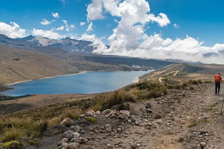
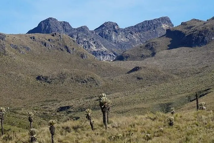
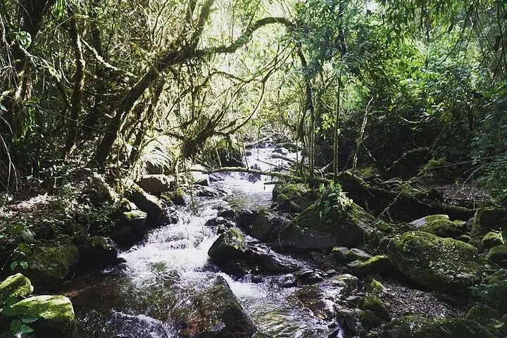
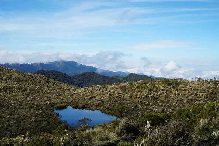
Within hours vegetation thins to páramo — a wild, wind-sculpted grassland — and the trail opens to Laguna del Otún, a high-altitude lake fed by glaciers and snowmelt. Hikers cross rocky talus and peat bogs, follow small streams that dare you to step lighter, and gain repeated, breath-stealing views of volcanic summits such as Nevado del Ruiz and Santa Isabel. The route includes an 8 km stretch to the first peasant refuge near Potosí (≈3,850 m), then continues over Paramillo del Quindío plateaus (≈3,250–3,950 m) before descending through cloud forest and waterfalls into the deep green folds of the Cocora Valley (≈2,400 m) and the painted streets of Salento.
This circuit combines natural history — glacially carved basins and nutrient-poor páramo soils — with Quindío’s coffee-culture villages and working fincas where local shepherding and water collection shape livelihoods. Guides coordinate permits and lodging; accommodations are simple peasant fincas with hot showers and regional meals.
Practical notes: acclimatize in Manizales or Pereira for a day, expect temperature swings from below freezing at high passes to warm valley afternoons, and plan for steep descents with wet clay underfoot. Bring layered clothing, waterproof boots, at least 2–3 liters of water per day, and basic altitude awareness. The itinerary is physically demanding but non-technical; the payoff is wide, high-mountain sky and the towering wax palms of Cocora on the final descent.
Frequently asked questions
The itinerary reaches roughly 3,850–3,950 meters on the páramo around Potosí and Paramillo del Quindío before descending to Cocora Valley (≈2,400 m).
Yes — Los Nevados National Natural Park manages access and guides typically handle permits and entrance fees as part of the tour.
No technical backpacking skills are needed, but you should be comfortable hiking multiple days with variable terrain and altitude exposure.
Overnights are in local peasant fincas and mountain refuges — basic but with hot showers and prepared regional meals included.
About This Experience
Quimbayas Trail Colombia operates guided outdoor trips and adventures with an emphasis on safety, stewardship, and memorable experiences.
Adventure tips
Recommended gear
- Waterproof hiking boots: Protect feet on wet páramo and steep, slippery descents.
- Insulating midlayer (fleece/down): Nights and high passes can drop below freezing; a warm midlayer is essential.
- Rain shell: Lightweight waterproof layer keeps you dry during frequent mountain showers.
- Hydration system (2–3 L): High-elevation exertion requires regular fluid intake to limit altitude effects.
Photos of the experience
Related adventures & guides
Read the full experience
Morning light arrives cold and thin above the Central Andes as a convoy of 4x4s climbs out of Manizales toward the Los Nevados corridor.
Morning light arrives cold and thin above the Central Andes as a convoy of 4x4s climbs out of Manizales toward the Los Nevados corridor.
Within hours vegetation thins to páramo — a wild, wind-sculpted grassland — and the trail opens to Laguna del Otún, a high-altitude lake fed by glaciers and snowmelt. Hikers cross rocky talus and peat bogs, follow small streams that dare you to step lighter, and gain repeated, breath-stealing views of volcanic summits such as Nevado del Ruiz and Santa Isabel. The route includes an 8 km stretch to the first peasant refuge near Potosí (≈3,850 m), then continues over Paramillo del Quindío plateaus (≈3,250–3,950 m) before descending through cloud forest and waterfalls into the deep green folds of the Cocora Valley (≈2,400 m) and the painted streets of Salento.
This circuit combines natural history — glacially carved basins and nutrient-poor páramo soils — with Quindío’s coffee-culture villages and working fincas where local shepherding and water collection shape livelihoods. Guides coordinate permits and lodging; accommodations are simple peasant fincas with hot showers and regional meals.
Practical notes: acclimatize in Manizales or Pereira for a day, expect temperature swings from below freezing at high passes to warm valley afternoons, and plan for steep descents with wet clay underfoot. Bring layered clothing, waterproof boots, at least 2–3 liters of water per day, and basic altitude awareness. The itinerary is physically demanding but non-technical; the payoff is wide, high-mountain sky and the towering wax palms of Cocora on the final descent.
Make a day of it nearby.
Verified experiences and guided adventures in the surrounding area.