THE ADVENTURE COLLECTIVE® · Independent discovery and booking for outdoor travel

Three days of mule tracks, mountain passes and Berber villages in the High Atlas — an accessible introduction to Toubkal’s high valleys. Expect steady climbs, simple lodgings, and rich local encounters between Imin Oughlad and Imlil.
Three days of mule tracks, mountain passes and Berber villages in the High Atlas — an accessible introduction to Toubkal’s high valleys. Expect steady climbs, simple lodgings, and rich local encounters between Imin Oughlad and Imlil.
You crest a rocky shoulder and below, narrow terraces and whitewashed houses step down the valley like a slow stairway. The High Atlas squeezes the horizon into sharp ribs; a wind pushes across the slopes as if testing the pack on your shoulders.
Verified experiences and guided adventures in the surrounding area.
Operated by Ouirgane Atlas Activity · Imlil, Marrakech-Safi
You crest a rocky shoulder and below, narrow terraces and whitewashed houses step down the valley like a slow stairway. The High Atlas squeezes the horizon into sharp ribs; a wind pushes across the slopes as if testing the pack on your shoulders.
This three-day route follows old mule tracks through Berber villages—Imin Oughlad, Tizi Oussem and Imlil—crossing passes used for centuries by shepherds and traders. Geologically the massif is folded metamorphic rock rising abruptly from Marrakech plains, with scree slopes above 2,000–2,400 m and springs that still supply village terraces. Culturally the trail threads farming hamlets where terraced barley and walnut groves mark seasonal rhythms, and small shrines such as Sidi Chamharouch draw local pilgrims.
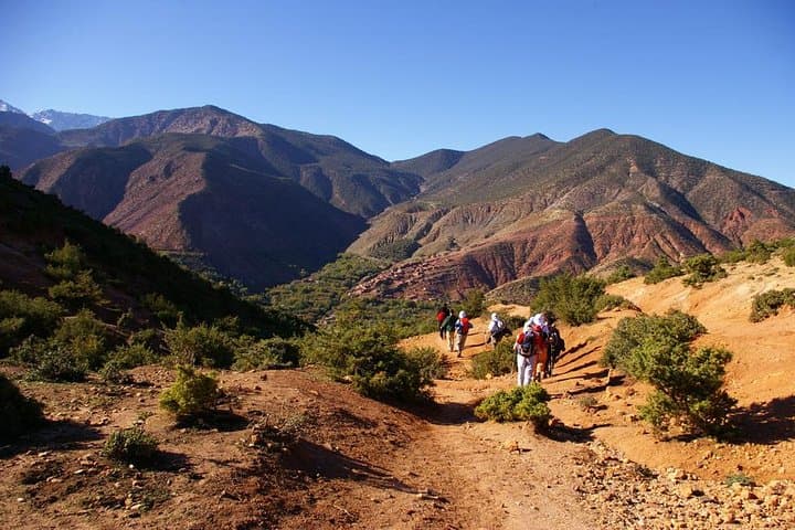
Expect 4–6 hours of walking on Days 1 and 2 with steady climbs to Tizi n Tachte and Tizi Mzik (around 2,000–2,400 m), and a shorter Day 3 with cultural stops and a picnic beneath ancient walnut trees. Terrain alternates dirt tracks, stepped village routes, and rocky singletrack; mules carry luggage but boots with good ankle support are essential. Guides lead navigation and arrange lodging in basic mountain cottages; pack a water filter or tablets, layered clothing for cold nights, and cash for small purchases and tips.
Timing: spring and autumn offer the best weather and wildflowers; winter brings snow above the passes. Respect local customs—ask before photographing—and keep to paths to protect fragile alpine soils. This is a route that pairs village encounters with straightforward mountain travel: scenic, social, and physically engaging.
moderate.
3 days.
Moderate fitness—able to hike 4–6 hours per day on uneven terrain and manage steady ascents to ~2,400 m.
The trek is moderate: trails are well-worn but include steep sections and 4–6 hour walking days; a basic level of fitness and comfortable boots are recommended.
Yes—mules carry luggage and food, allowing you to hike with a daypack only; guides manage mule logistics.
Overnights are in simple mountain lodgings or guesthouses (cottage-style) with shared rooms and basic facilities; expect hearty stews and communal meals.
Routes reach around 2,400 m; most travelers acclimatize fine but watch symptoms—headache, nausea—and inform your guide if they appear.
The High Atlas has been home to Amazigh (Berber) communities for millennia; the mule tracks link seasonal pastures and terraces that shaped village life.
Stay on established trails, limit single-use plastics and respect grazing rotations—fragile alpine soils and limited water in the High Atlas require careful travel.
Ouirgane Atlas Activity operates guided outdoor trips and adventures with an emphasis on safety, stewardship, and memorable experiences.
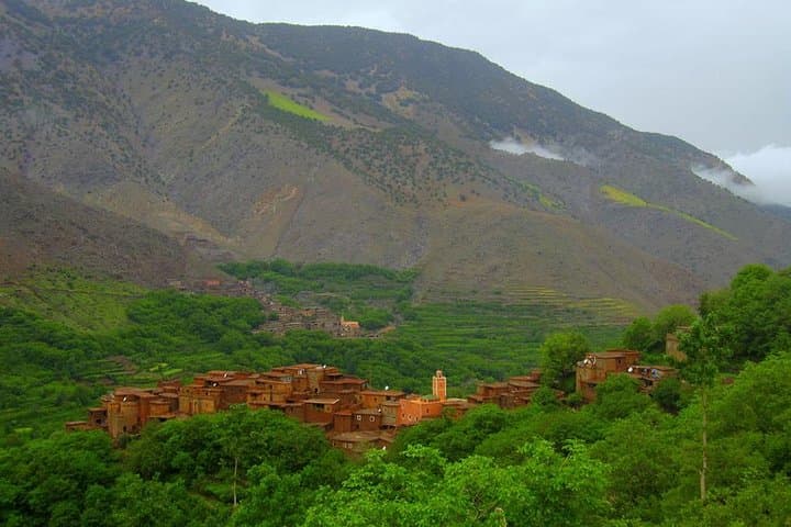
You crest a rocky shoulder and below, narrow terraces and whitewashed houses step down the valley like a slow stairway. The High Atlas squeezes the horizon into sharp ribs; a wind pushes across the slopes as if testing the pack on your shoulders.
You crest a rocky shoulder and below, narrow terraces and whitewashed houses step down the valley like a slow stairway. The High Atlas squeezes the horizon into sharp ribs; a wind pushes across the slopes as if testing the pack on your shoulders.
This three-day route follows old mule tracks through Berber villages—Imin Oughlad, Tizi Oussem and Imlil—crossing passes used for centuries by shepherds and traders. Geologically the massif is folded metamorphic rock rising abruptly from Marrakech plains, with scree slopes above 2,000–2,400 m and springs that still supply village terraces. Culturally the trail threads farming hamlets where terraced barley and walnut groves mark seasonal rhythms, and small shrines such as Sidi Chamharouch draw local pilgrims.
Expect 4–6 hours of walking on Days 1 and 2 with steady climbs to Tizi n Tachte and Tizi Mzik (around 2,000–2,400 m), and a shorter Day 3 with cultural stops and a picnic beneath ancient walnut trees. Terrain alternates dirt tracks, stepped village routes, and rocky singletrack; mules carry luggage but boots with good ankle support are essential. Guides lead navigation and arrange lodging in basic mountain cottages; pack a water filter or tablets, layered clothing for cold nights, and cash for small purchases and tips.
Timing: spring and autumn offer the best weather and wildflowers; winter brings snow above the passes. Respect local customs—ask before photographing—and keep to paths to protect fragile alpine soils. This is a route that pairs village encounters with straightforward mountain travel: scenic, social, and physically engaging.