THE ADVENTURE COLLECTIVE® · Independent discovery and booking for outdoor travel

A compact 3-day route through Vietnam’s northern highlands—drive the spine of Ma Pi Leng Pass, explore Dong Van’s ancient streets and stand at Lung Cu Flagpole. Expect dramatic karst views, ethnic homestays and long travel days punctuated by short hikes and markets.
A compact 3-day route through Vietnam’s northern highlands—drive the spine of Ma Pi Leng Pass, explore Dong Van’s ancient streets and stand at Lung Cu Flagpole. Expect dramatic karst views, ethnic homestays and long travel days punctuated by short hikes and markets.
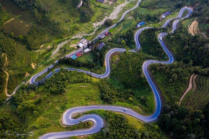
You step off the road at a lookout and the mountains pull you forward—the Ma Pi Leng ridge dropping in serrated folds toward the Nho Que River, which dares you to follow its ribbon of jade far below.
Verified experiences and guided adventures in the surrounding area.
Operated by Vnatour - The Best Vietnam Tour · Ha Giang, Ha Giang Province
You step off the road at a lookout and the mountains pull you forward—the Ma Pi Leng ridge dropping in serrated folds toward the Nho Que River, which dares you to follow its ribbon of jade far below.
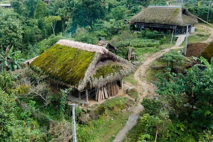
Over three days this route moves from Ha Giang city into the Dong Van Karst Plateau, a landscape of limestone towers carved over millions of years and recognized as a UNESCO Global Geopark. Villages cling to slopes; ethnic groups such as the Hmong, Lo Lo and Tay maintain distinctive textiles, markets and houses like the Vuong Family Residence in Sa Phin—an artifact of 20th-century regional power.
Geology here explains the scenery: uplift and erosion left fractured karst plateaus and deep river gorges, while climate and isolation shaped diverse cultural pockets.
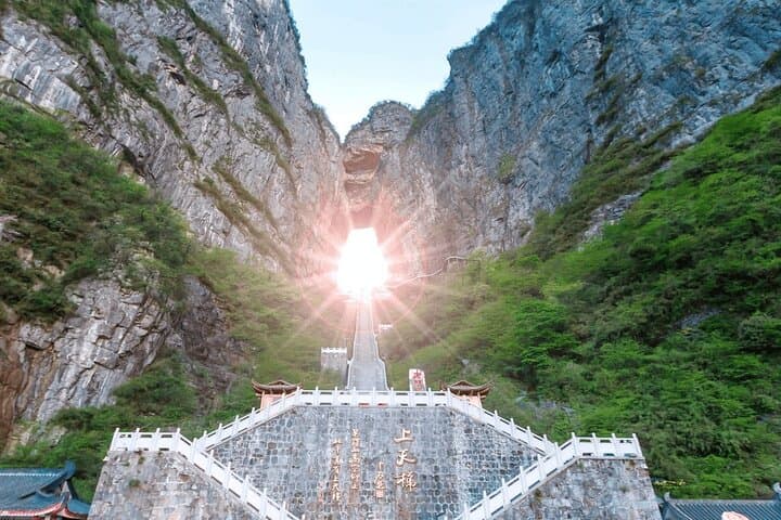
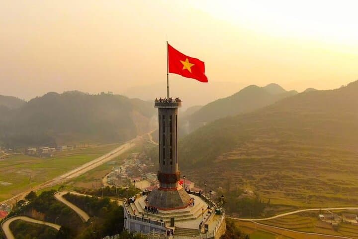
Practically, expect long driving stints broken by short village walks and photo stops at Heaven’s Gate (Quan Ba), Ma Pi Leng Pass and Lung Cu Flagpole at Vietnam’s northern tip. Accommodations are local homestays or simple guesthouses in Dong Van and Du Gia—comfort varies but offers genuine hospitality and shared meals.
Bring layered clothing, a reliable rain shell and sturdy walking shoes; roads can be dusty, wet and uneven depending on season. Hydrate on the move and carry cash for market purchases; mobile coverage is intermittent.
This itinerary balances dramatic overlooks with cultural contact—listen, ask, and move slowly through villages to leave minimal impact while gaining the full measure of Ha Giang’s highland edges.
easy.
3 days.
Suitable for travelers comfortable with long vehicle transfers and short walks; not strenuous but requires stamina for travel days.
Most tours include roundtrip transfer by minivan; independent travelers can take overnight buses to Ha Giang city and join local tours from there.
Roads are winding, narrow and can be steep—many operators use driven vehicles; if you plan to ride, choose a reliable bike and only attempt sections you’re confident on.
Expect local guesthouses or family-run homestays in Dong Van and surrounding villages—simple rooms with shared facilities and home-cooked meals.
Autumn (September–November) and spring (March–May) offer clearer skies and milder temperatures; winter can be very cold, while summer brings rain and occasional fog.
Dong Van and surrounding plateaus are part of a landscape shaped by long human settlement and trade; the Vuong Family Residence reflects local governance during the early 20th century and the area is part of the Dong Van Karst Plateau UNESCO Global Geopark.
The karst plateau is ecologically fragile—stick to marked routes, avoid collecting plants or cultural artifacts, and minimize plastic waste to reduce impact on remote communities.
Vnatour - The Best Vietnam Tour operates guided outdoor trips and adventures with an emphasis on safety, stewardship, and memorable experiences.
You step off the road at a lookout and the mountains pull you forward—the Ma Pi Leng ridge dropping in serrated folds toward the Nho Que River, which dares you to follow its ribbon of jade far below.
You step off the road at a lookout and the mountains pull you forward—the Ma Pi Leng ridge dropping in serrated folds toward the Nho Que River, which dares you to follow its ribbon of jade far below.
Over three days this route moves from Ha Giang city into the Dong Van Karst Plateau, a landscape of limestone towers carved over millions of years and recognized as a UNESCO Global Geopark. Villages cling to slopes; ethnic groups such as the Hmong, Lo Lo and Tay maintain distinctive textiles, markets and houses like the Vuong Family Residence in Sa Phin—an artifact of 20th-century regional power.
Geology here explains the scenery: uplift and erosion left fractured karst plateaus and deep river gorges, while climate and isolation shaped diverse cultural pockets.
Practically, expect long driving stints broken by short village walks and photo stops at Heaven’s Gate (Quan Ba), Ma Pi Leng Pass and Lung Cu Flagpole at Vietnam’s northern tip. Accommodations are local homestays or simple guesthouses in Dong Van and Du Gia—comfort varies but offers genuine hospitality and shared meals.
Bring layered clothing, a reliable rain shell and sturdy walking shoes; roads can be dusty, wet and uneven depending on season. Hydrate on the move and carry cash for market purchases; mobile coverage is intermittent.
This itinerary balances dramatic overlooks with cultural contact—listen, ask, and move slowly through villages to leave minimal impact while gaining the full measure of Ha Giang’s highland edges.