THE ADVENTURE COLLECTIVE® · Independent discovery and booking for outdoor travel

A three-day guided trek from Marrakech to the 4,167 m summit of Jbel Toubkal, combining traditional Berber villages, high-mountain mule trails and a refuge overnight. Ideal for fit hikers ready for significant elevation gain and alpine conditions.
A three-day guided trek from Marrakech to the 4,167 m summit of Jbel Toubkal, combining traditional Berber villages, high-mountain mule trails and a refuge overnight. Ideal for fit hikers ready for significant elevation gain and alpine conditions.
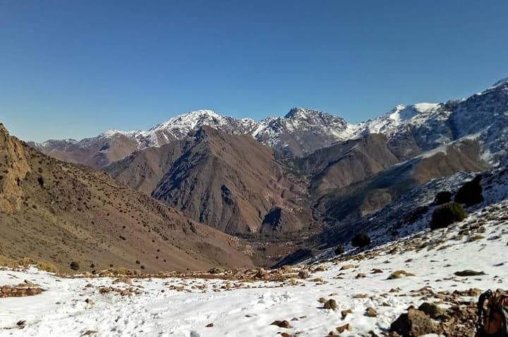
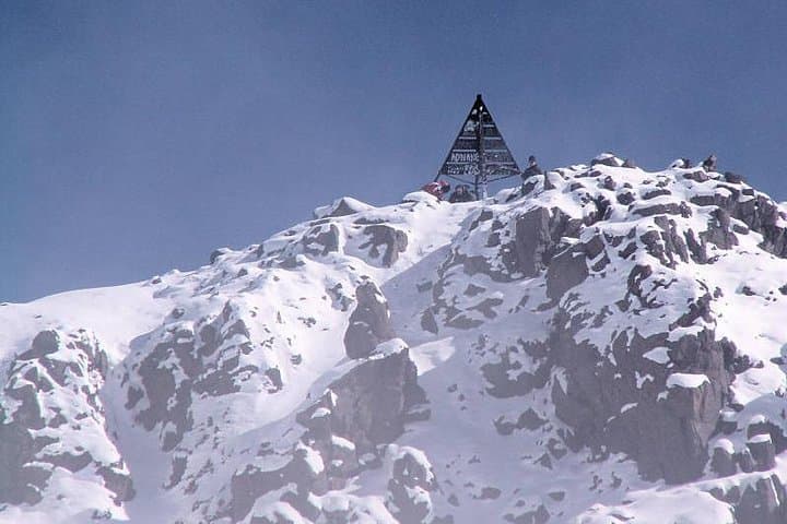
Dawn breaks over the High Atlas as the road from Marrakech narrows into red-soiled tracks. You leave the city heat behind, the air thinning and the landscape sharpening into jagged ridgelines. Villages of stone and flat roofs cling to the slopes; mule trails climb steadily toward the refuge and the summit of Jbel Toubkal (4,167 m), North Africa’s highest point.
Verified experiences and guided adventures in the surrounding area.
Operated by Smart Morocco Tours Excursions · Imlil, Marrakech-Safi
Dawn breaks over the High Atlas as the road from Marrakech narrows into red-soiled tracks. You leave the city heat behind, the air thinning and the landscape sharpening into jagged ridgelines. Villages of stone and flat roofs cling to the slopes; mule trails climb steadily toward the refuge and the summit of Jbel Toubkal (4,167 m), North Africa’s highest point.
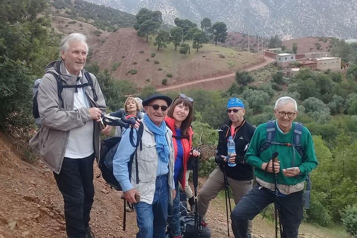
The region is steeped in Amazigh (Berber) culture—small hamlets, seasonal grazing, and shrines like Sidi Chamharouch that mark pilgrim routes. Geologically the High Atlas rose from the African–Eurasian collision; underfoot you’ll find hard metamorphic and plutonic rocks that wear into scree and steep cols. The trek weaves through juniper and dwarf cedar, opens onto red Azzaden Valley soils, and finishes above the treeline where wind and altitude shape the slopes.
Expect three days of mule-trail climbing: an approach through Tassa Ouirgane to Tizi Oussem (1,800 m), a full day ascending to Toubkal Refuge (3,207 m) via Tizi Aguelzim (≈3,104 m), and an early summit push followed by the descent through Sidi Chamharouch to Imlil and back to Marrakech.
Practical notes: plan for roughly 1,400 m of ascent on day two and ~960 m on summit day; trails switch from packed earth to loose scree near the peak. Start pre-dawn on summit day to avoid afternoon wind and to manage altitude. Bring layered insulation, sturdy boots and poles, and hydrate—altitude is the limiting factor more than technical terrain. Guided refuge stays reduce logistics so you can focus on pace and acclimatization.
challenging.
3 days (approx. 72 hours).
Good aerobic fitness and experience with long uphill days; comfortable carrying a daypack and walking 6–10 hours on summit day.
No technical climbing skills are required for the normal route, but you should be comfortable on steep, loose terrain and at altitude; many groups use experienced local guides.
Typical inclusions are hotel pickup in Marrakech, meals (breakfasts, lunches, dinners as listed), refuge accommodation, local guide and trekking equipment; confirm specifics with the operator.
Altitude sickness can occur even on a short itinerary; hydrate, ascend conservatively, eat, and communicate symptoms to your guide—descent is the primary treatment.
Late spring (May–June) and early fall (September–October) offer the most stable conditions; winter requires technical gear and experience.
The High Atlas is home to Amazigh (Berber) communities whose seasonal grazing and mountain commerce shaped the trails; Sidi Chamharouch is a small pilgrimage site tied to local spiritual traditions.
Toubkal sits within a protected national park—stay on trails, pack out waste, and hire local guides to support community-based conservation and economies.
Smart Morocco Tours Excursions operates guided outdoor trips and adventures with an emphasis on safety, stewardship, and memorable experiences.
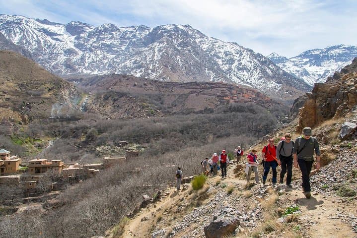
Dawn breaks over the High Atlas as the road from Marrakech narrows into red-soiled tracks. You leave the city heat behind, the air thinning and the landscape sharpening into jagged ridgelines. Villages of stone and flat roofs cling to the slopes; mule trails climb steadily toward the refuge and the summit of Jbel Toubkal (4,167 m), North Africa’s highest point.
Dawn breaks over the High Atlas as the road from Marrakech narrows into red-soiled tracks. You leave the city heat behind, the air thinning and the landscape sharpening into jagged ridgelines. Villages of stone and flat roofs cling to the slopes; mule trails climb steadily toward the refuge and the summit of Jbel Toubkal (4,167 m), North Africa’s highest point.
The region is steeped in Amazigh (Berber) culture—small hamlets, seasonal grazing, and shrines like Sidi Chamharouch that mark pilgrim routes. Geologically the High Atlas rose from the African–Eurasian collision; underfoot you’ll find hard metamorphic and plutonic rocks that wear into scree and steep cols. The trek weaves through juniper and dwarf cedar, opens onto red Azzaden Valley soils, and finishes above the treeline where wind and altitude shape the slopes.
Expect three days of mule-trail climbing: an approach through Tassa Ouirgane to Tizi Oussem (1,800 m), a full day ascending to Toubkal Refuge (3,207 m) via Tizi Aguelzim (≈3,104 m), and an early summit push followed by the descent through Sidi Chamharouch to Imlil and back to Marrakech.
Practical notes: plan for roughly 1,400 m of ascent on day two and ~960 m on summit day; trails switch from packed earth to loose scree near the peak. Start pre-dawn on summit day to avoid afternoon wind and to manage altitude. Bring layered insulation, sturdy boots and poles, and hydrate—altitude is the limiting factor more than technical terrain. Guided refuge stays reduce logistics so you can focus on pace and acclimatization.