THE ADVENTURE COLLECTIVE® · Independent discovery and booking for outdoor travel

Three days of highland switchbacks, karst passes and market culture—this motorcycle loop through Ha Giang delivers raw geology and intimate homestay stays. Read on for what to expect and how to prepare.
Three days of highland switchbacks, karst passes and market culture—this motorcycle loop through Ha Giang delivers raw geology and intimate homestay stays. Read on for what to expect and how to prepare.
Morning light slices across limestone ridges as a low-slung motorcycle convoy peels out of Ha Giang city, tires whispering on switchback asphalt. Over three days the road becomes the route and the rhythm: passes that crest above 1,400–1,500 m, cliffs dropping to the Nho Que River, and villages where terraces roll like living maps.
Verified experiences and guided adventures in the surrounding area.
Operated by Chat Tourist · Ha Giang, Ha Giang Province
Morning light slices across limestone ridges as a low-slung motorcycle convoy peels out of Ha Giang city, tires whispering on switchback asphalt. Over three days the road becomes the route and the rhythm: passes that crest above 1,400–1,500 m, cliffs dropping to the Nho Que River, and villages where terraces roll like living maps.
This loop runs through the Dong Van Karst Plateau Global Geopark, a region carved by ancient uplift and erosion into dramatic spires and folds. Centuries of Hmong, Tay and Dao presence register in stone houses, woven hemp and marketplaces—Dong Van’s Sunday market still pulses with trade-pulse rhythms unchanged by tourism.
Expect geology up close: narrow canyons, karst limestone escarpments and one of Southeast Asia’s deepest river cuts at Ma Pi Leng, where the Nho Que rushes below. Cultural notes arrive in homestays—shared dinners, hemp weaving demonstrations in Lung Tam and the Vuong family palace in Sa Phin.
Practical guidance: ride time averages 3–5 hours between stops, with short hikes (Sky Pass ~1.5 hours) and multiple viewpoints. Weather is changeable—mornings can be cool at elevation, afternoons warm; rain can make passes slick. Guides and motorbike drivers are provided, lowering technical demand but keep alert on narrow edges.
Bring layered wind protection, waterproofs and a compact first-aid kit. Hydrate and pace photo stops—altitude and continuous riding fatigue hikers and riders alike. With moderate fitness and a readiness for rustic homestay comfort, this loop delivers highland panoramas and close cultural contact without sacrificing practical safety.
moderate.
3 days.
Moderate; comfortable sitting on a motorcycle for multiple hours, able to do short hikes of 1–2 hours and manage uneven homestay conditions.
No—motorbike drivers are included; guests are typically passengers unless a specific rider arrangement is confirmed in advance.
Moderate—expect long periods seated on a bike, short hikes up to 1.5 hours, and some walking in uneven village terrain; moderate fitness recommended.
Overnights are in local homestays and small hotels in Dong Van and Du Gia, offering basic amenities and family-style meals.
Heavy rain or unsafe conditions can force route changes or cancellations; dress in layers and bring waterproofs as high-elevation weather is variable.
The Vuong family palace in Sa Phin reflects the semi-feudal local lordship that shaped Dong Van’s social landscape under the Hmong Vuong lineage.
The Dong Van Geopark status highlights geological conservation and community-led tourism; stick to trails and avoid leaving waste in villages and viewpoints.
Chat Tourist operates guided outdoor trips and adventures with an emphasis on safety, stewardship, and memorable experiences.
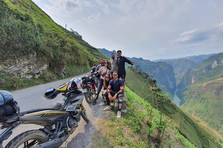
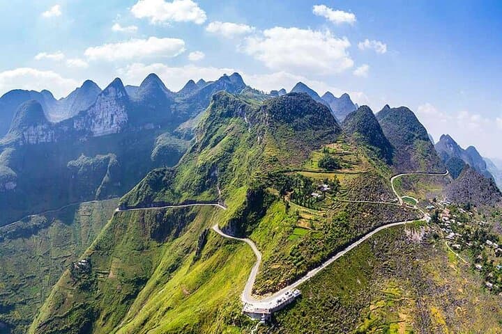
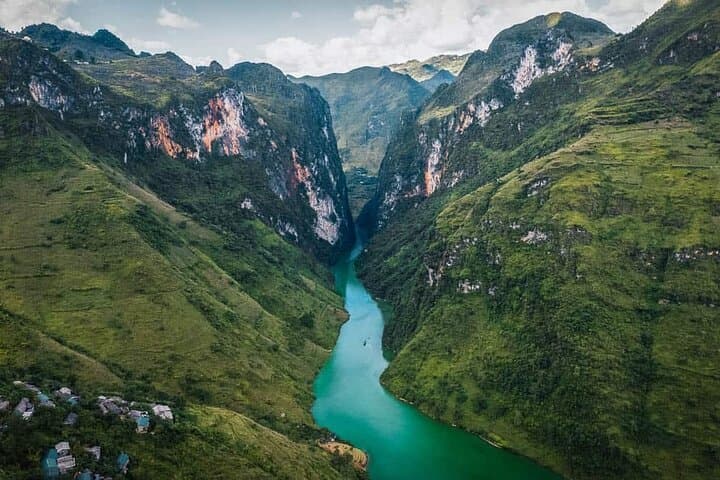
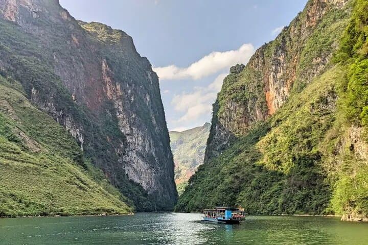
Morning light slices across limestone ridges as a low-slung motorcycle convoy peels out of Ha Giang city, tires whispering on switchback asphalt. Over three days the road becomes the route and the rhythm: passes that crest above 1,400–1,500 m, cliffs dropping to the Nho Que River, and villages where terraces roll like living maps.
Morning light slices across limestone ridges as a low-slung motorcycle convoy peels out of Ha Giang city, tires whispering on switchback asphalt. Over three days the road becomes the route and the rhythm: passes that crest above 1,400–1,500 m, cliffs dropping to the Nho Que River, and villages where terraces roll like living maps.
This loop runs through the Dong Van Karst Plateau Global Geopark, a region carved by ancient uplift and erosion into dramatic spires and folds. Centuries of Hmong, Tay and Dao presence register in stone houses, woven hemp and marketplaces—Dong Van’s Sunday market still pulses with trade-pulse rhythms unchanged by tourism.
Expect geology up close: narrow canyons, karst limestone escarpments and one of Southeast Asia’s deepest river cuts at Ma Pi Leng, where the Nho Que rushes below. Cultural notes arrive in homestays—shared dinners, hemp weaving demonstrations in Lung Tam and the Vuong family palace in Sa Phin.
Practical guidance: ride time averages 3–5 hours between stops, with short hikes (Sky Pass ~1.5 hours) and multiple viewpoints. Weather is changeable—mornings can be cool at elevation, afternoons warm; rain can make passes slick. Guides and motorbike drivers are provided, lowering technical demand but keep alert on narrow edges.
Bring layered wind protection, waterproofs and a compact first-aid kit. Hydrate and pace photo stops—altitude and continuous riding fatigue hikers and riders alike. With moderate fitness and a readiness for rustic homestay comfort, this loop delivers highland panoramas and close cultural contact without sacrificing practical safety.