THE ADVENTURE COLLECTIVE® · Independent discovery and booking for outdoor travel

Three days of highland trekking from Ella and Haputale take you through tea estates, cloud forest and Sri Lanka’s highest waterfall. This guided itinerary combines raw scenery with village visits and full-day walks — plan for steep terrain, mist and sudden rain.
Three days of highland trekking from Ella and Haputale take you through tea estates, cloud forest and Sri Lanka’s highest waterfall. This guided itinerary combines raw scenery with village visits and full-day walks — plan for steep terrain, mist and sudden rain.
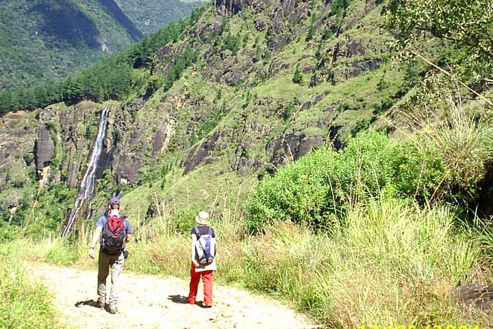
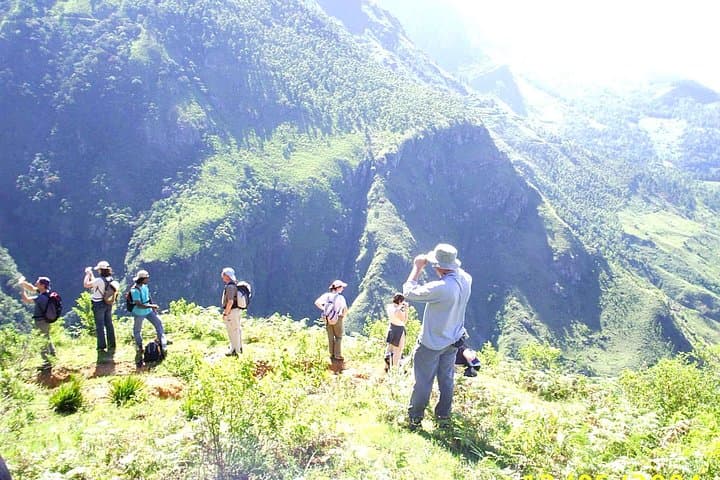
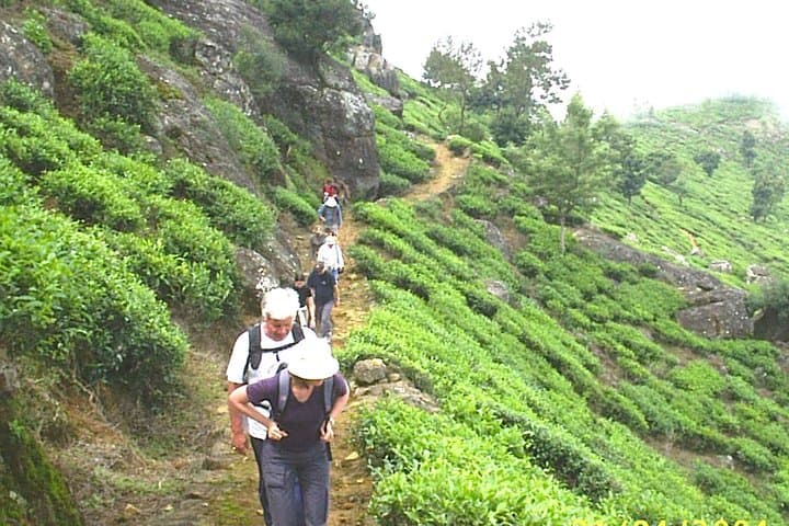
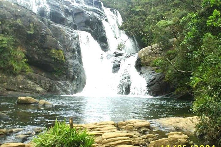
A low cloud sits on the ridge as the group leaves Haputale at first light — tea bushes drip with dew and the railway line hisses past, daring walkers to follow. Over three days the route threads through eucalyptus and native montane forest, across high grassland at Horton Plains, and down narrow estate roads toward the thunder of Bambarakanda, Sri Lanka’s highest waterfall.
Verified experiences and guided adventures in the surrounding area.
Operated by Sri Lanka Trekking Club · Ohiya, Central Province
A low cloud sits on the ridge as the group leaves Haputale at first light — tea bushes drip with dew and the railway line hisses past, daring walkers to follow. Over three days the route threads through eucalyptus and native montane forest, across high grassland at Horton Plains, and down narrow estate roads toward the thunder of Bambarakanda, Sri Lanka’s highest waterfall.
Geology here is old: Precambrian charnockites and khondalites pillared by weather, feeding the headwaters of the Mahaweli and Kelani rivers. Horton Plains’ plateau at 2,100–2,300 m holds montane grassland and cloud forest zones with endemic plants and birdlife shaped by elevation and mist. Culturally, the trek passes remote tea-village communities where smallholder life and colonial-era plantations overlap; you’ll see traditional pluckers and may visit a village school.
Prepare for varied terrain — packed earth, broken estate roads, slippery forest steps and an 18 km mountain descent on day three. The walking is physically demanding: expect long uphill and downhill sections, exposed highland wind, and sudden showers. Bring layered rain protection, stout waterproof boots with good grip, 2–3 liters of water, and snacks; a local guide navigates unclear tracks and arranges park entry. Start early at Horton Plains to avoid crowds at World’s End and carry a packed lunch for the Bambarakanda day.
Wildlife sightings (langurs, sambar deer, endemic bulbuls) reward patience; respect local customs when visiting villages and minimize impact by staying on trails and packing out trash. With sound gear and a steady pace this loop delivers highland vistas, silent cloud forest and a dramatic waterfall finale.
challenging.
3 days (approx. 8–10 hours active on peak days).
Good cardiovascular fitness and endurance for long uphill and downhill sections; able to carry a daypack for several hours.
Yes — park entry fees and permits are required and typically arranged by the tour operator or guide at the park entrance.
Expect ~18 km and 7+ hours of hiking over rough terrain with steep sections; it is a full-day, physically demanding trek.
Swimming is possible at some pools but conditions vary; always assess water flow and depth and follow your guide’s advice for safety.
Reception is intermittent across highland and forest sections; plan for limited connectivity and carry paper maps or an offline GPS app.
Horton Plains became a national park in 1988; archaeological finds show human activity in the highlands dating to the Balangoda culture.
The plateau’s cloud forest is sensitive to trampling and fire; stay on designated trails and avoid introducing non-native seeds or litter.
Sri Lanka Trekking Club operates guided outdoor trips and adventures with an emphasis on safety, stewardship, and memorable experiences.
A low cloud sits on the ridge as the group leaves Haputale at first light — tea bushes drip with dew and the railway line hisses past, daring walkers to follow. Over three days the route threads through eucalyptus and native montane forest, across high grassland at Horton Plains, and down narrow estate roads toward the thunder of Bambarakanda, Sri Lanka’s highest waterfall.
A low cloud sits on the ridge as the group leaves Haputale at first light — tea bushes drip with dew and the railway line hisses past, daring walkers to follow. Over three days the route threads through eucalyptus and native montane forest, across high grassland at Horton Plains, and down narrow estate roads toward the thunder of Bambarakanda, Sri Lanka’s highest waterfall.
Geology here is old: Precambrian charnockites and khondalites pillared by weather, feeding the headwaters of the Mahaweli and Kelani rivers. Horton Plains’ plateau at 2,100–2,300 m holds montane grassland and cloud forest zones with endemic plants and birdlife shaped by elevation and mist. Culturally, the trek passes remote tea-village communities where smallholder life and colonial-era plantations overlap; you’ll see traditional pluckers and may visit a village school.
Prepare for varied terrain — packed earth, broken estate roads, slippery forest steps and an 18 km mountain descent on day three. The walking is physically demanding: expect long uphill and downhill sections, exposed highland wind, and sudden showers. Bring layered rain protection, stout waterproof boots with good grip, 2–3 liters of water, and snacks; a local guide navigates unclear tracks and arranges park entry. Start early at Horton Plains to avoid crowds at World’s End and carry a packed lunch for the Bambarakanda day.
Wildlife sightings (langurs, sambar deer, endemic bulbuls) reward patience; respect local customs when visiting villages and minimize impact by staying on trails and packing out trash. With sound gear and a steady pace this loop delivers highland vistas, silent cloud forest and a dramatic waterfall finale.