THE ADVENTURE COLLECTIVE® · Independent discovery and booking for outdoor travel

Drive narrow mountain roads, sleep in ethnic homestays and stand above the Nho Que River at Ma Pi Leng. This three-day private loop combines geology, culture and dramatic views with practical logistics for first-time visitors.
Drive narrow mountain roads, sleep in ethnic homestays and stand above the Nho Que River at Ma Pi Leng. This three-day private loop combines geology, culture and dramatic views with practical logistics for first-time visitors.
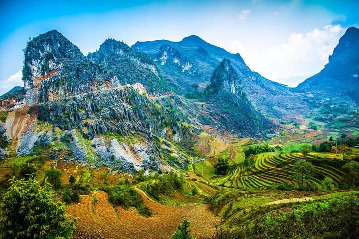
You arrive before dawn on a road that clings to the mountains, headlights slicing fog as terraces and tea plots slip past. Over the next three days the ridge-line opens and closes — limestone cliffs, the deep green throat of the Nho Que River, and villages that seem to have been built to the rhythm of switchbacks. The road dares you to look over the guardrail; at Ma Pi Leng the canyon pushes back.
Verified experiences and guided adventures in the surrounding area.
Operated by Old Quarter Travel · Ha Giang, Ha Giang Province
You arrive before dawn on a road that clings to the mountains, headlights slicing fog as terraces and tea plots slip past. Over the next three days the ridge-line opens and closes — limestone cliffs, the deep green throat of the Nho Que River, and villages that seem to have been built to the rhythm of switchbacks. The road dares you to look over the guardrail; at Ma Pi Leng the canyon pushes back.
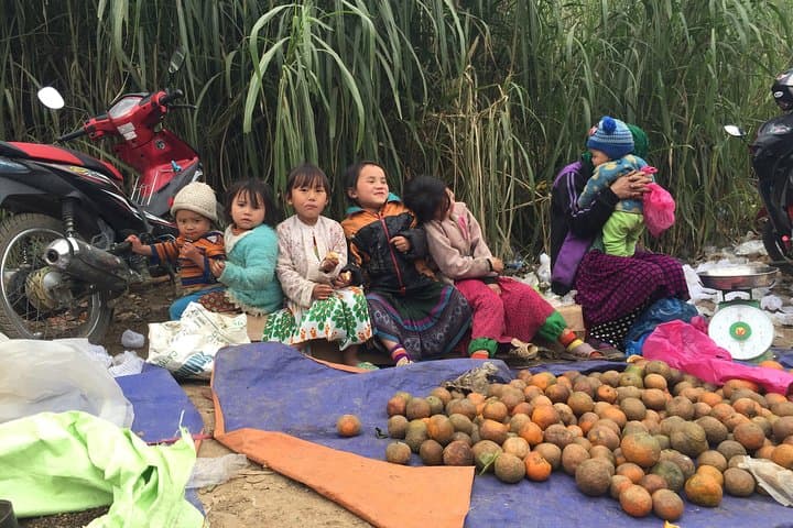
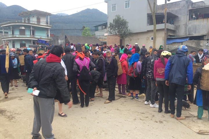
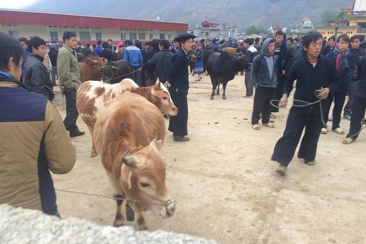
This region sits on the Dong Van Karst Plateau, a geological landscape carved from uplifted limestone and punctuated by stone forests and deep river gorges. The H’Mong, Dao and other ethnic minority groups have lived here for centuries; their markets, textiles and the Vuong family mansion in Sa Phin are durable cultural markers. Meo Vac and Dong Van towns grew as trading hubs where horses and produce converged along the plateau.
Practically: expect roughly 300–350 km of mountain driving across three days with elevation rising to about 1,500–1,600 m on the plateau. Roads are paved but narrow, with steep switchbacks and short walking stops for markets, viewpoints and homestays. Accommodations alternate between family-run homestays and basic hotels; meals are local and included per itinerary.
Plan for sudden weather: mornings are cold and afternoons can be hot and wet. Hydrate on the road, wear sturdy shoes for village walks, and carry cash — markets and small shops rarely accept cards. Respect local customs when staying in homestays and keep to marked paths to protect fragile karst fields.
moderate.
3 days (72 hours).
Suitable for travelers in average fitness — mostly driven with short walks and market visits; be comfortable on uneven village paths and stairs.
Private transportation and most meals listed in the itinerary are included — typically 3 lunches, 2 dinners and 2 breakfasts as arranged by the operator.
Yes — passport details are required at booking and you should carry your passport during travel for any official checks.
Elevations reach roughly 1,500–1,600 m; most travelers adapt fine, but those sensitive to altitude should monitor symptoms and stay hydrated.
Reception is intermittent on the plateau; expect strong signals in towns like Ha Giang and Dong Van but limited coverage in remote stretches.
The Dong Van Karst Plateau is part of a UNESCO Global Geopark and has long been home to H’Mong, Dao and other ethnic groups who maintain distinct textile and agricultural traditions.
The karst landscape is fragile — stick to paths, avoid collecting stones or plants, and support homestays and local guides to keep tourism benefits in the community.
Old Quarter Travel operates guided outdoor trips and adventures with an emphasis on safety, stewardship, and memorable experiences.
You arrive before dawn on a road that clings to the mountains, headlights slicing fog as terraces and tea plots slip past. Over the next three days the ridge-line opens and closes — limestone cliffs, the deep green throat of the Nho Que River, and villages that seem to have been built to the rhythm of switchbacks. The road dares you to look over the guardrail; at Ma Pi Leng the canyon pushes back.
You arrive before dawn on a road that clings to the mountains, headlights slicing fog as terraces and tea plots slip past. Over the next three days the ridge-line opens and closes — limestone cliffs, the deep green throat of the Nho Que River, and villages that seem to have been built to the rhythm of switchbacks. The road dares you to look over the guardrail; at Ma Pi Leng the canyon pushes back.
This region sits on the Dong Van Karst Plateau, a geological landscape carved from uplifted limestone and punctuated by stone forests and deep river gorges. The H’Mong, Dao and other ethnic minority groups have lived here for centuries; their markets, textiles and the Vuong family mansion in Sa Phin are durable cultural markers. Meo Vac and Dong Van towns grew as trading hubs where horses and produce converged along the plateau.
Practically: expect roughly 300–350 km of mountain driving across three days with elevation rising to about 1,500–1,600 m on the plateau. Roads are paved but narrow, with steep switchbacks and short walking stops for markets, viewpoints and homestays. Accommodations alternate between family-run homestays and basic hotels; meals are local and included per itinerary.
Plan for sudden weather: mornings are cold and afternoons can be hot and wet. Hydrate on the road, wear sturdy shoes for village walks, and carry cash — markets and small shops rarely accept cards. Respect local customs when staying in homestays and keep to marked paths to protect fragile karst fields.