THE ADVENTURE COLLECTIVE® · Independent discovery and booking for outdoor travel

Three days of mule tracks, granite ridgelines and Berber hospitality take you from Imlil to the summit of North Africa’s highest peak. Expect sustained climbs, variable alpine terrain and mountain shelter nights—ideal for fit hikers seeking a guided high‑altitude push.
Three days of mule tracks, granite ridgelines and Berber hospitality take you from Imlil to the summit of North Africa’s highest peak. Expect sustained climbs, variable alpine terrain and mountain shelter nights—ideal for fit hikers seeking a guided high‑altitude push.
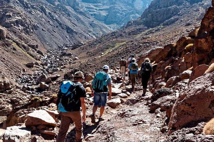
A thin morning light tints the red roofs of Imlil as trekkers tighten boots and load packs for the climb. The trail leaves the village on old mule tracks, shoulder-high terraced fields sliding away beneath scattered junipers; the air thins and the landscape takes on a granite, wind-sculpted clarity that tests lungs and focus.
Verified experiences and guided adventures in the surrounding area.
Operated by Smart Morocco Tours Excursions · Imlil, Marrakesh-Safi
A thin morning light tints the red roofs of Imlil as trekkers tighten boots and load packs for the climb. The trail leaves the village on old mule tracks, shoulder-high terraced fields sliding away beneath scattered junipers; the air thins and the landscape takes on a granite, wind-sculpted clarity that tests lungs and focus.
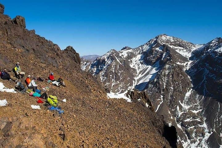
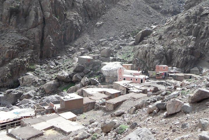
The High Atlas is the cultural home of Amazigh (Berber) villages where stone houses, irrigation channels and seasonal barley plots trace a human history of mountain survival. Geologically, Toubkal is a mass of metamorphic and igneous rock—steep gullies, loose scree and hard slabs that demand steady footing. The refuge at 3,100 m sits where weather can pivot fast: clear views of Siroua and the Marrakech plain give way to wind-driven snow in winter.
Expect three days of sustained uphill: roughly 1,350–1,400 m gain to the refuge on day one, a 1,000+ m summit push from the refuge on day two and a measured descent back to Imlil on day three. Trails are a mix of packed dirt, rocky switchbacks and occasional stone steps; mule support lightens load-carrying but not the need for conditioning.
Practical notes: start early on the summit day to avoid afternoon winds, layer for temperature swings, and bring water purification or enough capacity—sources are intermittent above Imlil. Guides manage logistics, meals and shelter; they also read mountain signals. This is a high-altitude trek that rewards preparation—proper boots, steady pacing and respect for changing conditions make the difference between a memorable ascent and an overreach.
challenging.
3 days.
Requires good cardiovascular fitness and leg strength for sustained ascents and descents; prior multi‑day hiking experience is strongly recommended
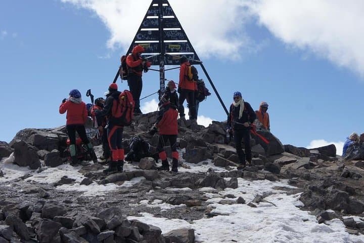
From the refuge to the summit is a steady 1,000+ m ascent typically taking 3–6 hours depending on conditions and fitness; expect loose scree and steeper pitches near the top.
Prior multi‑day hiking is recommended; while technical skills aren’t mandatory in summer, winter ascents can require crampon and ice‑axe proficiency.
Yes—meals and two nights’ accommodation in the refuge are provided as part of the guided 3‑day itinerary.
Guides monitor conditions and can alter plans or delay the summit; always bring warm layers and follow guide instructions for safety.
The High Atlas is historically home to Amazigh (Berber) communities who developed terraced agriculture and mule routes; villages around Imlil remain culturally vibrant and guide generations deep.
Trekking pressure has increased erosion and waste in sensitive alpine areas; stick to established trails, pack out rubbish and support local guide services that invest in responsible tourism.
Smart Morocco Tours Excursions operates guided outdoor trips and adventures with an emphasis on safety, stewardship, and memorable experiences.
A thin morning light tints the red roofs of Imlil as trekkers tighten boots and load packs for the climb. The trail leaves the village on old mule tracks, shoulder-high terraced fields sliding away beneath scattered junipers; the air thins and the landscape takes on a granite, wind-sculpted clarity that tests lungs and focus.
A thin morning light tints the red roofs of Imlil as trekkers tighten boots and load packs for the climb. The trail leaves the village on old mule tracks, shoulder-high terraced fields sliding away beneath scattered junipers; the air thins and the landscape takes on a granite, wind-sculpted clarity that tests lungs and focus.
The High Atlas is the cultural home of Amazigh (Berber) villages where stone houses, irrigation channels and seasonal barley plots trace a human history of mountain survival. Geologically, Toubkal is a mass of metamorphic and igneous rock—steep gullies, loose scree and hard slabs that demand steady footing. The refuge at 3,100 m sits where weather can pivot fast: clear views of Siroua and the Marrakech plain give way to wind-driven snow in winter.
Expect three days of sustained uphill: roughly 1,350–1,400 m gain to the refuge on day one, a 1,000+ m summit push from the refuge on day two and a measured descent back to Imlil on day three. Trails are a mix of packed dirt, rocky switchbacks and occasional stone steps; mule support lightens load-carrying but not the need for conditioning.
Practical notes: start early on the summit day to avoid afternoon winds, layer for temperature swings, and bring water purification or enough capacity—sources are intermittent above Imlil. Guides manage logistics, meals and shelter; they also read mountain signals. This is a high-altitude trek that rewards preparation—proper boots, steady pacing and respect for changing conditions make the difference between a memorable ascent and an overreach.