THE ADVENTURE COLLECTIVE® · Independent discovery and booking for outdoor travel

A three‑day expedition from Bogotá that puts you at the heart of Caño Cristales during its color season (June–November). Expect boat rides, a 4x4 transfer, and a guided full‑day loop to Los Ochos with swimming and plentiful photo stops.
A three‑day expedition from Bogotá that puts you at the heart of Caño Cristales during its color season (June–November). Expect boat rides, a 4x4 transfer, and a guided full‑day loop to Los Ochos with swimming and plentiful photo stops.
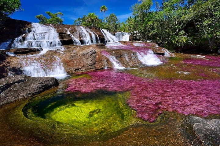
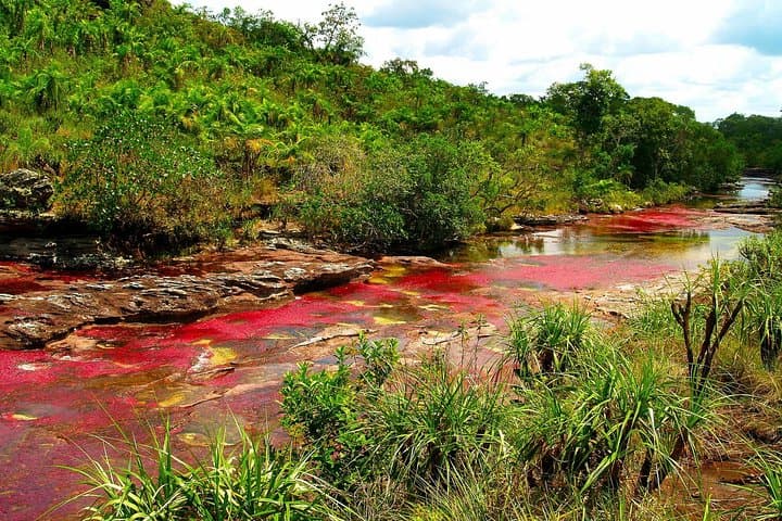
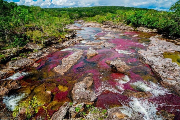
You step off the small prop plane into La Macarena’s heat and the river seems to call you—clear water sliding over smooth rock, algae flashing red and green like moving paint. The town itself is low and humid, fringe forest meeting the wide Guayabero; by boat you cut a 30‑minute corridor of water and reeds toward the Serranía de la Macarena where Caño Cristales threads its colors through exposed rock slabs.
Verified experiences and guided adventures in the surrounding area.
Operated by FlashpackerConnect LLC · La Macarena, Meta
You step off the small prop plane into La Macarena’s heat and the river seems to call you—clear water sliding over smooth rock, algae flashing red and green like moving paint. The town itself is low and humid, fringe forest meeting the wide Guayabero; by boat you cut a 30‑minute corridor of water and reeds toward the Serranía de la Macarena where Caño Cristales threads its colors through exposed rock slabs.
The river's fame comes from Macarenia clavigera, a riverweed that blooms June–November and paints riffles in scarlet and emerald. Geologically the park mixes ancient rock shelves and shallow, polished channels; trails are mostly low‑elevation (roughly 200–400 m above sea level) with short climbs and river crossings rather than sustained ascents. Culturally, La Macarena is a frontier town with llanero music, cattle‑ranch history, and a conservation ethos driven by Cormacarena and local guides.
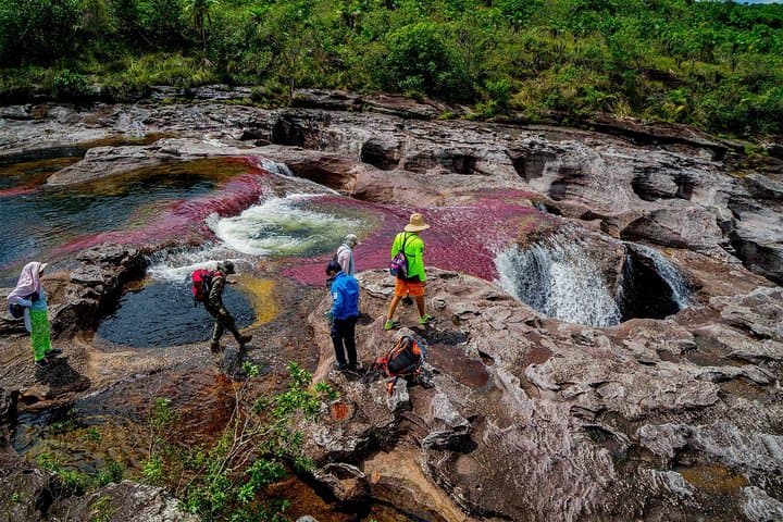
Expect a full day in the park: a 30‑minute boat, a 4x4 transfer, then a 5–6 hour loop to Los Ochos with frequent photo and swim stops—roughly 6–8 km over mixed dirt tracks and granite‑like slabs, minimal elevation gain but slippery sections. Guides control routes to protect the fragile ecosystem; numbers are limited by park permits.
Practical advice: bring a reusable water system, non‑marking water shoes, sun protection, and a dry bag for cameras. Flights from Bogotá run early; plan a buffer day for weather delays and respect local rules—no sunscreen in the water, no single‑use plastic, and follow ranger instructions to keep the river colorful for the next visitors.
moderate.
3 days (full‑day excursions).
Suitable for people who can walk 4–6 hours with breaks; low technical demand but steady stamina helps.
June through November is the peak season for Macarenia clavigera; colors are richest in the middle months, though visibility varies with rainfall.
Expect a 5–6 hour day on mixed terrain (6–8 km) with swims and photo stops; minimal sustained elevation but some uneven, slippery rock.
Yes — guided park access and National Park fees are managed on most organized tours; routes are assigned by park authorities each morning.
Swimming is allowed in designated areas, but sunscreen and insect repellent should be avoided in the water—use biodegradable products and rinse off before entering.
The Serranía de la Macarena sits at the ecological meeting point between the Andes, Amazon and Orinoco, creating unique species mixes and long‑standing llanero ranching traditions.
Park authorities strictly limit daily visitors and enforce no‑trash, no‑sunscreen rules to protect the fragile Macarenia mats; follow guide instructions and pack out all waste.
FlashpackerConnect LLC operates guided outdoor trips and adventures with an emphasis on safety, stewardship, and memorable experiences.
You step off the small prop plane into La Macarena’s heat and the river seems to call you—clear water sliding over smooth rock, algae flashing red and green like moving paint. The town itself is low and humid, fringe forest meeting the wide Guayabero; by boat you cut a 30‑minute corridor of water and reeds toward the Serranía de la Macarena where Caño Cristales threads its colors through exposed rock slabs.
You step off the small prop plane into La Macarena’s heat and the river seems to call you—clear water sliding over smooth rock, algae flashing red and green like moving paint. The town itself is low and humid, fringe forest meeting the wide Guayabero; by boat you cut a 30‑minute corridor of water and reeds toward the Serranía de la Macarena where Caño Cristales threads its colors through exposed rock slabs.
The river's fame comes from Macarenia clavigera, a riverweed that blooms June–November and paints riffles in scarlet and emerald. Geologically the park mixes ancient rock shelves and shallow, polished channels; trails are mostly low‑elevation (roughly 200–400 m above sea level) with short climbs and river crossings rather than sustained ascents. Culturally, La Macarena is a frontier town with llanero music, cattle‑ranch history, and a conservation ethos driven by Cormacarena and local guides.
Expect a full day in the park: a 30‑minute boat, a 4x4 transfer, then a 5–6 hour loop to Los Ochos with frequent photo and swim stops—roughly 6–8 km over mixed dirt tracks and granite‑like slabs, minimal elevation gain but slippery sections. Guides control routes to protect the fragile ecosystem; numbers are limited by park permits.
Practical advice: bring a reusable water system, non‑marking water shoes, sun protection, and a dry bag for cameras. Flights from Bogotá run early; plan a buffer day for weather delays and respect local rules—no sunscreen in the water, no single‑use plastic, and follow ranger instructions to keep the river colorful for the next visitors.