THE ADVENTURE COLLECTIVE® · Independent discovery and booking for outdoor travel

Two days of mountain travel from Marrakech to Mount Toubkal’s 4,167 m summit, crossing Amazigh villages, shrine paths and high alpine scree. Non-technical but demanding—expect long days, altitude and unforgettable views.
Two days of mountain travel from Marrakech to Mount Toubkal’s 4,167 m summit, crossing Amazigh villages, shrine paths and high alpine scree. Non-technical but demanding—expect long days, altitude and unforgettable views.
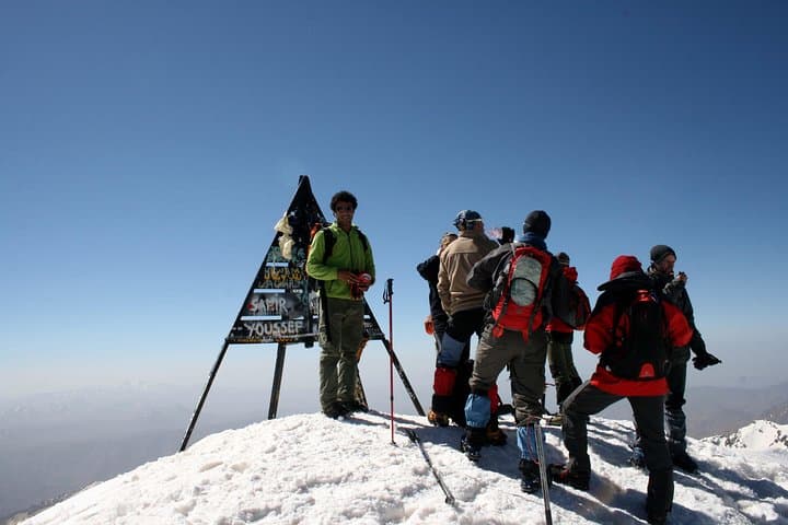
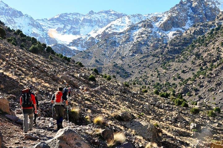
Morning light breaks over the High Atlas and the mule tracks out of Imlil wind upward like a promise. You set off through the Mizane Valley—olive terraces, dry-stone houses and the occasional prayer shrine—then the valley narrows and the trail climbs, stepping from village paths onto high mountain track. The refuge at ~3,206 m appears on a rocky shoulder; above it, Toubkal’s south cirque and scree ridges point to the summit at 4,167 m.
Verified experiences and guided adventures in the surrounding area.
Operated by Morocco Authentic journey · Imlil, Marrakesh-Safi
Morning light breaks over the High Atlas and the mule tracks out of Imlil wind upward like a promise. You set off through the Mizane Valley—olive terraces, dry-stone houses and the occasional prayer shrine—then the valley narrows and the trail climbs, stepping from village paths onto high mountain track. The refuge at ~3,206 m appears on a rocky shoulder; above it, Toubkal’s south cirque and scree ridges point to the summit at 4,167 m.
Geologically the High Atlas is rugged, uplifted rock and steep cirques carved by ancient glaciers; on the trail you’ll see folded strata and talus slopes that demand careful footing. Culturally the route threads through Amazigh (Berber) villages where pastoral life and pilgrimage meet at Sidi Chamarouch, a small shrine that remains a local landmark.
Practically, the trek is non-technical but demanding: Day 1 is typically 5–6 hours with roughly 1,300–1,500 m of gain to the refuge (8–10 km). Day 2 is an early start—expect 7–10 hours total for ascent and descent (about 10–15 km round trip) with nearly 960 m of climbing from the refuge to the summit. Scree, altitude and long days are the main challenges; crampons or microspikes are useful in shoulder seasons and winter.
Plan for layered clothing, a headlamp, trekking poles for scree, and 2–3 liters of water. Allow time to acclimatize in Imlil or Marrakech if you’ve come from sea level. Respect local customs in villages, carry out waste, and consider a local guide: they read the mountain and keep the schedule realistic. The summit view—Marrakech plains to the Sahara’s edge—is the payoff for steady, careful climbing.
challenging.
2 days (two days of trekking; ~5–10 hours walking/day).
Good cardiovascular fitness and leg strength; prior day-hiking experience and comfort on steep, loose terrain are recommended.
No technical climbing skills are required; the route is non-technical but physically demanding and involves loose scree and significant altitude gain.
Imlil is roughly 60–90 minutes from Marrakech by road (about 70 km depending on route), then the trek begins from the village.
Guides are recommended for safety, navigation and to support local communities—many operators include a guide as part of the package.
Late spring to early fall offers stable conditions; winter is possible with snow and requires proper winter gear and experience.
The High Atlas has long been home to Amazigh shepherding communities; the trail passes small shrines and villages that reflect centuries of mountain life and local pilgrimage.
High-altitude vegetation is fragile and trail erosion is a concern—stay on established paths, pack out waste, and hire local guides to support sustainable tourism.
Morocco Authentic journey operates guided outdoor trips and adventures with an emphasis on safety, stewardship, and memorable experiences.
Morning light breaks over the High Atlas and the mule tracks out of Imlil wind upward like a promise. You set off through the Mizane Valley—olive terraces, dry-stone houses and the occasional prayer shrine—then the valley narrows and the trail climbs, stepping from village paths onto high mountain track. The refuge at ~3,206 m appears on a rocky shoulder; above it, Toubkal’s south cirque and scree ridges point to the summit at 4,167 m.
Morning light breaks over the High Atlas and the mule tracks out of Imlil wind upward like a promise. You set off through the Mizane Valley—olive terraces, dry-stone houses and the occasional prayer shrine—then the valley narrows and the trail climbs, stepping from village paths onto high mountain track. The refuge at ~3,206 m appears on a rocky shoulder; above it, Toubkal’s south cirque and scree ridges point to the summit at 4,167 m.
Geologically the High Atlas is rugged, uplifted rock and steep cirques carved by ancient glaciers; on the trail you’ll see folded strata and talus slopes that demand careful footing. Culturally the route threads through Amazigh (Berber) villages where pastoral life and pilgrimage meet at Sidi Chamarouch, a small shrine that remains a local landmark.
Practically, the trek is non-technical but demanding: Day 1 is typically 5–6 hours with roughly 1,300–1,500 m of gain to the refuge (8–10 km). Day 2 is an early start—expect 7–10 hours total for ascent and descent (about 10–15 km round trip) with nearly 960 m of climbing from the refuge to the summit. Scree, altitude and long days are the main challenges; crampons or microspikes are useful in shoulder seasons and winter.
Plan for layered clothing, a headlamp, trekking poles for scree, and 2–3 liters of water. Allow time to acclimatize in Imlil or Marrakech if you’ve come from sea level. Respect local customs in villages, carry out waste, and consider a local guide: they read the mountain and keep the schedule realistic. The summit view—Marrakech plains to the Sahara’s edge—is the payoff for steady, careful climbing.