THE ADVENTURE COLLECTIVE® · Independent discovery and booking for outdoor travel

Escape Marrakech for a two‑day push to North Africa’s highest peak. This guided trek from Imlil includes an overnight refuge, mule support for luggage, and a summit sunrise on Mount Toubkal.
Escape Marrakech for a two‑day push to North Africa’s highest peak. This guided trek from Imlil includes an overnight refuge, mule support for luggage, and a summit sunrise on Mount Toubkal.
You leave Marrakech before dawn, the city’s heat giving way to serrated blue ridgelines as the minibus climbs toward Imlil. By the time you step out into the high‑Atlas air the village trees are frosted with alpine light; mules rustle, guides check packs, and the narrow trail threads through stacked stone houses toward higher slopes.
Verified experiences and guided adventures in the surrounding area.
Operated by Toubkal alpine · Imlil, Marrakech-Safi
You leave Marrakech before dawn, the city’s heat giving way to serrated blue ridgelines as the minibus climbs toward Imlil. By the time you step out into the high‑Atlas air the village trees are frosted with alpine light; mules rustle, guides check packs, and the narrow trail threads through stacked stone houses toward higher slopes.
The High Atlas is young, tectonically lifted rock—jagged ridges of limestone and schist—cut by seasonal torrents that roar in spring. The Imlil valley has been a Berber gateway for centuries: small mountain shrines like Sidi Chamharouch sit where trans‑Saharan and local paths converge. The refuge system below Toubkal (Refuge du Toubkal ≈ 3,207 m) is a modern foothold amid traditional village life.
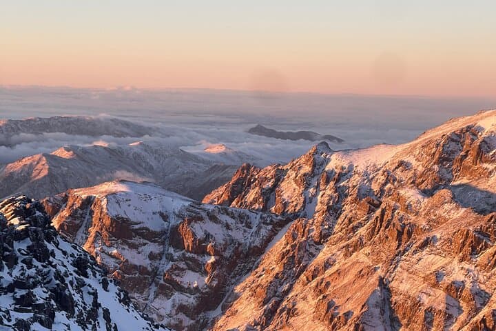
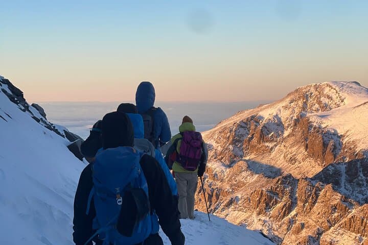
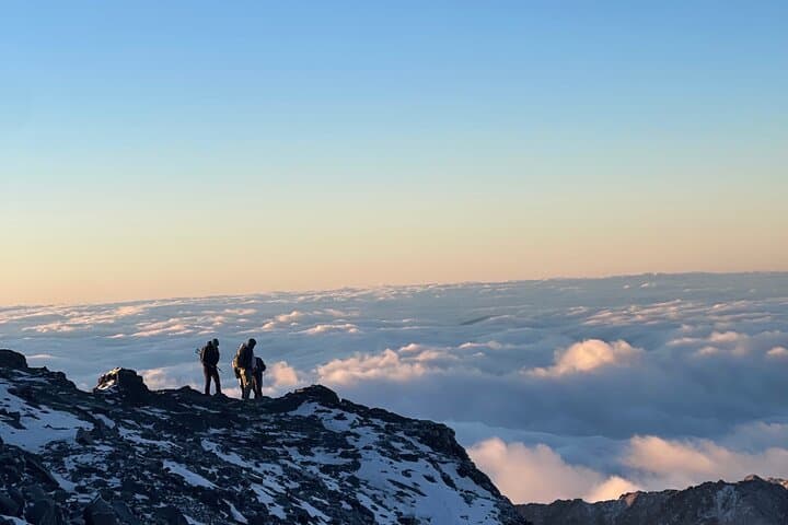
Expect two contrasting days: a steady climb from Imlil (≈1,750 m) to the refuge with roughly 1,400 m of gain across 7–9 km of rocky mule tracks and terraces; then an early summit push to 4,167 m with about 950 m of ascent on mixed scree and steep switchbacks. Sunrise from the summit is sharp and exposed—weather moves quickly up here, so layers matter.
Logistics are straightforward: guides and muleteers handle luggage, meals are refuge-style, and the return road transfer drops you back in Marrakech the same afternoon. Plan for 6–10 hours of active hiking on the summit day, solid boots, water treatment or filtration, and time to move deliberately to reduce altitude strain. This is an achievable but demanding two‑day objective for fit hikers who respect high‑mountain pacing and weather.
challenging.
2 days (total) — summit day 6–10 hours of hiking.
Suitable for hikers with good aerobic fitness and prior multi‑day trekking experience; expect sustained ascent and thin air above 3,000 m.
You should have regular cardiovascular fitness and experience with full‑day hikes; the summit day includes nearly 1,000 m of ascent at high altitude.
No technical climbing skills are required—routes are non‑technical trekking paths—but crampons may be needed in winter snow and guides advise accordingly.
Yes, muleteers transport main luggage to the refuge; you should carry a comfortable daypack with water, layers, and essentials for the summit push.
Altitude effects are possible above 3,000 m—move slowly, stay hydrated, know symptoms (headache, nausea), and inform your guide if you feel unwell.
The High Atlas has long been home to Amazigh (Berber) communities whose terrace agriculture and mountain routes shaped trade and pilgrimage patterns across Morocco.
Trails are fragile—stick to existing paths, pack out waste, and use mule services to minimize new erosive impacts on steep slopes.
Toubkal alpine operates guided outdoor trips and adventures with an emphasis on safety, stewardship, and memorable experiences.

You leave Marrakech before dawn, the city’s heat giving way to serrated blue ridgelines as the minibus climbs toward Imlil. By the time you step out into the high‑Atlas air the village trees are frosted with alpine light; mules rustle, guides check packs, and the narrow trail threads through stacked stone houses toward higher slopes.
You leave Marrakech before dawn, the city’s heat giving way to serrated blue ridgelines as the minibus climbs toward Imlil. By the time you step out into the high‑Atlas air the village trees are frosted with alpine light; mules rustle, guides check packs, and the narrow trail threads through stacked stone houses toward higher slopes.
The High Atlas is young, tectonically lifted rock—jagged ridges of limestone and schist—cut by seasonal torrents that roar in spring. The Imlil valley has been a Berber gateway for centuries: small mountain shrines like Sidi Chamharouch sit where trans‑Saharan and local paths converge. The refuge system below Toubkal (Refuge du Toubkal ≈ 3,207 m) is a modern foothold amid traditional village life.
Expect two contrasting days: a steady climb from Imlil (≈1,750 m) to the refuge with roughly 1,400 m of gain across 7–9 km of rocky mule tracks and terraces; then an early summit push to 4,167 m with about 950 m of ascent on mixed scree and steep switchbacks. Sunrise from the summit is sharp and exposed—weather moves quickly up here, so layers matter.
Logistics are straightforward: guides and muleteers handle luggage, meals are refuge-style, and the return road transfer drops you back in Marrakech the same afternoon. Plan for 6–10 hours of active hiking on the summit day, solid boots, water treatment or filtration, and time to move deliberately to reduce altitude strain. This is an achievable but demanding two‑day objective for fit hikers who respect high‑mountain pacing and weather.