THE ADVENTURE COLLECTIVE® · Independent discovery and booking for outdoor travel

Walk the original wartime Kokoda Track from Port Moresby over 11 days: steep jungle ridges, ceremonial dawn services at Isurava, visits to Lake Myola and battlefield sites. This guided trek combines historical briefing with sustained mountain trekking through the Owen Stanley Range.
Walk the original wartime Kokoda Track from Port Moresby over 11 days: steep jungle ridges, ceremonial dawn services at Isurava, visits to Lake Myola and battlefield sites. This guided trek combines historical briefing with sustained mountain trekking through the Owen Stanley Range.
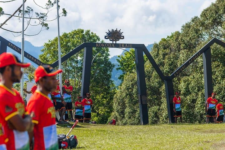
Morning mist lifts off the creeks as you step onto the original wartime trail — a narrow ribbon of mud, roots and stone that climbs and falls through the Owen Stanley Range. The air smells of wet earth and fern; the steady chant of guides and carriers sets the day’s pace. By dawn at Isurava the ridge opens to a small clearing where a measured, private service often brings the group to silence.
Verified experiences and guided adventures in the surrounding area.
Operated by Adventure Kokoda · Kokoda, Oro Province
Morning mist lifts off the creeks as you step onto the original wartime trail — a narrow ribbon of mud, roots and stone that climbs and falls through the Owen Stanley Range. The air smells of wet earth and fern; the steady chant of guides and carriers sets the day’s pace. By dawn at Isurava the ridge opens to a small clearing where a measured, private service often brings the group to silence.
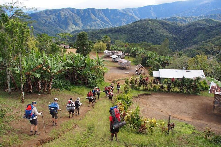
This route follows the 1942 Kokoda campaign corridor, linking sites such as Deniki, Isurava, Eora Creek and Imita Ridge. Geologically the walk crosses eroded volcanic plateaus (Lake Myola), steep ridgelines and swampy saddles where water channels force frequent stream crossings. Villages along the way — Hoi, Menari, Efogi — offer direct contact with local cultures and the people who maintain the trail. Expect a sober mix of battlefield interpretation and living community life.
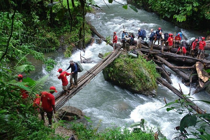
Practical guide: the full Kokoda Track between Owers Corner and Kokoda runs roughly 96 km across repeatedly steep terrain with daily elevation changes that can reach several hundred metres; the highest sections approach roughly 2,000–2,200 m above sea level. Trails are muddy, root-strewn and often lashed by heavy tropical rain; river and creek crossings are common. The itinerary includes charter flights, official permits, mosquito-proof tents and daily briefings. Bring high-capacity hydration, durable waterproof boots, gaiters, trekking poles and layers for cool ridge mornings. Fitness should be high—this is a sustained multi-day expedition rather than a casual hike. Respect local customs, pack out waste where possible, and allow extra time for weather delays — the trail demands patience as much as stamina.
difficult.
10–12 days.
Requires high cardiovascular fitness and experience with multi-day, steep jungle trekking; be able to carry a daypack for 7–8 hours daily
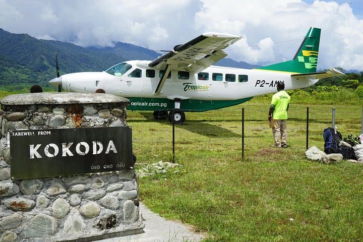
This guided route covers the traditional Kokoda Track corridor over an 11-day schedule, which translates to roughly 90–100 kilometres of trekking spread across sustained daily stages.
Yes — the Kokoda Track Authority permit and local campsite fees are typically included; trekkers should provide personal gear like boots, rainwear, sleeping bag liner and daypack.
Groups usually include a first-aid kit and trained staff; however, evacuations in remote sections can be complex, so appropriate travel insurance and fitness are essential.
The drier months (June–September) tend to offer firmer trails and cooler ridge mornings, while the wet season increases mud, river flows and leech activity.
The Kokoda Track was the site of key 1942 engagements between Australian and Japanese forces; memorial sites and briefings along the trail interpret the campaign’s strategic and human story.
Local communities manage campsite use and the Kokoda Track Authority controls permits; minimize impact by sticking to campsites, packing out waste and using replanted trails where available.
Adventure Kokoda operates guided outdoor trips and adventures with an emphasis on safety, stewardship, and memorable experiences.
Morning mist lifts off the creeks as you step onto the original wartime trail — a narrow ribbon of mud, roots and stone that climbs and falls through the Owen Stanley Range. The air smells of wet earth and fern; the steady chant of guides and carriers sets the day’s pace. By dawn at Isurava the ridge opens to a small clearing where a measured, private service often brings the group to silence.
Morning mist lifts off the creeks as you step onto the original wartime trail — a narrow ribbon of mud, roots and stone that climbs and falls through the Owen Stanley Range. The air smells of wet earth and fern; the steady chant of guides and carriers sets the day’s pace. By dawn at Isurava the ridge opens to a small clearing where a measured, private service often brings the group to silence.
This route follows the 1942 Kokoda campaign corridor, linking sites such as Deniki, Isurava, Eora Creek and Imita Ridge. Geologically the walk crosses eroded volcanic plateaus (Lake Myola), steep ridgelines and swampy saddles where water channels force frequent stream crossings. Villages along the way — Hoi, Menari, Efogi — offer direct contact with local cultures and the people who maintain the trail. Expect a sober mix of battlefield interpretation and living community life.
Practical guide: the full Kokoda Track between Owers Corner and Kokoda runs roughly 96 km across repeatedly steep terrain with daily elevation changes that can reach several hundred metres; the highest sections approach roughly 2,000–2,200 m above sea level. Trails are muddy, root-strewn and often lashed by heavy tropical rain; river and creek crossings are common. The itinerary includes charter flights, official permits, mosquito-proof tents and daily briefings. Bring high-capacity hydration, durable waterproof boots, gaiters, trekking poles and layers for cool ridge mornings. Fitness should be high—this is a sustained multi-day expedition rather than a casual hike. Respect local customs, pack out waste where possible, and allow extra time for weather delays — the trail demands patience as much as stamina.