
What the day feels like
You arrive on a narrow coastal road where the Atlantic is more sound than sight—an endless, unseen weight rolling beyond the cliffs. Wind pins the roadside grass flat and, for a moment, you’re the only deliberate movement in a landscape that feels older than navigation. Your driver eases into a lookout and points to a dark notch in the sea: Gris Gris. Below, waves fold into themselves, then explode against an iron lip of volcanic rock. The fresh salt of the shore scrapes the air. This is the tone of a half-day that stitches together beaches, geological oddities, and small villages across Mauritius’s southern edge.
The Mauritius Adventure tour is a compact, private loop through the island’s more rugged south. In roughly five to six hours you’ll move from high viewpoints to sheltered coves, stopping at spots with names that read like a guidebook to drama—Chamouny’s many-hued earth, Gris Gris beach, La Roche Qui Pleure (the weeping rock), and the lookout at Macondé. Most of the travel time is by car, but each stop invites short walks: stair-descents to gritty beaches, boardwalks around lookout platforms, and flat, photogenic strolls through palm-fringed roadside clearings.
Geology is the region’s headline act. The colored earths at Chamouny (often referenced in island lore as the Seven Colored Earths) are an aftermath of volcanic breakdown—the basalt that formed Mauritius has weathered into clays with different iron and aluminum concentrations, producing burns of red, purple, ochre, and blue-gray in close proximity. They’re not mountains so much as compacted, colorful humps in a fenced viewing area; the effect is more visual puzzle than hikeable trail, and the site is protected to limit erosion.
Gris Gris and La Roche Qui Pleure are examples of how the island’s volcanic bones interact with the ocean. Here, cliffs are sharp, the surf frequently furious, and the sound of water is a constant—sometimes a low, steady drum, sometimes a sudden roar as a swell finds purchase. Macondé is a quieter lookout, a place to watch gulls wheel and fishermen check lines from a ledge. The coastal flora—hardy shrubs, wind-leaned pandanus, and coconut palms—feels sculpted by salt and breeze, and in the small inland villages you’ll glimpse Creole rooflines, rum distilleries, and markets selling sugarcane juice and fried gateaux piments.
This isn’t a high-altitude scramble or a remote wilderness trek. It’s a layered half-day of accessible adventure: a few short walks (most under 1 kilometer), several viewpoints with small elevation changes, and a lot of driving between highlights. That makes it perfect for travelers who want variety without committing to a long backpacking day—families, couples, and solo travelers who want the island’s geology and coast in one go.
Practical details matter. The tour runs about 5–6 hours total and is private, which means you can ask to linger at a viewpoint, skip a stop, or add a beach dip. The paths are generally well-maintained but can be uneven or sandy; footwear with good grip is advisable. If you plan photography, aim for early morning or late afternoon for softer light and fewer crowds—midday sun flattens the colors of the earth and makes cliff edges harsh and contrasty. Bring water and sun protection; although the tour includes drives, exposed spots and cliff-top wind can dehydrate you faster than inland shade does.
Locals will tell you the south has its own tempo compared with the busier north and west coasts—slower markets, fewer high-rise hotels, and a stronger sense of community tied to fishing and rum production. Many travelers combine this tour with a visit to a sugar estate or a stop at a local restaurant serving rougaille and curries. Respect for landscape is part of the day: the colored earths are fragile, and staying on marked paths keeps the colors intact for everyone.
Why take the tour? In a compact timeline you see several of the island’s signature landscapes: the dramatic surf of Gris Gris, the curious palette of the colored earths, cliff-front lookouts, and small, authentic village stops. It’s an efficient, sensory-heavy primer on how volcanic forces and the ocean conspire to shape Mauritius, and it’s flexible enough to suit photographers, casual hikers, and families.
If you go: pick a morning slot to avoid the strongest winds and the midday crowd, wear sturdy shoes, and ask your guide about a local snack stop—fried samosas and chilled sugarcane juice feel like the island’s answer to a victory lap after a few good viewpoints. That combination of geology, surf, and community is what makes the Wild South feel like an essential, concentrated chapter of Mauritian travel—short in time but expansive in memory.
Trail wisdom
Small choices, better day.
Go early for light and fewer crowds
Book a morning slot to catch soft light on the colored earths and to avoid the strongest afternoon winds at the cliffs.
Wear stable shoes with grip
Paths to lookouts and beach approaches can be uneven and sandy—trail runners or trekking sandals with tread work well.
Bring water and sun protection
Exposed cliffs and short hikes offer little shade; carry at least 1–2 liters per person and a sun hat.
Respect protected areas
Do not walk on the colored earths or remove sand—these are fragile formations and often fenced for conservation.
Local knowledge
Read the place, not just the route.
Watch for native species including Tropical seabirds (terns, noddies), Mauritian fruit bats (in dusk hours).
Keep an eye out for wildlife during the transition between areas and habitats. Respect distance guidelines.
The colored earths are fragile dune formations; visitors should stay on marked paths, avoid touching the soils, and follow local rules to prevent erosion.
Follow the guide's instructions on size limits, ethical handling, and leave-no-trace practices.
Small roadside stalls near Macondé for fresh sugarcane juice. A tucked-away viewpoint past Gris Gris with fewer visitors in late afternoon
Locally recommended viewpoints and quiet spots known best to local operators.
The south of Mauritius has long been tied to fishing and sugarcane production; many lookout names reference early French and Creole settlers.
Maritime roots and regional tradition shape the waterways and working coasts.
Seasonal guide
Four versions of the same landscape.
Spring
Best forWildflowers · Moderate temperatures · Photogenic light
ChallengesUnpredictable showers · Some muddy patches
Spring (Sept–Nov) brings warming temperatures and lively coastal blossoms; expect occasional showers but excellent photo light.
Summer
Best forWarmer sea swims · Longer days · Lush vegetation
ChallengesHigher humidity · Possible heavy rains and cyclones (Nov–Apr)
Summer is hot and humid with a real chance of heavy rain; mornings are best for shore visits before afternoon storms.
Fall
Best forCalmer seas · Cooler air · Fewer tourists
ChallengesShorter daylight hours · Variable surf conditions
Fall (Mar–May) settles into drier, cooler weather—good for comfortable walks and less crowded lookouts.
Winter
Best forDry conditions · Cool temperatures · Clear vistas
ChallengesBrisk winds at cliffs · Cooler ocean swims
Winter (May–Oct) is drier and more comfortable for land exploration, though cliff-top winds can be strong.
Operator details
What the booking data adds.
Included
- ✓Private transportation
- ✓Driver guide
- ✓Air-conditioned vehicle
- ✓Hotel Pick up and Drop off
Not included
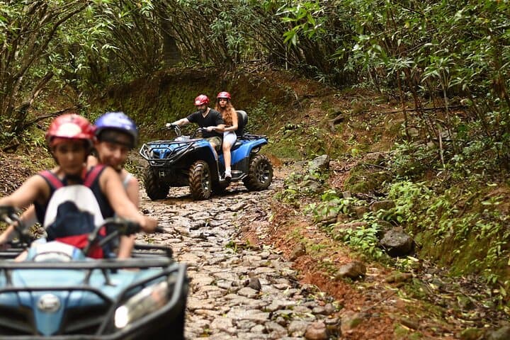
- —Activities at Vallee des couleurs (Quad bike and Zipline)
- —Lunch
- —Gratuities
- —Entrance fees at Vallee des Couleurs
Good to know
- ✓Infants and small children can ride in a pram or stroller
- ✓Specialized infant seats are available
- ✓Suitable for all physical fitness levels
- ✓The duration of the trip is around 6 hours and this includes the driving time from your respective hotels or apartments to the different attraction points.
Pack with intention
What to bring.
Good to know
Common questions.
The private tour lasts approximately 5–6 hours (300–360 minutes) and includes driving between multiple southern coast highlights.
Plan the edges
The details that make the day easier.
The colored earths at Chamouny formed when basaltic rock decomposed into clay minerals; differing iron and aluminum oxide content produced the distinct bands of color.
After the tour, head to a local canteen for rougaille (tomato-based Creole stew) and a glass of locally produced rum; small coastal villages offer simple seafood plates and a chance to chat with fishermen about tides and spots few tourists see.
- Closest airport
- Sir Seewoosagur Ramgoolam International Airport (SSR). Typical driving time to Souillac: ~1.5–2 hours. Trailheads
- access points
- Chamouny (colored earths), Gris Gris (Souillac cliffs). Cell service: Generally available but can be intermittent at some cliff lookouts. Permits
- fees
- Small entrance fee at the colored earths viewing area.
These coastal and dune environments are sensitive—stay on marked paths, don’t remove sand or rocks, use local guides to support community tourism, and pack out all trash.
Explore by topic
Follow the threads.
Keep exploring
Make the story part of the trip.
Set out from Bass Harbor for a private, customizable day on Blue Hill Bay — lighthouses, puffins, seals, and the chance to feel Acadia from the water. Small groups, local captains, unforgettable views.
In four hours you can move from shaded canyon ferns to wind-scoured coastal ridgelines, guided by someone who knows where the light—and the hidden views—live. This private half-day hike on the Monterey Peninsula or Big Sur is compact, curated, and perfect for travelers who want depth without a multiday commitment.
 Related story
Beneath a sky of shifting light, Skaftafell’s ice reads like a map of time. This three-hour guided glacier hike mixes technical instruction with geology and culture: compact, safe, and unforgettable.