Where Water Leads: A Leisure Hike Along East Aspen’s Hunter Creek
A creekside ramble where Aspen’s neighborhoods fade into willow, water, and easy miles.
The Roaring Fork speaks first—low and steady, a river clearing its throat as Aspen rubs sleep from its eyes. Cottonwoods flutter like pages turning, and the path pulls you east, past tidy porches and old miner’s cottages, toward the hush where neighborhoods yield to willow and water. This is the kind of outing that doesn’t demand heroics. It asks you to match its pace. Two hours. Two miles. A ribbon of trail that keeps one hand on town and the other in the creek.
Trail Wisdom
Hydrate Early and Often
Aspen sits near 8,000 feet; even an easy hike can feel tougher without water. Carry at least 1 liter and sip regularly.
Watch for Rooted Steps
Sections along lower Hunter Creek have roots and slick rocks—use deliberate foot placement, especially after rain.
Sun-Savvy Even in Shade
Shade comes and goes; high-elevation sun burns fast. Reapply SPF and wear a brimmed hat.
Pause on the Footbridges
The best creek views are from the wooden spans—stop for photos and to spot American dippers in the froth.
Local Knowledge
Hidden Gems
- •John Denver Sanctuary’s engraved lyric boulders near the river’s edge
- •The wooden Hunter Creek footbridge—prime spot to watch American dippers
Wildlife
Mule deer, American dipper
Conservation Note
You’re in the Roaring Fork watershed—stay on established paths to protect riparian plants and pack out everything you bring.
Smuggler Mountain, just above town, yielded one of the largest silver nuggets ever recorded in 1894, fueling Aspen’s mining-era boom.
Seasonal Guide
spring
Best for: Rushing snowmelt views, Birdwatching
Challenges: Muddy, slick trail sections, Variable weather
Expect cool mornings, wet tread, and lively flows that animate the creek. Layers and traction help.
summer
Best for: Shaded creek walks, Wildflowers
Challenges: Afternoon thunderstorms, Heavier trail traffic
Lush banks and steady shade make this route a heat-beater. Start early to avoid storms and crowds.
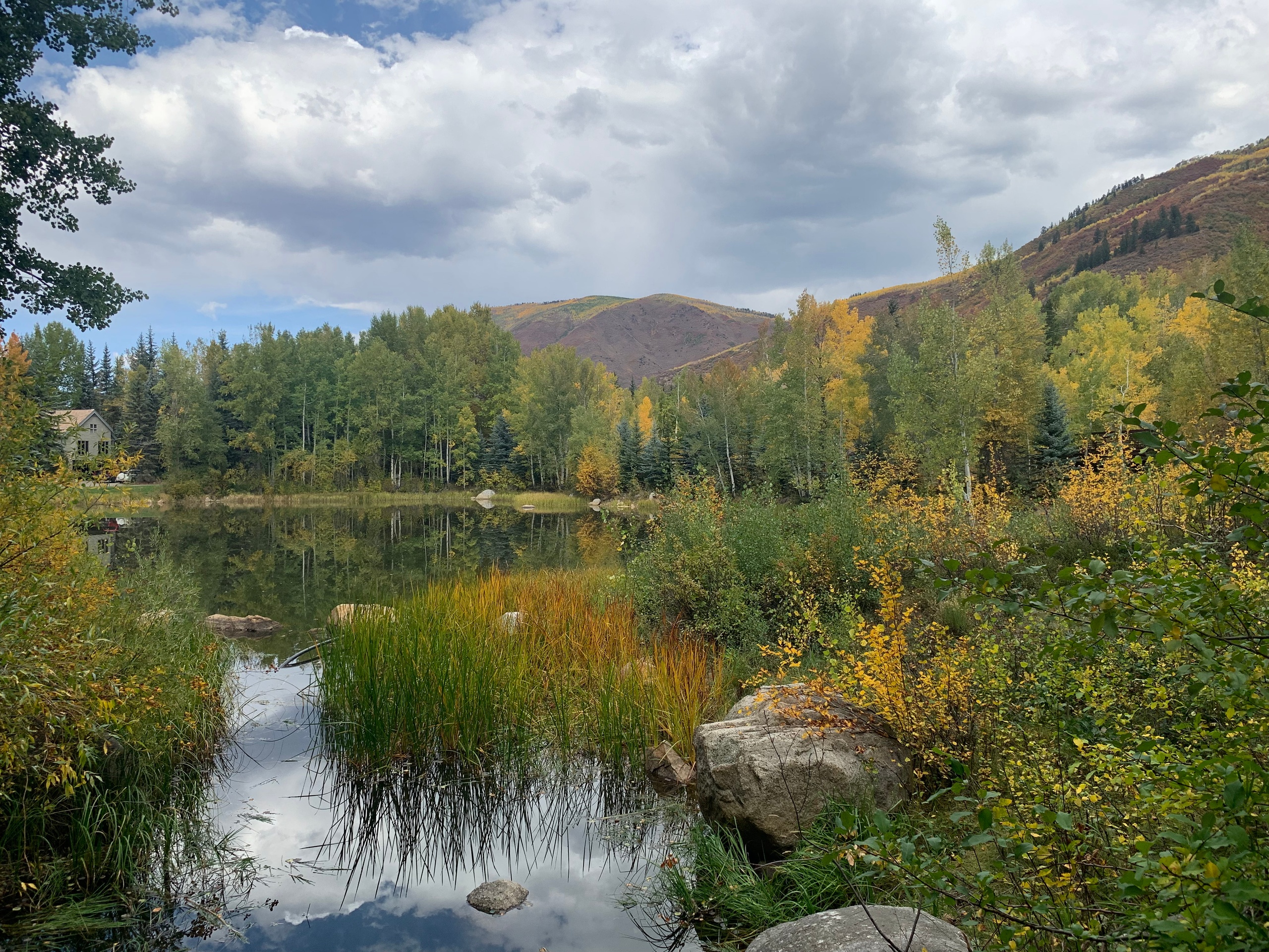
fall
Best for: Aspen foliage, Crisp, clear air
Challenges: Cool mornings, Shorter daylight
Gold-lit trees frame the creek and views pop. Bring a warm layer and catch the early light.
winter
Best for: Quiet paths, Icy creek formations
Challenges: Snow/ice on trail, Cold temperatures
With proper traction and layers, winter walks can be serene, but expect icy patches and colder air near the water.
Photographer's Notes
What to Bring
Lightweight Trail ShoesEssential
Good traction helps on rooty or damp sections along the creek.
1–2 Liter Water Bottle or Soft FlaskEssential
High-elevation dryness means you’ll need more water than you think.
Sun Hat and SPF 30+ SunscreenEssential
The high-altitude sun can be intense even on cool days.
Packable Rain/Wind Shell
Mountain weather shifts quickly; a light shell covers surprise breezes and showers.
Common Questions
Is this hike suitable for beginners?
Yes. It’s a two-mile, two-hour creekside walk with short, gentle climbs—ideal for beginners acclimating to Aspen’s elevation.
Can I bring my dog?
Leashed dogs are commonly seen on these paths. Pack waste bags and respect leash and wildlife regulations.
Are there restrooms on the route?
Facilities are available in town parks near the start/finish (e.g., Herron Park or downtown). There are no restrooms along the creek itself.
What about strollers?
Some riverwalk sections are stroller-friendly, but rooty, narrow stretches near Hunter Creek are not. A child carrier is better.
Will I have cell service?
Generally good near town with occasional dead spots in the lower valley. Don’t rely on streaming; download maps ahead of time.
Do I need a permit?
No permits are required for day hiking here. Follow posted signs regarding dogs, wildlife, and seasonal closures.
What to Pack
Light trail shoes for rooty stretches; 1–2 liters of water to offset high-elevation dryness; brimmed hat and SPF for shifting shade; a packable shell for quick mountain showers.
Did You Know
In 1894, Aspen’s Smuggler Mine produced a 1,840-pound silver nugget—one of the largest ever recorded—cementing the town’s place in Colorado mining history.
Quick Travel Tips
Start before 9 a.m. for easier parking and cooler temps; download offline maps just in case; bring cash or card for a post-hike coffee in town; check the forecast—summer thunderstorms can roll in quickly.
Local Flavor
Refuel at Local Coffee House on E Hyman for a cortado and pastry, then grab a casual bite at White House Tavern. If it’s warm, stroll the John Denver Sanctuary to cool your legs in the shallows before dinner along the pedestrian mall.
Logistics Snapshot
Closest airport: Aspen/Pitkin County (ASE). Trail access: Herron Park or Hunter Creek Trailhead (Lone Pine Rd). From downtown Aspen, the start is a 5–15 minute walk. Cell service: generally good, with spotty pockets near the creek. Permits: none for day hiking; follow leash and seasonal wildlife rules.
Sustainability Note
This corridor feeds the Roaring Fork River—pack out all trash, keep dogs leashed near wildlife, and avoid trampling streamside plants by staying on durable surfaces.