
What the day feels like
The morning air out of Antigua tastes like strong coffee and diesel; a handful of tourists, a local guide, and a white van make their way down a highland road while the landscape opens into a theater of volcanic silhouettes. By the time the van unloads in San Francisco de Sales, Pacaya is no longer a distant profile but a presence—blackened slopes, ridges scarred by old flows, and a constant, almost impatient heat that seems to emanate from the earth itself. You step onto a trail that alternates between volcanic ash and jagged basalt, and the volcano begins to assert itself: small plumes of steam, a whisper of sulfur, and those close-up textures of lava that look at once like petrified rivers and an artist's brutal brushstrokes.
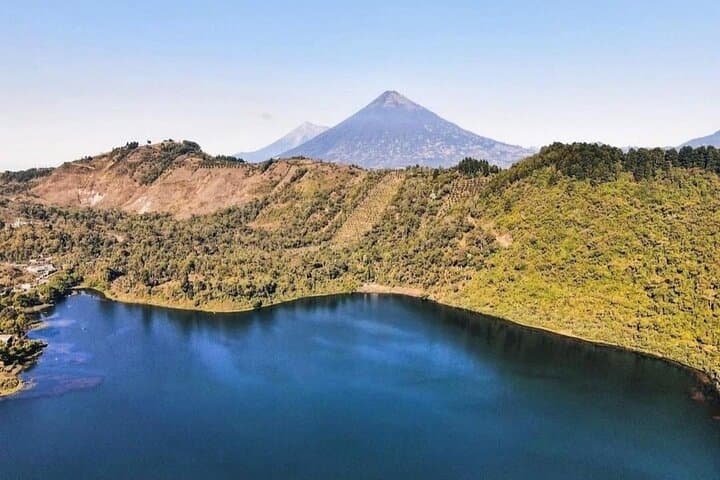
Pacaya is the kind of hike that trades alpine silence for a raw, tactile relationship with geology. The ascent lasts roughly 90–120 minutes for most groups on foot; the whole tour from Antigua—door-to-door—runs about five to six hours, including the drive and time at the summit. Guides weave in local stories as you move: how the volcano has shaped nearby towns, where lava redirected roads in decades past, which slopes hold bowls of rainwater locals call the Laguna de Calderas. On the upper slopes you reach fields of pahoehoe and ʻaʻā—names volcanologists use that suddenly feel intimate as your boots crunch over them—and there are angles for photographs that feel cinematic, with Agua and Fuego standing guard on the horizon.
Geologically, Pacaya is young and active, erupting intermittently for centuries and more frequently in the modern era. Its eruptions are not the apocalyptic explosions depicted in films but persistent, localized activity: vents that throw lava a few tens of meters, flows that advance slowly enough to be observed, and fumaroles that let the mountain breathe. Culturally, the volcano is braided into daily life around Antigua. Farmers, artisans, and tour operators all orient to its slopes. The town of San Francisco de Sales is a common jumping-off point; you’ll meet horse wranglers offering mounts for a surcharge, and guides who have been escorting visitors up Pacaya for years.
The experience is immediate: the wind on the ridge, the granular feel of ash underfoot, the contrast between cool green valleys and the heat rising from fresh rock. Nature here has a voice—lava fields dare you to pick a path, fumaroles sigh warnings of fresh venting—and your guide becomes translator, balancing curiosity with safety. Photography windows often run 15–30 minutes at the upper viewpoint, just enough time to catch volcanic light as it sharpens in late morning or softens toward dusk on private departures.
Practical matters are straightforward but crucial. Footing ranges from packed dirt to loose cinders and jagged lava; good, grippy footwear and trekking poles help. Hydration is non-negotiable; even when the highland air feels cool, the combination of sun and geothermal warmth dehydrates fast. Most tours provide bottled water and certified guides; this product includes pickup in Antigua and offers horse rental for those who prefer a mixed ascent, though it’s an extra cost. Core logistics—parking, park fees, and transport—are handled, which makes the day trip a tidy, lower-stress way to engage with a dramatic landscape.
Who should go? Casual hikers who are comfortable with a two-hour uphill and uneven terrain will find it rewarding. Families with older kids often manage it, and the option to rent a horse makes the summit more accessible to people with limited mobility or tight knees. Seasonality matters: the dry season (roughly November through April) offers the clearest light and safest footing; the rainy months bring slippery ash and limited views.
A climb of Pacaya is not a rite of endurance so much as a lesson in respect. The mountain is active, the terrain abrasive, and weather can flip the experience from panoramic to sodden. That said, the payoff is distinct: standing on a ridge of hardened lava, watching steam curl from a vent while the valley below hums with life, you get a concentrated lesson in how landscapes are made and remade. It’s honest, elemental travel—a day that leaves fingerprints of ash on your boots and an image of raw geology that sticks in the mind.
If you go, plan for early pickup from Antigua, use layered clothing to manage heat near the vents and chill in shaded sections, carry sun protection, and be ready to follow your guide’s safety instructions. Bring a camera with a mid-range zoom for landscape work and a solid pair of sunglasses—volcanic ash reflects light sharply. And remember: the best souvenir is not a rock from the summit but a photo and a story, told with respect for a mountain that is far from static.
Trail wisdom
Small choices, better day.
Hydrate and Bring Electrolytes
The combination of sun and geothermal heat dehydrates quickly; carry at least 1–2 liters plus electrolyte tablets.
Wear Steady Footwear
Sturdy hiking boots with good tread or approach shoes help on loose cinders and jagged lava.
Time Your Light
Morning or late afternoon offers the best low-angle light for photos; mid-day can be harsh and hot.
Consider a Pole or Horse
Trekking poles improve balance on uneven ground; horse rental is available for parts of the ascent for an extra fee.
Local knowledge
Read the place, not just the route.
Watch for native species including Common hawks and turkey vultures, Small lizards and endemic ground birds.
Keep an eye out for wildlife during the transition between areas and habitats. Respect distance guidelines.
The lava fields are fragile; visitors should stay on marked paths, avoid collecting rocks, and follow guide instructions to protect sensitive surfaces.
Follow the guide's instructions on size limits, ethical handling, and leave-no-trace practices.
Laguna de Calderas viewpoints—an off-trail but accessible viewpoint noted by local guides. Lower foothills where coffee farms offer contrasting green terraces against black lava slopes
Locally recommended viewpoints and quiet spots known best to local operators.
Pacaya has been an active landmark for centuries and has influenced settlement patterns around Antigua; modern eruptive episodes have been recorded frequently since the mid-20th century.
Maritime roots and regional tradition shape the waterways and working coasts.
Seasonal guide
Four versions of the same landscape.
Spring
Best forDry trails · Clear summit views · Wildflowers in lower foothills
ChallengesCool mornings · Higher visitor volume
Spring falls inside the dry season—expect clear, stable weather and busy tour schedules; mornings are crisp and ideal for photos.
Summer
Best forLush valley views · Fewer tourists on weekdays
ChallengesAfternoon storms · Slippery ash on trails
Summer arrives with the rainy season—plan early departures to avoid afternoon showers and mud on the lava fields.
Fall
Best forStable weather windows · Comfortable daytime temps
ChallengesVariable visibility · Shorter daylight hours
Autumn still benefits from dry-season conditions early on, with comfortable temperatures and fewer crowds compared to peak months.
Winter
Best forCrisp air and clear panoramas · Excellent sunrise colors
ChallengesCold mornings · Potentially higher winds
Winter mornings are cold but clear—dress in layers and expect sharp light that enhances volcanic textures.
Pack with intention
What to bring.
Good to know
Common questions.
Guides monitor current activity and park advisories; most tours access stable flank areas and keep a safe distance from active vents.
Plan the edges
The details that make the day easier.
Pacaya is one of Guatemala’s most active volcanoes and has had nearly continuous eruptive activity since the mid-20th century.
After the climb, return to Antigua for a late lunch of pepián or jocon, followed by a cold Gallo at a courtyard café; many local artisan workshops near Central Park offer textiles and pottery that reference regional volcanic motifs.
- Closest airport
- La Aurora International Airport (Guatemala City). Typical drive from Antigua to trailhead: 45–75 minutes. Cell service: intermittent near summit. Permits
- fees
- usually included in tour price; confirm on booking.
Pacaya sits within a broader protected landscape—pack out trash, respect local guides’ route choices, and never remove volcanic rock or vegetation.
Explore by topic
Follow the threads.
Keep exploring
Make the story part of the trip.
Set out from Bass Harbor for a private, customizable day on Blue Hill Bay — lighthouses, puffins, seals, and the chance to feel Acadia from the water. Small groups, local captains, unforgettable views.
In four hours you can move from shaded canyon ferns to wind-scoured coastal ridgelines, guided by someone who knows where the light—and the hidden views—live. This private half-day hike on the Monterey Peninsula or Big Sur is compact, curated, and perfect for travelers who want depth without a multiday commitment.
 Related story
Beneath a sky of shifting light, Skaftafell’s ice reads like a map of time. This three-hour guided glacier hike mixes technical instruction with geology and culture: compact, safe, and unforgettable.