
What the day feels like
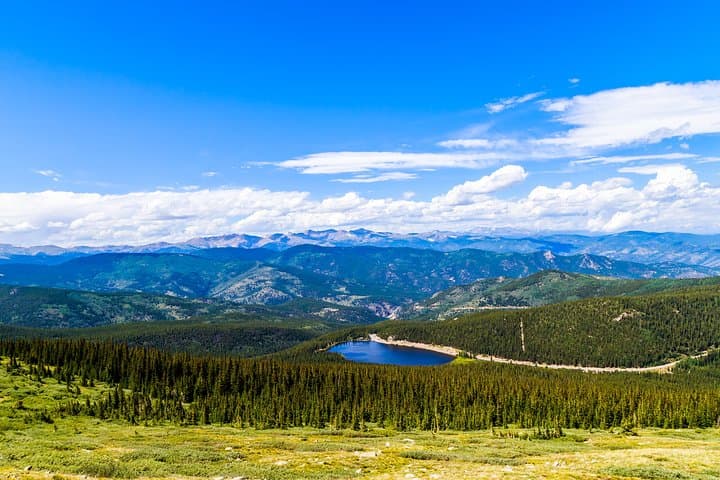
By midmorning the road lets you breathe again: the pinched grit of the Front Range opens, the highway curling into thin air as the car climbs from the pine-scented foothills into a world of wind and stone. You can feel the mountain rearrange itself around you — trees shrink into scraggly sculptures, switchbacks sweep the valley away, and the sky seems to drop closer to the hood of the car. This is Mount Blue Sky Scenic Byway, a 28-mile ribbon that rises more than 7,000 feet and delivers you to the highest paved road in North America, where the summit sniffles at 14,130 feet. A private, full-day tour that pairs that alpine drama with the red sandstone acoustics of Red Rocks Amphitheatre makes for one of the most compact, cinematic days out of Denver.
What makes the route singular is its contrasts. Morning light on the byway is a study in altitude: at base level the aspen and Douglas fir crowd the shoulders; higher up the trees thin, tundra blushes through, and mountain goats — indifferent to humans — stand like punctuation on the rim. The road itself is a piece of civic planning history. It was conceived by the Denver Mountain Parks system to connect Summit Lake Park and Echo Lake Park to lower foothill parks, climbing from Bergen Park through Echo Lake and up to the summit. That history matters because the byway was designed less as a transit corridor and more as a scenic sequence, a deliberate procession from city to alpine.
The name Mount Blue Sky is recent and meaningful: in 2023 the mountain formerly known as Mount Evans was officially renamed Mount Blue Sky to honor Indigenous cultures and their ties to the region. That renaming is part of a longer story — this landscape has been contested and celebrated for centuries, from Ute stewardship to the boom of Denver’s mountain-park era and the modern scramble for recreation in the Rockies.
Geology writes the rest. The road climbs over rock that remembers ancient seas and violent uplifts. By contrast, Red Rocks sits farther east, an amphitheatre carved from tilted sandstone slabs — a theatre nature made loud and dramatic. Here the Fountain Formation and the forces of uplift have tilted those red monoliths into an acoustical bowl that musicians and listeners have turned into a temple of live music. Visiting both in one day is to read two short chapters of Colorado’s natural history: summit tundra and high alpine weather one moment, tilted red stone and prairie views the next.
Why people do this tour is simple pragmatism mixed with awe. For travelers based in Denver it’s a day that maximizes variety: mountain drives, wildlife sightings, short summit walks that are high-reward for minimal technical demand, and an iconic cultural stop at Red Rocks where you can walk the stage and imagine a crowd. For photographers there’s extra incentive — summit panoramas, close-ups of goats on gray rock, and the reds of the amphitheatre under late-afternoon light.
Practicalities matter on a day like this. The road is steep and much of the experience happens at altitude; you’ll feel the thinness of the air even if you’re in good shape. Weather can switch from sun to hail in an hour. The private tour model solves many logistical headaches: a driver-guide who knows where to stop, which short trails are best given time and conditions, and how to pace the group to avoid altitude sickness.
Expect about a 7–8 hour day. The itinerary typically includes morning pickup in Denver, the climb to Echo Lake and the summit, a leisurely stop at Summit Lake or the summit area for photos and short walks, and an afternoon run out to Red Rocks with time to explore the amphitheatre and grab a snack before returning to the city. Price points reflect the private nature of the experience and the logistics involved; this particular private option starts from $1,195 for a full-day vehicle and guide.
Tips for getting the best out of the day: move slowly on the summit — short, slow walks reduce breathlessness and let you take photos without pushing your heart rate up. Layer up; even in July it blows cold at 14,000 feet. Bring water and snacks — hydration is the single most effective thing you can do to manage altitude. And if you want a quiet summit experience, aim for early in the day; tour buses and crowds build in the late morning and early afternoon.
The payoff is immediate and clear. At the summit the world flattens into a scale you rarely see: neighboring peaks, distant suburbs, the weave of highways, and the ribbon of the byway you conquered. At Red Rocks, stone always feels like a companion rather than a backdrop — it frames sound, light, and the people who come to listen.
For visitors who want the ease of a chauffeured day with the sense of an authentic mountain outing, this combination delivers. It’s not a technical climb or a multi-day trek; it’s a curated sequence of Colorado’s strengths: alpine drama, geology you can see with your hands, wildlife that holds its ground, and a cultural icon that ties the range to the city.
If you go, remember the landscape’s fragility. Tundra recovers slowly from footprints, and alpine ecosystems are vulnerable to warming climates and heavy visitation. Leave no trace, stay on established paths, and let the mountain hold its stillness after you leave. Do that, and you’ll leave with photos and stories that are as close to a Colorado essential as a single day can get.
Trail wisdom
Small choices, better day.
Acclimate Gradually
Spend the first hour moving slowly after the summit stop; sit, hydrate, and avoid sudden exertion to reduce altitude effects.
Layer for Wind
Temperatures can drop 20–30°F between the foothills and summit — bring a windproof outer layer.
Respect Wildlife Distance
Mountain goats and marmots are habituated to people but remain wild—use zoom lenses and keep at least 25 yards distance.
Time Your Photography
Early morning light on the byway and late afternoon at Red Rocks produce the best color and avoid midday crowds.
Local knowledge
Read the place, not just the route.
Watch for native species including Mountain goats, Marmots.
Keep an eye out for wildlife during the transition between areas and habitats. Respect distance guidelines.
Alpine tundra is fragile—stay on designated paths, pack out trash, and avoid disturbing plants or wildlife to minimize impact.
Follow the guide's instructions on size limits, ethical handling, and leave-no-trace practices.
Echo Lake shoreline for reflections and easy walks. Summit Lake buttes and the small tundra trails near the summit
Locally recommended viewpoints and quiet spots known best to local operators.
The byway was built by the Denver Mountain Parks system to connect high-altitude parks with lower foothill parks; the summit road was intended as a scenic link rather than a rapid route.
Maritime roots and regional tradition shape the waterways and working coasts.
Seasonal guide
Four versions of the same landscape.
Spring
Best forEarly-season snow scenes · Fewer crowds · Wildflower emergence at lower elevations
ChallengesUnpredictable weather · Paved road may still have snow at higher elevations · Shorter daylight
Spring turnout is variable; lower stretches green up early but the summit can hold snow well into May—check road openings.
Summer
Best forFull access to summit road · Warm base temperatures · Long daylight for photography
ChallengesHigher visitation · Afternoon thunderstorms · Intense sun at altitude
Summer is peak access and reliability for the summit road; go early to avoid clouds and crowds.
Fall
Best forGolden aspens · Crisp air and clearer visibility · Smaller crowds post-Labor Day
ChallengesRapid temperature drops · Possible early snow · Shorter daylight
Fall colors in the foothills make the lower-byway stretches spectacular; summit conditions can change quickly.
Winter
Best forSnow-clad landscapes · Off-season solitude · Unique frozen vistas
ChallengesSummit road typically closed · Icy conditions and limited services · Short daylight and cold
Winter travel to the summit is generally not possible by the paved byway; the area becomes a high-elevation, snowy environment for experienced winter travelers.
Operator details
What the booking data adds.
Included
- ✓Park Entry Fees
- ✓Professional Driver/Guide
- ✓Water refill - bring reusable bottle please
- ✓Transportation
Not included
- —Gratuities (10-20% recommended)
Good to know
- ✓Specialized infant seats are available
- ✓Suitable for all physical fitness levels
- ✓Car Seats available upon request. Please specify in special requirements field during checkout what type of car seat needed
- ✓A water refill will be available in the van, bring a reusable bottle
- ✓Not recommended for travelers with heart or lungs problems
Pack with intention
What to bring.
Good to know
Common questions.
No: the Mount Blue Sky (Mount Evans) Scenic Byway is typically seasonal; closures occur in winter due to snow—check local road reports before booking.
Plan the edges
The details that make the day easier.
Mount Blue Sky Scenic Byway reaches 14,130 feet and is the highest paved road in North America; the mountain was officially renamed Mount Blue Sky in 2023 to honor Indigenous ties to the region.
After the day’s climbs, head to Morrison for a late lunch—The Fort offers regional historic flavor near Red Rocks—or return to Denver’s LoDo neighborhood for craft beer and elevated pub fare; many visitors combine the tour with a rooftop or brewery stop to round out the day.
- Closest airport
- Denver International Airport (DIA); Typical pick-up: Denver hotels; Driving distance: ~60 miles one-way to the summit area from Denver (tour handles driving); Cell service: patchy above tree line; Permits
- fees
- concert tickets at Red Rocks as required, possible parking fees—no summit permit required.
Alpine tundra recovers slowly—pack out all trash, stick to trails and pullouts, avoid feeding wildlife, and favor guided operators that practice Leave No Trace.
Explore by topic
Follow the threads.
Keep exploring
Make the story part of the trip.
Set out from Bass Harbor for a private, customizable day on Blue Hill Bay — lighthouses, puffins, seals, and the chance to feel Acadia from the water. Small groups, local captains, unforgettable views.
In four hours you can move from shaded canyon ferns to wind-scoured coastal ridgelines, guided by someone who knows where the light—and the hidden views—live. This private half-day hike on the Monterey Peninsula or Big Sur is compact, curated, and perfect for travelers who want depth without a multiday commitment.
 Related story
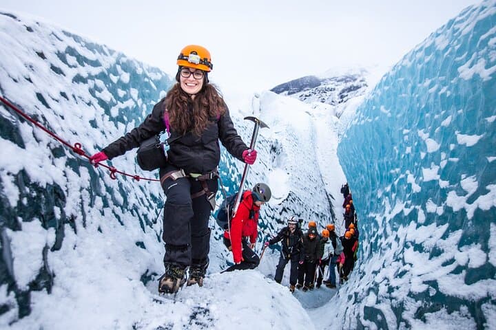
Beneath a sky of shifting light, Skaftafell’s ice reads like a map of time. This three-hour guided glacier hike mixes technical instruction with geology and culture: compact, safe, and unforgettable.