
What the day feels like
Daybreak arrives as a bruise of indigo over Java, and you’re already on the road. The van hums across sugarcane flats while the driver points out the smear of morning smoke where villagers burn old fields; the landscape here is not passive—it stirs, breathes, and insists you pay attention. In three days you’ll stand beneath a curtain of water so dense it sounds like a low, constant drum; you’ll watch a crater breathe steam until it blooms at sunrise; and you’ll shuffle up a pitch-black trail to witness a blue flame that seems to belong more to myth than to chemistry. This is East Java—small in distance but enormous in geological temperament.
Tumpak Sewu opens the trip with a different kind of vertigo. The waterfall’s name, often translated as "a thousand waterfalls," is less a literal count than a reference to the many streams that break and braid as they fall. You hike through humidity and fern, the trail narrowing into a corridor where mist hangs like a curtain. Rocks wear the slow polish of centuries of water; moss and fern cling like postage stamps. From certain viewpoints the plunge pool looks contained, a dark bowl holding every echo. The waterfall doesn’t just sit there— it moves you forward, dares you into the spray.
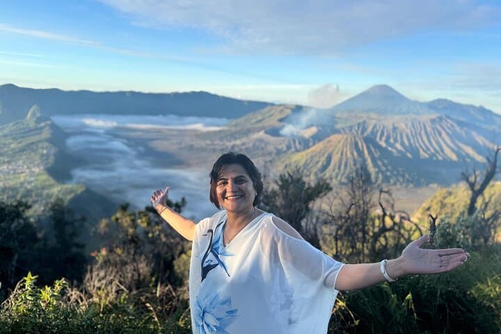
Geologically, the route is a lesson in fire and water. Mount Bromo is a member of Tengger massif, its sandy caldera an ancient bowl carved by eruptions and wind. On the classic two-hour pre-dawn Jeep ride, the 4WD rattles across sea-like sand; the vehicle becomes a small island in a larger, lunar plain. When the horizon begins to line with gold, Bromo’s crater edge silhouettes against sky. The air carries the mineral smell of ash and the sharper sting of cold; walking to the rim is an intimate, raw exchange—rock, breath, and the gape of a volcanic throat.
Then there’s Ijen—dark, quiet, and electric. The Ijen Crater calls for a pre-dawn ascent. The final approach is steep and narrow, the path riding a ridge until it drops away into the crater below where a milky turquoise lake sits like a wound. The real spectacle—blue fire—appears before first light when sulfur-laden gases ignite at the source. The flame is not a romantic glow; it’s the hard, alien blue of chemical combustion, a reminder that the Earth is actively changing beneath your boots. Miners work these slopes hauling baskets of bright yellow sulfur for export; their presence ties the spectacle to labor, not just tourism.
Culturally, East Java is patient and practical. Villages you pass live by rice, coffee, and small trades—warungs (food stalls) serve hardworking bowls of bakso and rawon that taste like the land: straightforward, salty, sustaining. Guides are often local, and their stories—about eruptions, elder sages, or the best route to a hidden viewpoint—are as valuable as the maps.
This itinerary is not a stroll. Expect steep climbs (particularly at Ijen), uneven steps at Tumpak Sewu, and cold winds at Bromo’s rim. But the physical demands are straightforward: strong shoes, steady footing, and an early alarm. For many travelers, the payoff is both sensory and photographic: the scale of the waterfall, the cinematic sweep of Bromo’s sunrise, the alien blue of Ijen—each scene rewards patience.
Practicalities matter. Start early to avoid crowds at Bromo and to catch the blue fire at Ijen before dawn; bring a headlamp and pack layers—the temperature swings are larger than you expect. Respect the miners at Ijen; keep a safe distance from sulfur vents and use a gas mask or high-filtration respirator when wind blows the fumes. On food and lodging: the tour includes basic but comfortable accommodation and breakfasts, but local warungs are where you’ll taste Malang’s bakso and strong Java coffee—simple, filling, and a cultural touchstone.
For first-timers, this loop is an ideal introduction to Indonesia’s untamed edges. It’s manageable in three days because distances are short and the flow is efficient: waterfall, sandsea sunrise, crater night trek. For repeat visitors, the trip holds layers—each site shifts with light and weather. Bring curiosity and some grit, and the trip will return images and impressions that last longer than a vacation album.
Logistically, this is best done in the dry months (May–September) when trails are firmer and visibility is highest. Weather is never fully predictable; cloud will sometimes veil a sunrise and rain will thicken into a veil at Tumpak Sewu, but those are the moments when the landscape feels most honest. Travel lightly but prepared: a good pair of boots, windproof layers, a headlamp, and a mask for sulfur make the trip significantly more comfortable.
By the end of day three you’re less a tourist checking boxes and more an attentive witness. The falls will have soaked you; Bromo will have rimmed your day with ash and silence; Ijen will have given you a blue flame that refuses to look ordinary. These places are not passive backdrops. They are active, opinionated, and often loud—sometimes with water, sometimes with steam, sometimes with the quiet necessity of miners’ labor. Walk humbly, pack sensibly, and you’ll carry home a three-day story of elemental contrasts: water that dances, mountains that breathe, and fire that burns blue.
Trail wisdom
Small choices, better day.
Start before dawn
Blue Fire at Ijen and the best Bromo viewpoints require pre-dawn departures to avoid crowds and catch optimal light.
Bring a respirator
Sulfur fumes at Ijen can be harsh—use an N95 or a reusable gas mask when close to vents or when miners are working.
Wear grippy boots
Trails at Tumpak Sewu and the rim at Ijen are steep and slippery—sturdy footwear improves safety and comfort.
Respect local workers
Keep distance from sulfur miners and don’t interfere with their paths or baskets—observe respectfully and photograph discreetly.
Local knowledge
Read the place, not just the route.
Watch for native species including Long-tailed macaque, Various forest birds including Javan munia.
Keep an eye out for wildlife during the transition between areas and habitats. Respect distance guidelines.
Ijen’s sulfur mining is labor-intensive and environmentally impactful—minimize disturbance, refrain from purchasing raw sulfur souvenirs, and support community-based tourism initiatives.
Follow the guide's instructions on size limits, ethical handling, and leave-no-trace practices.
Cemoro Lawang viewpoints near Bromo for quieter sunrise angles. Small warungs in Malang that serve bakso Malang—perfect after long drives
Locally recommended viewpoints and quiet spots known best to local operators.
Bromo sits within the Tengger caldera, and the Tenggerese people still practice Hindu rituals here—Mount Bromo remains culturally significant and part of local ceremonies.
Maritime roots and regional tradition shape the waterways and working coasts.
Seasonal guide
Four versions of the same landscape.
Spring
Best forFewer tourists · Lush greenery at waterfalls
ChallengesIntermittent rain · Mud on trails
Spring (wet-to-dry transition) brings vivid green vegetation and fewer travelers, though occasional rain can make trails slick.
Summer
Best forClear skies for sunrise · Firm trails at dry season peak
ChallengesHigher daytime heat in lowlands · More tourists at Bromo
Summer—East Java’s dry season—offers the most reliable conditions for visibility at Bromo and stable trail footing.
Fall
Best forMilder temperatures · Fewer crowds after peak season
ChallengesPossible short rains early/late · Variable visibility
Fall balances comfortable temperatures with reduced visitor numbers, though weather can switch between clear and cloudy.
Winter
Best forQuiet lodgings · Moody cloudscapes
ChallengesHigher chance of heavy rain · Some trails become slippery or impassable
Winter brings more rain and denser mist—atmospheric views are possible, but expect wet conditions and muddy approaches.
Operator details
What the booking data adds.
Included
- ✓Fuel, Toll, Parking, Charges
- ✓Special Gas Mask & Headlamp
- ✓Breakfast
- ✓2 Nights Stay Accomodation
- ✓Private Air Conditioned Vehicle
- ✓Coffee Break and Mineral Water
- ✓Profesional English Guide
- ✓4WD Off-Road Jeep
- ✓Medical Confirmation
- ✓Entrance Tickets
Not included
- —Personal Expenses
Good to know
- ✓Not recommended for travelers with spinal injuries
- ✓Not recommended for pregnant travelers
- ✓Not recommended for travelers with poor cardiovascular health
- ✓Travelers should have at least a moderate level of physical fitness
Pack with intention
What to bring.
Good to know
Common questions.
Moderate fitness is required: expect a steep 1–2 hour ascent with uneven steps; regular walkers who can manage continuous uphill hiking will be fine.
Plan the edges
The details that make the day easier.
Kawah Ijen’s blue fire is caused by burning sulfuric gases that ignite as they emerge from cracks—this phenomenon is rare and visible at only a few volcanic sites worldwide.
After a long day, head back to Malang for bakso (meatball soup) or rawon (black beef stew) at a local warung; try strong Javanese coffee and small cafes in Kampung Warna-Warni for a relaxed evening—Cemoro Lawang also has simple cafés with dramatic views if you want to linger near Bromo.
- Closest airports
- Juanda Int’l (Surabaya, ~3 hr drive) or Abdul Rachman Saleh (Malang, ~45–60 min). Typical driving: Malang to Tumpak Sewu ~2 hr; Malang to Cemoro Lawang (Bromo) ~2–3 hr; Cell service: intermittent at craters; Permits: park entrance fees and local guide
Ijen’s sulfur miners face hazardous conditions—observe from a distance, don’t buy raw sulfur souvenirs, and support operators who contribute to local communities and practice low-impact tourism.
Explore by topic
Follow the threads.
Keep exploring
Make the story part of the trip.
Set out from Bass Harbor for a private, customizable day on Blue Hill Bay — lighthouses, puffins, seals, and the chance to feel Acadia from the water. Small groups, local captains, unforgettable views.
In four hours you can move from shaded canyon ferns to wind-scoured coastal ridgelines, guided by someone who knows where the light—and the hidden views—live. This private half-day hike on the Monterey Peninsula or Big Sur is compact, curated, and perfect for travelers who want depth without a multiday commitment.
 Related story
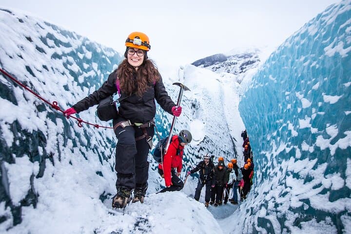
Beneath a sky of shifting light, Skaftafell’s ice reads like a map of time. This three-hour guided glacier hike mixes technical instruction with geology and culture: compact, safe, and unforgettable.