
What the day feels like
The engine hums and the freeway folds behind you, giving way to the brittle, blue-brown skyline of the Front Range. By the time the houses shrink to dots and the air tightens, the red fins of Red Rocks Amphitheatre lean into view—stacked sandstone like a bruised set of hands cupping an amphitheater where music and geology meet. This private tour moves at the pace of discovery: a few careful stops at iconic overlooks, a lakeside breather at Echo Lake, and a vertical ascent that pushes into the thin, pinched air above 14,000 feet on Mount Evans.
A good day on this route is cinematic but honest. Red Rocks greets you with its amphitheatre—sharp, rust-colored ridges carved by water and time more than 65 million years ago. Standing on the stone seats, you feel the scale: the park is both a concert hall and a geological exhibit. The driver-guide—often a local who knows the backstory—will point out the Dakota Sandstone layers, the same rock that shapes nearby hogbacks and badlands, and explain how the Laramide uplift tilted them into the dramatic shapes you see today.
From there you drop into the valley towns shaped by Colorado’s gold rush past. Idaho Springs still wears its mining-era bones: brick storefronts, sluice-box history, and steam whistle echoes at the Argo Gold Mine. The town is compact, friendly, and a good place to stretch legs and try a local sandwich or craft beer; many guides will route the day so you get a sense of the living community, not just the scenic highlights.
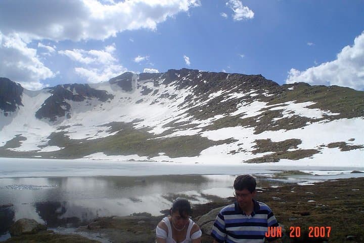
Echo Lake is the moment the tour shifts from history to alpine. The lake sits at high elevation beneath the jagged flanks of Mount Evans—stillness and a cold clarity that forces you to move slower. Trails here are short and well-marked: a lakeside loop and a few steeper boot-paths that head into subalpine forest. Expect pine needle carpets, wind-gnarled trees, and a granite-and-scree taste in the mouth of the landscape.
The final act is the climb. The Mount Evans Scenic Byway is the highest paved road in North America, snaking from mixed-conifer forests into alpine tundra. The road gains thousands of feet in a few dozen miles, delivering views that compress the continent’s geology into stacked plates of forests, valleys, and cloud-shadowed ridgelines. On clear days you can watch storms form in a handful of minutes and feel the sun sharpen into a cooler, thinner light as you rise.
This private day tour is less about record-setting hiking and more about curated contact with a range of Colorado landscapes—red sandstone amphitheatres, heritage mining towns, clear alpine lakes, and a high-mountain summit road. Physically, the exertion tends to be light-to-moderate: short walks, scenic overlooks, and one or two steeper stretches if you choose to climb higher off the road. The real challenge is the altitude—prepare for sharp air and bring patience.
History moves with you: Red Rocks’ amphitheatre has hosted music for a century and was part of the early conservation vision in Colorado. Idaho Springs embodies the 1860s gold rush, the boom-and-bust cycles that shaped settlement patterns, and the immigrant communities who built the early roads. Geologically the lift and erosion that created these features span tens of millions of years—here, you read deep time like a layered map.
Practical sense: the tour is private and customizable, which means you pick the tempo. Guides carry certificates and commercial insurance, and most operators adapt the route if Mount Evans Road is closed for ice or snow (common in spring and early winter). If the summit is unavailable, guides often pivot to the Continental Divide at roughly 12,000 feet for similar high-country panoramas. For photographers, the light at dawn and late afternoon is exquisite; midday can blanch the shadows but still offers sharp skies for summit shots.
Why travel here? The itinerary condenses the Rockies’ variety into a single day—a sensory sampler that’s accessible from Denver for a manageable price and with little navigation fuss. It’s ideal for travelers who want big, scenic payoffs without committing to multi-day backpacking, and for anyone curious about Colorado’s human and geological story.
Plan for altitude, sun, and quick weather swings. Bring layers, hydration, and good footwear for rocky shorelines and short alpine walks. Respect wildlife—mountain goats roam high above the treeline and marmots patrol the rocks. Keep to trails and pack out trash; these ecosystems are fragile and slow to recover.
At the end of the day you won’t have climbed a fourteen-thousand-foot peak on foot, but you will have earned an acute sense of place—the smell of spruce, the taste of thin air, and a series of views that read like postcards of the Rockies. It’s a day that stitches together history, geology, and mountain craft into a single, memorable route—one best enjoyed deliberately, with good company and a capable guide who knows when to stop the car and let the mountains speak.
Trail wisdom
Small choices, better day.
Acclimatize before you go
Spend a few hours in Denver or Idaho Springs if you're arriving from low elevation; the summit tops 14,000 feet and altitude can hit quickly.
Check road and weather conditions
Mount Evans Road can close seasonally for ice—confirm opening times with your guide and bring a rain/wind layer.
Hydrate and protect from sun
High-altitude sun is strong—carry extra water and broad-spectrum sunscreen even on cool days.
Wear sturdy shoes
Expect paved overlooks and short rocky stretches around Echo Lake and the summit—trail runners or hiking boots are best.
Local knowledge
Read the place, not just the route.
Watch for native species including Mountain goats, Marmots.
Keep an eye out for wildlife during the transition between areas and habitats. Respect distance guidelines.
High-elevation tundra is fragile—stay on established paths and pack out all waste; avoid disturbing wildlife and nesting birds near rock faces.
Follow the guide's instructions on size limits, ethical handling, and leave-no-trace practices.
Mirror-like reflections on Echo Lake in the morning. Historic Argo Gold Mine and Mill in Idaho Springs for short tours
Locally recommended viewpoints and quiet spots known best to local operators.
Idaho Springs grew from the 1860s gold rush and the area’s mining legacy still shapes local museums and tours; Red Rocks became a public venue in the early 20th century after land acquisition and conservation efforts.
Maritime roots and regional tradition shape the waterways and working coasts.
Seasonal guide
Four versions of the same landscape.
Spring
Best forWildflower onset · Fewer crowds · Off-season rates
ChallengesIcy high-elevation roads · Unpredictable storms
Spring brings melting snow and early blooms but Mount Evans Road may be closed into late spring—plan for alternates and layered weather.
Summer
Best forFull road access · Alpine views · Wildlife spotting
ChallengesAfternoon thunderstorms · Crowds on weekends
Summer offers the most reliable access to the summit and warm daytime temperatures—start early to avoid afternoon storms.
Fall
Best forAutumn aspen color · Clear air · Smaller crowds
ChallengesEarly snow at high elevations · Shorter daylight
Fall delivers crisp light and golden stands of aspen; check for early closures and bring warm layers.
Winter
Best forSnow-covered landscapes · Photography of frozen lakes
ChallengesRoad closures to Mount Evans · Icy, dangerous driving
Winter turns the route into a different animal—expect closures and plan for alternate high-country stops if driving to the summit is impossible.
Pack with intention
What to bring.
Good to know
Common questions.
The road is typically open from late spring through mid-fall, but exact dates vary with snow and ice—check with your guide or the forest service before booking.
Plan the edges
The details that make the day easier.
Mount Evans Scenic Byway is the highest paved road in North America, reaching roughly 14,130 feet above sea level.
After the tour, grab a local brew at Tommyknocker Brewery in Idaho Springs or a quick bite near Red Rocks in Morrison; the Argo Gold Mill offers a compact look at mining history and a café for a post-tour coffee.
- Closest airport
- Denver International Airport (DIA); Typical driving distance from Denver: 40–60 miles (1–1.5 hours depending on traffic); Cell service: good in towns, variable above treeline; Permits
- passes
- no special permits required for the byway, but Red Rocks may have parking
This route traverses sensitive alpine and riparian environments—pack out all trash, stay on maintained trails, and avoid approaching wildlife; small choices help protect fragile tundra and lake ecosystems.
Explore by topic
Follow the threads.
Keep exploring
Make the story part of the trip.
Set out from Bass Harbor for a private, customizable day on Blue Hill Bay — lighthouses, puffins, seals, and the chance to feel Acadia from the water. Small groups, local captains, unforgettable views.
In four hours you can move from shaded canyon ferns to wind-scoured coastal ridgelines, guided by someone who knows where the light—and the hidden views—live. This private half-day hike on the Monterey Peninsula or Big Sur is compact, curated, and perfect for travelers who want depth without a multiday commitment.
 Related story
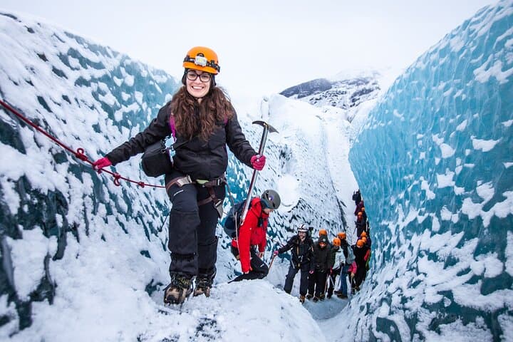
Beneath a sky of shifting light, Skaftafell’s ice reads like a map of time. This three-hour guided glacier hike mixes technical instruction with geology and culture: compact, safe, and unforgettable.