
What the day feels like
The forest tightens its grip as you step under the canopy, the air cool and damp with the scent of leaf mold and volcanic earth. Howler monkeys declare the morning like cranky alarm clocks, and the trail—root-latticed and slick with last night’s rain—nudges you forward. Then the jungle parts, and you hear it before you see it: a river with attitude. It rounds a bend and shows its cards—an improbable ribbon of electric blue. The Rio Celeste doesn’t just flow; it flaunts, daring your eyes to believe.
That color is why hikers cross the northern ranges of Costa Rica to Tenorio Volcano National Park. The route winds to a viewpoint, a waterfall locals sometimes call “Bride’s Veil,” and the river’s famed Teñidero—where two clear streams merge and, through a natural alchemy of minerals and light, turn a shade of gemstone you’ll remember for years.
This is Tenorio country, where the volcano keeps its secrets close. On the forest floor, steam hisses from thermal vents and mud pots burble like the earth thinking out loud. On the trail, you move through a living laboratory. While you may hear that sulfur from the volcano meets calcium carbonate from rain to create the hue, scientists have refined the story: at the Teñidero, changes in pH cause tiny aluminosilicate particles to form and scatter sunlight, intensifying blue tones. Nature paints with physics.
The hike itself is a study in contrasts: modest distance—about 3.5 to 4 miles (6 to 6.5 km) round-trip if you visit the waterfall, lookout, and Teñidero—but with sections that demand respect. Expect mud in any season and roughly 250–300 steps down to the waterfall platform (and back up). The park keeps the route contained and signed: platforms protect delicate banks, and rope rails steer you away from edges that crumble under a season’s worth of rain.
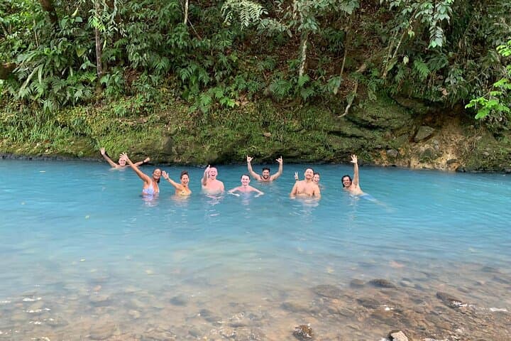
When the river drops into the amphitheater of stone at the waterfall, the plunge pool glows like a lantern, but swimming is off-limits inside the national park—both for your safety and the river’s. Downstream, the current presses forward, restless as it rushes past mineral springs and vents, adding a breath of sulfur to the air. Birds flash through the canopy—trogons and tanagers with tropical confidence—and if you’re lucky, you might see a basilisk scamper across the surface like a magician who forgot about gravity.
What sets this hike apart in Costa Rica’s crowded roster of day adventures is how concentrated the payoff feels. In less than a half-day of walking, you witness active volcanic processes, a world-class waterfall, and a geologic phenomenon rare enough to draw researchers and photographers from around the globe. It’s rainforest pilgrimage without the marathon.
Practicalities here matter. Plan for 2.5–4 hours on the trail depending on pace and photo stops. The steps to the waterfall can be slick; grippy footwear is not optional. The mud is democratic—it will find you—so consider lightweight gaiters or shoes you don’t mind washing in a roadside stream. Start early to maximize visibility; the Rio Celeste shines brightest with some sun overhead, and afternoon showers are a regional habit.
From Bijagua de Upala, the closest gateway town, you’ll drive about 20–30 minutes to the El Pilón ranger station. Entry is capped for conservation, so booking with a guide or arriving early is smart. Guides add texture to the day—helping you spot sloths curled like commas, explaining the names of trees that perfume the air, and sharing the local legend that after painting the sky, the gods washed their brushes in this river. Science and story coexist here; the forest approves either way.
Along the route, you’ll reach the Teñidero—the dyeing point—where the Río Buena Vista and Río Roble meet and perform their blue trick. The river feels alive here, shouldering its way past submerged logs and smoothing itself against boulders. Downtrail, boardwalks span sections of thermal activity, and the water whispers a warning: look, don’t touch. The park prohibits swimming in the main river and near vents to protect both people and an ecosystem balanced on a tightrope of chemistry.
Culture rides along with the hike. This rural corner of Alajuela leans on small farms, dairy, and tourism. Post-hike, a simple casado—rice, beans, plantains, salad, and your choice of protein—never tastes better, and many tours include lunch at a local soda. Order a maracuyá batido and let your core cool while the day rearranges itself around you.
Weather rules the narrative. Even in the dry season (roughly December to April), showers can slide in like uninvited guests. In the wet months, the river sometimes runs chocolate-brown after big storms; the blue returns as sediments settle. The trail remains open unless conditions compromise safety, and rangers will turn visitors back to protect the resource—an act of stewardship that should be applauded, not resented.
Come ready to move smart. Hydrate. Carry a small first-aid kit and a lightweight shell. Watch your step on roots that rise like ribs from the ground. The forest has a pulse, and on this hike, you sync to it: slow, observant, steady. You leave with mud on your calves and a new color lodged in your memory. The Rio Celeste doesn’t just pose for photos; it rewrites your sense of what water can be.
In a country known for volcanoes and waterfalls, this one stands out because everything happens at once: the geology, the rainforest, the narrative of an elemental transformation. Tenorio doesn’t shout; it shows. And the river, with its impossible blue, does the rest.
Trail wisdom
Small choices, better day.
Start Early
Arrive for park opening to avoid crowds and catch the river at its brightest before afternoon clouds build.
Grip Matters
Wear lugged hiking shoes—stairs and mud make the descent to the waterfall slick even in dry season.
Stay On Trail
Boardwalks protect delicate banks and thermal features; off-trail shortcuts erode quickly in this wet forest.
No Swimming Zones
Swimming is prohibited in the park for safety and conservation; ask your guide about legal soak spots outside.
Local knowledge
Read the place, not just the route.
Watch for native species including Howler monkeys, Green basilisk lizards.
Keep an eye out for wildlife during the transition between areas and habitats. Respect distance guidelines.
Visitor numbers are limited and trails are engineered to reduce erosion. Staying on marked paths and packing out trash protects fragile riverbanks and thermal zones.
Follow the guide's instructions on size limits, ethical handling, and leave-no-trace practices.
Teñidero confluence viewpoint—watch the exact spot where the two clear rivers turn blue. Thermal vents boardwalk—subtle steam and bubbling hints of Tenorio’s energy
Locally recommended viewpoints and quiet spots known best to local operators.
Tenorio Volcano National Park was established in 1976, protecting cloud forest, premontane rainforest, and active geothermal features tied to the Tenorio volcanic complex.
Maritime roots and regional tradition shape the waterways and working coasts.
Seasonal guide
Four versions of the same landscape.
Spring
Best forClearer views · Lower rainfall
ChallengesMidday heat · High UV
Generally drier with bright river color and firm-ish trails—still expect passing showers.
Summer
Best forLush foliage · Fewer crowds early
ChallengesFrequent rain · Muddier trail conditions
Green season deepens; plan for rain gear and slower going on roots and stairs.
Fall
Best forWildlife activity · Moody misty photos
ChallengesHeaviest rains · Occasional river discoloration after storms
Expect downpours and potential trail advisories; the blue returns as sediments settle.
Winter
Best forDry trails · Best chance of turquoise color
ChallengesBusier crowds · Midday heat on exposed sections
Peak season with favorable conditions—arrive early or book a guided slot to beat the rush.
Operator details
What the booking data adds.
Included
- ✓Private transportation
- ✓Local guide
- ✓Lunch
- ✓All Fees and Taxes
Not included
- —Towel
- —Bottled water
Good to know
- ✓Not recommended for travelers with poor cardiovascular health
- ✓Not recommended for travelers with spinal injuries
- ✓Not recommended for pregnant travelers
- ✓Travelers should have at least a moderate level of physical fitness
- ✓Children must be accompanied by an adult - Recommended from 12 years old
- ✓Please advise any specific dietary requirements at time of booking
- ✓Special requirements are granted inly if confirmed by tour operator on written message 24 hours in advance
- ✓Passport required
Pack with intention
What to bring.
Good to know
Common questions.
Plan 3.5–4 miles (6–6.5 km) round-trip with stairs and muddy sections. It’s moderate; beginners with basic fitness can manage with time and care.
Plan the edges
The details that make the day easier.
Recent studies show Rio Celeste’s blue color comes from light scattering by tiny aluminosilicate particles formed at the Teñidero, not dissolved dye.
After the hike, refuel at a local soda in Bijagua with a casado and a passion fruit batido. Roadside stands on Route 6 sometimes sell fresh cheese and tortillas—simple, local, perfect after a muddy climb.
- Closest airports
- LIR (1.5–2 hrs) or SJO (3.5–4 hrs). Trailhead: El Pilón ranger station, Tenorio Volcano NP. 20–30 min from Bijagua; ~1.5–2.5 hrs from La Fortuna. Limited cell service. Park entry required; no swimming; capacity controls in effect.
Tenorio’s riverbanks erode easily, and thermal features are sensitive—stay on marked trails, skip swimming, and leave no trace to keep Rio Celeste blue.
Explore by topic
Follow the threads.
Keep exploring
Make the story part of the trip.
Set out from Bass Harbor for a private, customizable day on Blue Hill Bay — lighthouses, puffins, seals, and the chance to feel Acadia from the water. Small groups, local captains, unforgettable views.
In four hours you can move from shaded canyon ferns to wind-scoured coastal ridgelines, guided by someone who knows where the light—and the hidden views—live. This private half-day hike on the Monterey Peninsula or Big Sur is compact, curated, and perfect for travelers who want depth without a multiday commitment.
 Related story
Beneath a sky of shifting light, Skaftafell’s ice reads like a map of time. This three-hour guided glacier hike mixes technical instruction with geology and culture: compact, safe, and unforgettable.