

What the day feels like
You pull up to a corrugated-metal shed across from the Sunscape Resort, the kind of place that looks like it shouldn’t be the gateway to an island’s wildest corners. A row of orange and black UTVs waits like caged animals, engines ticking as they cool. Within minutes the guide flips a helmet toward you and points north. The road becomes sand; the radio quiets. The island’s polite, pastel shorelines fall away and the terrain hardens into a raw, arid scrub of cacti, limestone outcrops, and low scrub that catches the trade winds. This is Curaçao’s north: where the ocean collides with rock, where waves find cavities and throw themselves back at the cliffs in white foam. The buggy’s wheels bite, and the world narrows to dust, spray, and the narrow ribbon of track ahead.
The 2.5-hour Buggy Adventure Tour is compact and relentless in the best way. It’s not a languid island cruise; it’s a hands-on, kinetic way to meet Curaçao’s geology and history up close. You’ll cross the sandy plains of St. Joris, a stretch of cactus and talus that reads as an island’s interior logic—drier, harder, more uncompromising than the manicured bays around Willemstad. Along the way the guide pulls up at a “cave of doom” in formation, a natural arch and grotto where the sea has been chiseled into sculptural gestures. Strong currents throw themselves against the north shore here with a force you can feel in your chest; the so-called geiser formations and blowholes huff and spit seawater, a reminder that the Caribbean here is not always calm.
Curaçao has always worn a dual personality: a Dutch colonial capital of colorful facades and seaside resorts on the south, and a rough, wind-scoured north that’s less manicured and more elemental. Geologically, the island is the exposed top of an ancient submarine terrace—limestone platforms and volcanic intrusions that created pockets, arches, and blowholes where waves can concentrate their energy. Historically, those rugged coves were less hospitable to plantations and settlements, which shaped a different human imprint on the north coast: lonesome fishermen’s huts, isolated farms, and now a scattering of tour operators who know how to show the island’s raw side without erasing it.
The cultural beat of the tour is subtle but present. Guides will pass through small, off-grid settlements and point out former slave-era paths, abandoned cisterns, and how the local economy shifted from agricultural to tourism-centric in the 20th century. On quieter stretches of track, you’ll hear the language of the island—Papiamentu—slip into conversations: short, musical phrases that give the place a regional texture. At the north shore, beachcombers find shards of coral, ancient seashells, and the occasional washed-up artifact, reminders that this coast keeps its own ledger of storms and ships.
Practically, the tour is designed for people who want motion and access. For 2.5 hours (bookings commonly at 9:30am, 12:30pm, or 3:30pm), you’ll drive or ride a two-seat UTV—side-by-side machines with roll cages, basic harnesses, and enough power to laugh at rutted tracks. There’s no technical rock-climbing skill required, but you should be comfortable on loose sand, shallow rock ledges, and short slopes. The guide knows the best micro-climates: where coastal wind will sting your face, where the sun will momentarily burn through cloud, and when to step out for a short walk to the natural bridge or a geyser-like blowhole.
What you’ll feel—aside from raw adrenaline—is the island’s texture: the coarseness of cactus thorns, the sting of salt on your lips, the hollow thunder in a rock cavity after a wave hits. And between the surges and gravel runs, there’s time to notice small things: a ruddy lizard sunning on limestone, a pelican winging low above the surf, or the smell of crushed saltbush when your helmet comes off.
For planning: the tour is instant-confirmation and typically runs with small groups. It’s priced from about $170 per vehicle (drivers and passengers can trade off on many tours), and the operator provides helmets and basic safety gear. Expect to be out of cellphone range for some stretches, and to return with sand in surprising places. If you want to extend the day, pair the ride with a late lunch in Willemstad’s Otrobanda district—try local keshi yena, a slow-baked cheese-and-meat dish that tastes like the island made comfort food—before a sunset walk across the Queen Emma Pontoon Bridge.
This ride isn’t for travelers seeking velvet beaches and full-service quiet. It’s for people who like their landscapes with a little bite, who want the island’s wild face rather than its polished smile. It’s also an efficient, visceral way to learn something real about Curaçao: that an island can hold many climates, many histories, and a coastline that still surprises.
If you go: go early in the morning to avoid the hottest stretch, wear closed-toe shoes and layers (trade winds can chill you immediately after a high-speed stretch), and carry a small daypack with water and a waterproof phone case. Let the engine vibrate out the touristy static; the north shore will do the rest.
At the end of the tour, when the UTVs line up again and everyone loosens their helmets, you’ll have a better map of Curaçao in your head—one that includes both salt-washed cliffs and coral-shelf beaches, colonial streets and empty coves. It’s a short trip with a sharp punch of place-making: efficient, a little wild, and absolutely memorable.
Trail wisdom
Small choices, better day.
Secure loose belongings
Strap phones and sunglasses into a zippered pack or use a waterproof case—sand and wind will find unsecured items.
Wear closed-toe shoes
Sturdy trail shoes protect your feet from sharp limestone, cactus spines, and hot metal footwells.
Time your ride
Morning departures are cooler and calmer; afternoon sessions can be windier but offer dramatic afternoon light for photos.
Hydrate and protect
Carry at least 1–2 liters of water per person and apply reef-safe sunscreen before you board.
Local knowledge
Read the place, not just the route.
Watch for native species including Brown pelican, Curaçao whiptail lizard.
Keep an eye out for wildlife during the transition between areas and habitats. Respect distance guidelines.
Stay on established tracks to limit erosion and damage to cacti; avoid disturbing seabird nesting areas and take all trash back to town.
Follow the guide's instructions on size limits, ethical handling, and leave-no-trace practices.
Small coves along the north shore ideal for private beach walks. A short walk to a remote blowhole that’s quieter than the main viewpoints
Locally recommended viewpoints and quiet spots known best to local operators.
The north coast was historically less settled than the south due to rough seas and scarce freshwater; remnants of early colonial and plantation-era structures dot the interior.
Maritime roots and regional tradition shape the waterways and working coasts.
Seasonal guide
Four versions of the same landscape.
Spring
Best formild temperatures · fewer crowds · clear light for photos
Challengesoccasional showers · strong trade winds some days
Spring (March–May) is part of the dry season with pleasant temperatures and good visibility—expect some breezy days on the north shore.
Summer
Best forlong daylight hours · hot-weather driving · lively ocean conditions
Challengeshigher heat and humidity · increasing chance of scattered storms
Summer is warm and lively; plan for heat-management and possible short, intense rain showers.
Fall
Best forwarm seas · fewer tourists · good snorkeling after calmer days
Challengesinfrequent tropical activity farther out at sea · variable winds
Fall holds warm temperatures and quieter tourism seasons, with variable wind—check conditions before you go.
Winter
Best forcooler trade winds · dry weather · excellent visibility
Challengeswind can be strongest on north coast · choppy seas at viewpoints
Winter (Dec–Feb) is the island’s dry season—crisp, bright, and popular; winds make the north dramatically energetic.
Operator details
What the booking data adds.
Included
- ✓goggles
- ✓Bottled water
Not included
- —Private transportation
- —GST (Goods and Services Tax)
- —Scarf or Bandana
Good to know
- ✓Public transportation options are available nearby
- ✓Not recommended for travelers with spinal injuries
- ✓Not recommended for pregnant travelers
- ✓Not recommended for travelers with poor cardiovascular health
- ✓Travelers should have at least a moderate level of physical fitness
- ✓This tour is sold for per vehicle single or double. Customers needing more vehicles need to purchase the vehicles separate.
Pack with intention
What to bring.
Good to know
Common questions.
Yes—drivers must present a valid driver’s license; passengers do not need one but must wear safety gear.
Plan the edges
The details that make the day easier.
Shete Boka and many north-coast formations on Curaçao are the product of centuries of wave action carving porous limestone—some blowholes can spray seawater over 20 feet on high surf days.
After the ride, head to Willemstad’s Otrobanda or Plasa Bieu for local fare—try keshi yena (cheese-stuffed meat) and a cold Balashi beer. For relaxed cocktails and ocean views, Mambo Beach or Pietermaai’s beachfront bars are nearby.
- Closest airport
- Hato International (CUR); Meeting point: buggy shop across Sunscape Resort, Willemstad; Driving distance from Willemstad center: 10–25 minutes to meeting point, 45–75 minutes to furthest north-coast outlooks; Cell service: generally good near towns, patchy on remote north coast; Permits: none required
The north coast contains fragile limestone and coastal habitats—stay on designated tracks, avoid trampling vegetation, and pack out all trash to protect nesting seabirds and slow erosion.
Explore by topic
Follow the threads.
Keep exploring
Make the story part of the trip.
Set out from Bass Harbor for a private, customizable day on Blue Hill Bay — lighthouses, puffins, seals, and the chance to feel Acadia from the water. Small groups, local captains, unforgettable views.
In four hours you can move from shaded canyon ferns to wind-scoured coastal ridgelines, guided by someone who knows where the light—and the hidden views—live. This private half-day hike on the Monterey Peninsula or Big Sur is compact, curated, and perfect for travelers who want depth without a multiday commitment.
 Related story
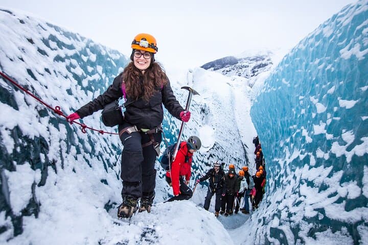
Beneath a sky of shifting light, Skaftafell’s ice reads like a map of time. This three-hour guided glacier hike mixes technical instruction with geology and culture: compact, safe, and unforgettable.