
What the day feels like
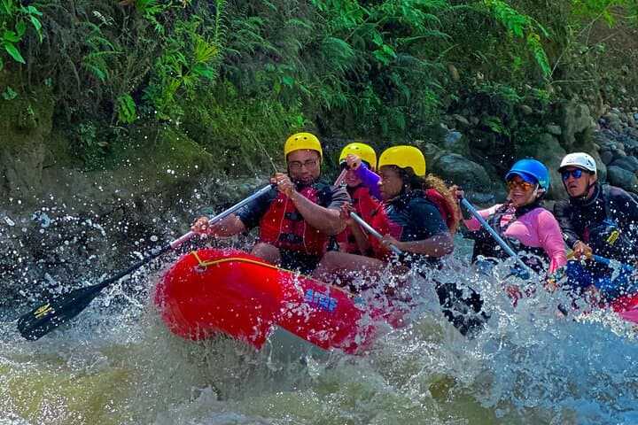
The river greets you before you ever see it—cool air slips up the canyon, the smell of wet stone and guava leaves folds into the van, and somewhere below, the Savegre mutters and then laughs outright. By the time you step onto the smooth river rocks, clouds snag the shoulders of the Talamanca foothills and a kingfisher streaks past like a thrown coin. The current nudges your calves, daring you to lean in. And when the raft’s bow cuts the first tongue of whitewater, the Savegre grins and pushes forward.
This is the friendly side of whitewater—playful, not punishing—on one of Costa Rica’s cleanest, most beloved rivers. Savegre Rafting sets out from Quepos and climbs inland on a winding road that peels open the landscape: palm plantations give way to pasture and then dense forest. You gear up at a rural put-in near El Silencio, where guides—seasoned, calm, and unmistakably proud of their backyard—tighten PFD straps and run through the basics. Paddle commands are simple and decisive. The river, they explain, will do most of the talking.
The Savegre moves like a skilled conversationalist: riffles turn into standing waves, pools into silent eddies. Class II–III rapids arrive in flurries, separated by long green corridors where herons stalk the banks and blue morpho butterflies bob past like misplaced neon. Granite boulders shoulder the flow; jungle leans in, listening. The river has carved this path from high cloud forests toward the Pacific, carrying mountain-cold springs, rain, and stories. It’s also the spine of the Savegre Biosphere Reserve, a 2017 UNESCO designation that recognizes staggering biodiversity—from quetzals in the heights to crocodiles at the estuary. Out here, you read the current as much as the scenery. The Savegre isn’t just scenery anyway. It’s a living neighbor.
You’ll paddle for roughly 10–13 kilometers, give or take based on water levels, and spend about 2.5 to 3 hours on the water. The full outing runs around six hours door-to-door with the mountain drive, a safety briefing, and a riverside fruit break under the trees. In the wet season, the volume builds—rapids get punchier and the river’s tone deepens. In the dry months, it slips back into speed and clarity, a liquid window. Either way, it’s a forgiving classroom for first-timers and still lively enough for seasoned paddlers hunting clean wave trains and quick maneuvering.
Between rapids, you learn the river’s voice: the telegraph of a standing wave, the hush behind a boulder, the tug of an eddy-line that wants your paddle like a handshake. Guides point out a hidden waterfall veiled by heliconia and the almond trees that lure scarlet macaws downriver toward the coast. You might drift past a local angler in rubber boots, flicking a hand line for machaca. The Savegre doesn’t hurry you, even as it moves with intent.
History runs alongside. This watershed has long supported small-scale farms and indigenous communities deeper in the mountains. Far downstream at El Brujo, a petroglyph boulder bears pre-Columbian art, a reminder that humans have always read stories in this valley’s rock. Today, it’s the clean water itself that draws people close—birders scan for tanagers and toucans on the road in, and paddlers come for a dose of motion that feels kinetic but not reckless.
The geology sets the tone: Precambrian bedrock from the Talamancas creates solid, predictable channel features, and the river’s gradient dishes out fun, readable lines. In other words, the Savegre is generous. It wants you to get the move. And when a guide calls for a high side, the raft answers in a sideways leap and sticks the landing. Laughter bounces off the canyon walls, dissolving into mist.
Practicalities anchor the day. Expect a bumpy, beautiful drive from Quepos—about 60 to 90 minutes depending on the put-in used. On-river, you’ll wear a PFD, helmet, and likely a sun layer; closed-toe water shoes are best. The sun can be direct even under cloud, and the rain can arrive on schedule or not at all. Hydrate early, sip often. If you’ve never rafted, no problem: basic swimming ability and the willingness to follow guide commands are the only real prerequisites. Families make up a big slice of boats here, and the Savegre welcomes them.
The river’s pace lets you look up. There’s a moment that tends to stick: a flat stretch where the water glides like smoked glass and you can hear the forest breathing—cicadas ratchet up, a parrot scolds, and the current hums beneath the raft, steady and sure. You could swear the river is encouraging you onward. Take the hint. The next corner holds another wave train and another chance to feel the tug-of-war that makes whitewater addictive: gravity pulling, water insisting, you translating that energy into a synchronized paddle stroke with strangers who quickly become a crew.
Back at the take-out, the helmets come off and cheeks hold that after-river glow. Lunch may be a plate of casado at a roadside soda—rice, beans, plantains, salad, a choice of meat or veggies, and salsa Lizano in easy reach—or fresh fruit under a tin roof while rains drum the jungle. Either way, the Savegre keeps talking long after you’re towel-dry. It’s the river you thought you wanted—photogenic, splashy, green—and also the river you didn’t know you needed: honest, clean, and alive, gently pushing you to step a little past your edges and into the current.
For travelers anchored in Quepos or Manuel Antonio, this is the easy yes. It’s a half-day that feels bigger. It delivers both the postcard—emerald corridors, tropical birds, the relieved whoop after a clean run—and the part you take home: the quiet confidence that shows up when you’ve moved in rhythm with a place and let it move you back.
Trail wisdom
Small choices, better day.
Dress for sun and splash
Wear a quick-dry sun shirt, shorts, and closed-toe water shoes. Cotton stays wet and gets chilly in shaded canyons.
Stash essentials in a small dry bag
Bring only what you need—ID, cash for lunch or tips, and a spare lens cloth—sealed in a personal dry bag if permitted.
Hydrate before the put-in
Start hydrating in the van; it’s humid, and you’ll be paddling. Bring a reusable bottle to top up at the base.
Listen for water level briefings
Guides adjust lines based on daily flows. Pay attention at scout talks; a small tweak in your stroke makes a big difference.
Local knowledge
Read the place, not just the route.
Watch for native species including Scarlet macaw, Green kingfisher.
Keep an eye out for wildlife during the transition between areas and habitats. Respect distance guidelines.
Pack out all trash, use reef-safe sunscreen, and support small, local businesses along the watershed—your choices help keep the Savegre among the cleanest rivers in Central America.
Follow the guide's instructions on size limits, ethical handling, and leave-no-trace practices.
El Brujo petroglyph boulder on the Savegre—best visited with a local guide. Playa Matapalo at the Savegre River mouth for sunset and shorebirds
Locally recommended viewpoints and quiet spots known best to local operators.
In 2017, UNESCO designated the Savegre watershed a Biosphere Reserve, recognizing its exceptional biodiversity and the communities that steward it.
Maritime roots and regional tradition shape the waterways and working coasts.
Seasonal guide
Four versions of the same landscape.
Spring
Best forLower flows and clearer water · Wildlife spotting
ChallengesStrong sun exposure · Occasional afternoon showers
March–May often brings moderate water and good visibility—great for first-timers and photographers.
Summer
Best forPunchier rapids · Lush rainforest scenery
ChallengesFrequent rain · Potential for higher, faster water
June–August is green and lively. Expect bigger wave trains, warm rain, and dramatic clouds over the Talamancas.
Fall
Best forHigh-volume runs · Fewer crowds
ChallengesHeavy storms possible · Muddy access roads
September–November can deliver powerful flows. Trips may shift put-ins for safety; be flexible and heed guide calls.
Winter
Best forSunny skies · Stable conditions
ChallengesPopular holiday periods · Stronger UV even on cloudy days
December–February is the dry season on the coast. The river still runs, with crisp mornings and bright afternoons.
Operator details
What the booking data adds.
Included
- ✓Lunch and Snack are included
- ✓Air-conditioned vehicle
- ✓Rafting Equipment - (Paddles, Lifevest)
Good to know
- ✓Public transportation options are available nearby
- ✓Not recommended for travelers with spinal injuries
- ✓Not recommended for pregnant travelers
- ✓Not recommended for travelers with poor cardiovascular health
- ✓Suitable for all physical fitness levels
Pack with intention
What to bring.
Good to know
Common questions.
No. This stretch of the Savegre is Class II–III and beginner-friendly. Guides provide a thorough safety talk and paddle commands.
Plan the edges
The details that make the day easier.
The Savegre watershed was designated a UNESCO Biosphere Reserve in 2017, recognized for hosting about 20% of Costa Rica’s plant species and some of its clearest rivers.
Post-river, swing by a roadside soda for a casado and fresh maracuyá juice. Back in Quepos, celebrate with a cold Imperial and ceviche along the malecón. If you’ve got time, catch sunset at Playa Biesanz near Manuel Antonio—calm water, local families, and howler monkeys in the treeline.
- Closest airport
- Quepos La Managua (XQP), or SJO (San José) ~3 hours by road. Pick-up: Quepos
- Manuel Antonio hotels. Drive to put-in
- ~60–90 minutes into the Talamanca foothills. Cell service: Spotty beyond town; download offline maps. Permits: None required for commercial trips; outfitter provides safety gear.
The Savegre is part of a UNESCO Biosphere Reserve—avoid single-use plastics, use reef-safe sunscreen, and respect riverbanks at put-ins/take-outs to reduce erosion.
Explore by topic
Follow the threads.
Keep exploring
Make the story part of the trip.
Set out from Bass Harbor for a private, customizable day on Blue Hill Bay — lighthouses, puffins, seals, and the chance to feel Acadia from the water. Small groups, local captains, unforgettable views.
In four hours you can move from shaded canyon ferns to wind-scoured coastal ridgelines, guided by someone who knows where the light—and the hidden views—live. This private half-day hike on the Monterey Peninsula or Big Sur is compact, curated, and perfect for travelers who want depth without a multiday commitment.
 Related story
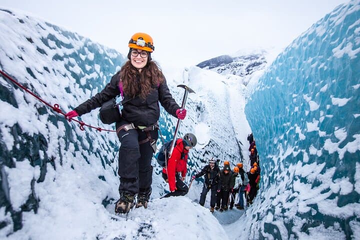
Beneath a sky of shifting light, Skaftafell’s ice reads like a map of time. This three-hour guided glacier hike mixes technical instruction with geology and culture: compact, safe, and unforgettable.