
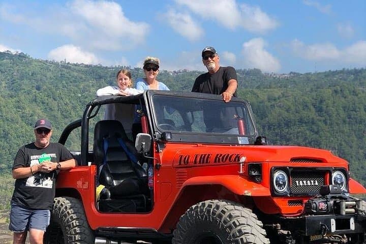
What the day feels like
The jeep shudders and climbs, tires crunching over black glassy rock that still remembers heat. All around, terraces cut like hairlines into the hills, and in the distance the caldera rim sits like a sleeping watchtower—Mount Batur at the center of a landscape that is equal parts agriculture and geology. Wind pushes across the plateau and seems to test you, as if the volcano itself is asking whether you came to observe or to participate. A local guide taps the brakes and points: a narrow ribbon of newer lava, a 1960s flow that braided across the valley and left farms to adapt around it. You can almost see the ground’s memory of its fury.
This is the practical thrill of a Mount Batur jeep tour. It’s less about summiting and more about riding the scarred, storied edges of Bali’s volcanic heart. The day unfolds as a stitched sequence of off-road runs and short walks—Lava Ball Point for a panoramic Kintamani view, a stop to walk the hardened 1964 lava, and a drive through smallholder farms where farmers coax vegetables from thin volcanic soils. The jeep navigates workaday tracks that bicycles and scooters avoid, and that intimacy with the land is what sets the tour apart from a simple overlook.
Geologically, the Kintamani district is the product of repeated eruptions, collapses, and slow renewal. Mount Batur sits inside a much larger caldera and is one of Bali’s most active volcanoes; its frequent eruptions have shaped soil, settlement patterns, and even local religion. Balinese animism and Hindu practices treat the volcano with respect: offerings appear in wayside shrines and in small woven baskets left at field corners, a quiet reminder that this landscape is cultivated, worshiped, and worked.
Culturally, the jeep tour is also a window into rural Bali. Farmers tending plots of sweet potato, cassava, and vegetables have learned to read the soil’s generosity and risk, planting according to seasons that the mountain dictates. Guides—often certified through local associations that emphasize safety and cultural knowledge—double as interpreters of both landscape and custom, pointing out crop cycles, local rituals, and the best angles for photos.
For travelers, the attraction is threefold: the geology, the access, and the narrative. You don’t need summit-level fitness, but you get close enough to the volcano to feel the scale. The route typically covers a mix of paved roads, dirt tracks, and 10–20 km of off-road lava and rubble—enough to feel like off-road adventure without venturing into extreme terrain. Elevation around the Kintamani rim hovers around 1,200–1,700 meters, so mornings can be cool and afternoons warm. Expect short hikes of 10–30 minutes at viewpoints; the main motion is behind the wheel.
Practicalities matter. Bring sun protection and a wind layer; the rim can go from bright and hot to gusty and cool in the span of a photo. If you’re shooting images, arrive when the light is right—early morning for low-angle glow, late afternoon for elongated shadows and warm hues. Respect private fields: most stops are adjacent to cultivated plots rather than inside them, and guides will tell you where it’s allowed to step.
Safety and sustainability are built into responsible operators’ itineraries. Vehicles should be well maintained and guides certified; operators who work with local communities will route tours to minimize crop disturbance and tip local warungs for restroom access or snacks. For households where tourism intersects agriculture, small purchases—coffee, snacks, or woven souvenirs—make a meaningful difference.
The jeep tour is a good fit for day-trippers based in Ubud, Seminyak, or the Sanur corridor, and it pairs well with a sunrise hike (for those wanting to add a steeper effort) or an afternoon of exploring local hot springs. Expect a half- to full-day commitment; operators commonly run 7–8 hour itineraries that include hotel pickup, several stops, and a relaxed pace that prioritizes photography and local interaction.
What you’ll remember afterward is tactile: the vibration of the jeep, the smell of scorched earth that has healed into soil, the patchwork of farms clinging to a once-fluid surface. It’s not an adrenaline-only excursion; it’s an observational one—engine, earth, and people in quiet dialogue. If you want a day that mixes geology, culture, and off-road motion without demanding summit fitness, this jeep tour is an efficient, revealing way to read Bali’s volcanic story.
Before you book, check the operator for certification and a clear sustainability policy, and pick a morning window to avoid the midday heat and typical cloud buildup. Stay curious about the layers: what you see on the surface—lava ribbons, stone fences, coffee trees—is linked to deeper, ongoing processes beneath your tires.
In short: come for the views, stay for the story beneath your feet, and remember that the mountain still has a voice. It speaks in cooled glass and in the ways farmers lean into risk to grow their food.
Trail wisdom
Small choices, better day.
Arrive Early for Clear Light
Morning windows usually offer the best visibility and cooler temperatures—ideal for photos and avoiding midday haze.
Bring a Wind Layer
Temperatures on the caldera rim can drop quickly with wind; pack a light jacket even if it’s warm below.
Respect Farm Boundaries
Stick to designated viewpoints; farms are private and guides will show where it's appropriate to explore.
Hydrate and Snack Locally
Carry water and buy a coffee or snack at a local warung to support communities you pass through.
Local knowledge
Read the place, not just the route.
Watch for native species including Long-tailed macaque, Great egret and local waterbirds.
Keep an eye out for wildlife during the transition between areas and habitats. Respect distance guidelines.
Operators who work with local communities help minimize crop disturbance and support small warungs—choose guides who follow leave-no-trace practices.
Follow the guide's instructions on size limits, ethical handling, and leave-no-trace practices.
Lava Ball Point viewpoint for sweeping Kintamani panoramas. A small warung near the caldera rim serving Batur coffee and homemade snacks
Locally recommended viewpoints and quiet spots known best to local operators.
Mount Batur’s repeated eruptions have created a large caldera and shaped local settlement patterns; villagers have farmed the volcanic soils for generations.
Maritime roots and regional tradition shape the waterways and working coasts.
Seasonal guide
Four versions of the same landscape.
Spring
Best forFewer crowds · Mild mornings
ChallengesOccasional rain in shoulder months · Variable visibility
Spring shoulder months can be quieter and pleasant, though occasional showers may reduce visibility—good for softer light.
Summer
Best forDry roads · Clear views
ChallengesStrong sun at midday · Higher visitor numbers
Summer aligns with Bali’s dry season—better off-road traction and wide views—so aim for morning or late-afternoon slots.
Fall
Best forCrisp air · Photogenic skies
ChallengesShorter daylight hours · Intermittent showers in early fall
Fall brings crisp air and dramatic skies; visibility can be excellent but afternoons may cloud up faster than expected.
Winter
Best forLush landscapes · Fewer tourists
ChallengesWet season rains · Slippery tracks
Winter is Bali’s wet season—green and dramatic but expect wet, muddier tracks; operators may alter routes for safety.
Operator details
What the booking data adds.
Included
- ✓Private transportation
- ✓Air-conditioned vehicle
Not included
- —Lunch
- —Alcoholic Beverages
Good to know
- ✓Not recommended for travelers with spinal injuries
- ✓Not recommended for pregnant travelers
- ✓Not recommended for travelers with poor cardiovascular health
- ✓Suitable for all physical fitness levels
Pack with intention
What to bring.
Good to know
Common questions.
Typical itineraries run 7–8 hours including hotel pickup, multiple stops, and return—operators usually confirm pickup windows.
Plan the edges
The details that make the day easier.
Mount Batur sits within a large caldera and is one of Bali’s most active volcanoes—its eruptions have repeatedly shaped the islands’ farming and settlement patterns.
After the tour, stop at a local warung in Kintamani for Batur coffee and a plate of nasi campur or grilled fish; small eateries run by farming families offer the freshest, most authentic bites and help direct tourism dollars to the community.
- Closest airport
- Ngurah Rai (Denpasar); Driving distance: ~1.5–2 hours to Kintamani (60–80 km depending on start); Cell service: generally available but spotty on rim and remote tracks; Permits: none for jeep viewpoints—operator handles access if needed
Choose operators that source local food, pay warungs for restroom access, and avoid driving across planted fields—small choices reduce impacts on fragile volcanic soils.
Explore by topic
Follow the threads.
Keep exploring
Make the story part of the trip.
Set out from Bass Harbor for a private, customizable day on Blue Hill Bay — lighthouses, puffins, seals, and the chance to feel Acadia from the water. Small groups, local captains, unforgettable views.
In four hours you can move from shaded canyon ferns to wind-scoured coastal ridgelines, guided by someone who knows where the light—and the hidden views—live. This private half-day hike on the Monterey Peninsula or Big Sur is compact, curated, and perfect for travelers who want depth without a multiday commitment.
 Related story
Beneath a sky of shifting light, Skaftafell’s ice reads like a map of time. This three-hour guided glacier hike mixes technical instruction with geology and culture: compact, safe, and unforgettable.