
What the day feels like
The spoon clinks against ceramic as the guide folds a folded map into a pocket. Outside the café — less than a mile from downtown Denver — the city hangs near the horizon like a steady hummingboard: taxis, glass towers, a distant blur of traffic. Then the van eases onto I‑70 and the skyline flexes into ridgeline. In 30 minutes pavement gives way to scrub and pine; soon, the air feels thinner and cleaner, and the Rockies do what they do best: they reframe your perspective.
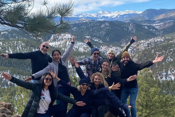
This half‑day guided hike is compact in its numbers — roughly a 5K round trip that fits neatly into a morning or afternoon — but generous in its payoff. The route threads the Front Range, the first uplift of the Rocky Mountains, where granite and sedimentary spines tilt up from the plains. You'll climb steady enough to feel your pulse quicken, stop to learn a few trailcraft basics, and find multiple places to set your camera down and decide which photo deserves a single like.
Geology is one of the hike’s quiet teachers. The Front Range rose during the Laramide orogeny, when tectonic plates folded and thrust older crystalline rocks westward over younger sediments. Underfoot, you'll notice the difference: rounded granite outcrops punctuate stretches of loose shale; talus slopes sit beside lichen‑speckled boulders. Weather in these mountains writes in abrupt edits — a sunlit switchback can become a grey, wind-whipped bench inside minutes. The guide will point out telltale signs of the land’s history and what to watch for when footing gets playful with gravel.
Culturally, these slopes belong to longer stories. Long before Denver became the Mile High City, Indigenous peoples — the Ute and Arapaho among them — followed seasonal rhythms through this landscape. Later, prospectors and rail crews mapped their own routes that now double as modern trails. That sense of layered use makes a short guided hike feel like a condensed primer on human and natural history.
The hike is deliberately beginner‑friendly: short, interpretive, and paced to be inclusive. Still, altitude is a real variable. Denver sits at 5,280 feet; many Front Range trailheads push you another 1,000–2,000 feet higher. Your breath will remind you of the change. The guide’s role is practical and encouraging — pacing, educating on hydration and breathing, and offering compact lessons on leaving no trace. The format — meet in a central café, shuttle to trailhead, walk, return — also makes the logistics frictionless for visitors and locals who want a mountain fix without weeks of planning.
On the trail, nature gets a little theatrical. Wind becomes a director, rerouting bird calls; a creek dares you to come nearer, rushing geometry over rocks; a cluster of aspens quivers as if gossiping about the clouds. You learn to listen, and the staff points out small delights you might otherwise miss: the way a certain lichen clings to the north side of stone, or the light through pine needles that photographs as gold.
Practicalities are built into the offering. The entire experience is roughly four hours — that includes the short downtown meet, drive, education stops on the trail, and time on summits and viewpoints. Expect about 3.1 miles (5 kilometers) round trip with a modest elevation gain typical of Front Range beginner routes (roughly 300–600 feet). The group size keeps the pace social and safe, with photo breaks and basic instruction on hiking technique.
Why book a guided short hike instead of going solo? For one, the guide offers context — flora, fauna, geological quirks — that transforms a walk into a miniature field class. Two, you'll get practical coaching on altitude, cadence, and gear; three, the social aspect is reliable: you meet people who appreciate both the view and the ways to protect it.
If you go, plan smart. Hydrate before you arrive. Wear boots with ankle support and grippy tread — the trail alternates between packed dirt and loose rock. Bring layers: mountain mornings can be cool, and midday sun can quickly scorch. Protect your skin and eyes; UV feels stronger at elevation. And leave room on your camera roll for the unexpected shot: a hawk on a thermal, a break in the clouds that ignites the valley, or a candid group selfie framed by a stand of trees.
This guided hike is an economical, accessible way to sample Colorado’s mountains without committing a full day. It’s ideal for travelers who want field‑guided interpretation and for locals who want a repeatable ritual — the half‑day that still counts as a real escape.
At the end, back in the café where the morning began, coffee tastes like altitude and satisfaction. You’ll walk out with practical new skills, a small stack of photos, and a clearer sense of how the Front Range pieces together — geology to sky, city to slope.
If you’re curious about taking a longer route next time, the guide will point you toward multiday trails, nearby peaks, and seasonal moves (wildflower timing, winter access), so this short loop serves as both a destination and a primer. For the traveler who wants a taste of Rocky Mountain hiking that’s secured, informed, and friendly, these four hours deliver more than their sum: a compact, connective mountain experience.
Trail wisdom
Small choices, better day.
Acclimatize to Elevation
Start hydrating the day before and move slowly on the climb — altitude can sap energy quickly.
Layer Up
Bring a lightweight insulating layer and wind shell — temps can swing dramatically above treeline.
Footwear Matters
Wear sturdy hiking boots with good tread; the terrain alternates between packed dirt and loose rock.
Leave No Trace
Pack out all trash and stick to the established trail to protect fragile alpine plants.
Local knowledge
Read the place, not just the route.
Watch for native species including Mule deer, Golden eagle.
Keep an eye out for wildlife during the transition between areas and habitats. Respect distance guidelines.
Stick to the trail to reduce erosion, pack out all trash, and avoid disturbing wildlife; many Front Range trails are managed for both recreation and habitat protection.
Follow the guide's instructions on size limits, ethical handling, and leave-no-trace practices.
Lookout Mountain (near Golden) for quiet overlooks and historic Buffalo Bill museum nearby. Mount Falcon’s less-visited ruins and stone amphitheater — great for a contemplative detour
Locally recommended viewpoints and quiet spots known best to local operators.
The Front Range was uplifted during the Laramide orogeny; Indigenous peoples including the Ute and Arapaho used these slopes seasonally long before Euro‑American settlement.
Maritime roots and regional tradition shape the waterways and working coasts.
Seasonal guide
Four versions of the same landscape.
Spring
Best forWildflowers · Fewer crowds · Cooler hiking temps
ChallengesSnow patches at higher elevations · Mud on trails
Late spring brings wildflowers and quieter trails, but snow can linger into May on shady sections — microspikes may be needed early in the season.
Summer
Best forWarm weather · Full daylight · Stable trail access
ChallengesAfternoon thunderstorms · Higher UV exposure
Summer is the most accessible time with long days and reliably dry trails, but plan hikes for morning to avoid frequent afternoon storms.
Fall
Best forAspen color · Crisp air · Clear skies
ChallengesRapid temperature changes · Shorter daylight
Fall delivers stunning color and cool hiking weather; bring warm layers as mornings are brisk and afternoons can cool quickly.
Winter
Best forSnowy landscapes · Quiet trails · Snow photography
ChallengesSnow and ice · Cold temps and limited services
Winter transforms the Front Range into a quiet, snowy landscape; winter gear (crampons, warm layers) and experience in short cold hikes are essential.
Operator details
What the booking data adds.
Included
- ✓Granola bars, protein bars, and fruit snacks
- ✓Fun
- ✓Hiking Gear
Not included
- —Please bring at least 1 liter of water
- —Gratuities
Good to know
- ✓Service animals allowed
- ✓Public transportation options are available nearby
- ✓Not recommended for pregnant travelers
- ✓Not recommended for travelers with poor cardiovascular health
- ✓Travelers should have at least a moderate level of physical fitness
Pack with intention
What to bring.
Good to know
Common questions.
The route is about 5 kilometers (roughly 3.1 miles) round trip with a moderate amount of uphill; the full experience including transport and stops generally lasts around four hours.
Plan the edges
The details that make the day easier.
Denver is nicknamed the "Mile High City" because its official elevation is 5,280 feet (exactly one mile above sea level).
Start and end at a downtown Denver café — savor a hearty breakfast burrito or Colorado green‑chile stew post‑hike. Head to LoDo or Union Station afterward for local microbreweries and mountain‑inspired pub fare such as bison burgers or trout. If time allows, visit a neighborhood taproom to compare local IPAs and chat with guides about longer routes.
- Closest airport
- Denver International (DEN); Meeting point: café <1 mile from downtown Denver; Drive to trailhead: ~30–60 minutes from city center depending on traffic; Cell service: generally good near trailheads but patchy on steeper slopes; Permits
- fees
- usually none required for guided Front Range trails but some trailheads charge parking fees.
These Front Range trails are sensitive to erosion and native plants — stay on designated paths, pack out all waste, and avoid trampling fragile alpine vegetation.
Explore by topic
Follow the threads.
Keep exploring
Make the story part of the trip.
Set out from Bass Harbor for a private, customizable day on Blue Hill Bay — lighthouses, puffins, seals, and the chance to feel Acadia from the water. Small groups, local captains, unforgettable views.
In four hours you can move from shaded canyon ferns to wind-scoured coastal ridgelines, guided by someone who knows where the light—and the hidden views—live. This private half-day hike on the Monterey Peninsula or Big Sur is compact, curated, and perfect for travelers who want depth without a multiday commitment.
 Related story
Beneath a sky of shifting light, Skaftafell’s ice reads like a map of time. This three-hour guided glacier hike mixes technical instruction with geology and culture: compact, safe, and unforgettable.