
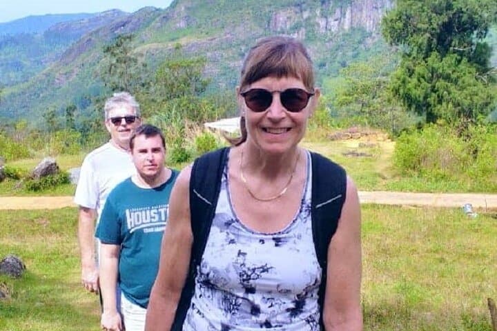
What the day feels like
Dawn eases over Kandy in a slim ribbon of gold, and the hills answer back—mist lifting, tea leaves catching light, tuk-tuks yawning to life. By 6:30 a.m., the road unspools toward the Knuckles, that serrated wall where Sri Lanka’s Central Highlands clench like a fist against the sky. The mountains set the tempo here. Streams murmur a first verse, their currents pushing forward. Ferns open like pages. The ridge, stubborn and sure, dares you to come and see what waits in the folds.
This is a full-day push—roughly 12–18 kilometers depending on the chosen route, and 700–1,200 meters of climbing that comes in long, honest pulls. Trails thread through cloud forest, across spice-scented foothills, and out onto wind-scrubbed edges where the island seems to tilt into the Indian Ocean haze. The pace is not frantic, but steady. The mountain asks for attention, and it gives back in views shaped by time and weather.
The Knuckles Range, spanning about 21,000 hectares, is part of the Central Highlands of Sri Lanka UNESCO World Heritage Site. Though close to Kandy by the map, it’s walled off by river valleys—the Mahaweli to the south and east, Matale to the west—creating a world of its own. Geologically, these are ancient rocks, Precambrian in age, folded and uplifted into a corrugated skyline. The name comes from perspective: look from the right angle and the five main ridges resemble the knuckles of a clenched hand. Up close, the mountains feel alive. The wind carries a peppery bite. Trees gleam with epiphytes. On damp mornings, the forest breathes in visible clouds.
Local life moves with the weather. Villages like Meemure and Loolwatta guard narrow valleys of paddy terraces and home gardens. Cardamom grows in shade-laced plots, and roadside stalls send out the warm scent of roti on griddles. Simple white shrines mark bends; they’re as much a guide as the trail itself. Guides who work these paths know every contour—where leeches gather after heavy rain, which waterfall swells fast, which ridge catches the cleanest breeze at noon.
By mid-morning, the trail steadies into a rhythm of forest tunnel and open shoulder. Birdsong keeps time. In the canopy, you might catch the flick of a Sri Lanka white-eye hopping through leaves or the liquid whistle of a hill myna. Lower down, purple-faced langurs move with a gravity-defying grace, tails like exclamation marks. And while the forest holds its cards close, footprints tell stories—sambar deer, wild boar, the occasional porcupine.
The terrain changes without announcement. One minute, duff underfoot is soft as felt; the next, the tread pitches up slick rock and root ladders. The mountain tests ankles and uses the wind to keep hikers honest. On clear days, the views run wild: waves of green ridges rolling toward tea country, the toothy outline of peaks with names you’ll want to learn. When clouds move in—swift and theatrical—the drama tightens. The ridge becomes a line you feel rather than see, and the forest presses closer, rich with damp-earth scent.
Expect to move for 9–11 hours with breaks, lunch, and the unhurried moments that make this kind of day worthwhile. The classic flow starts at first light, climbs through montane forest to a viewpoint—Mini World’s End near Deanston for a sheer-faced panorama, or the long arc toward Corbett’s Gap—then skirts streams on the descent. If your guide suggests a short detour to a cascade, take it. Cold water snaps the fatigue right out of your legs.
Hydration is strategy, not afterthought. Two to three liters is a good baseline, more if the day runs hot. Filter or treat what you refill from streams. Footwear should be proven—lugs for traction, support for long, uneven hours, and socks that dry fast. In the wet months (roughly October to December, and pockets around April–May), leech socks or a splash of repellent around ankles are a serene insurance policy. Weather swings fast at altitude, so pack a shell and a warm layer even when the valley bakes.
What you won’t pack is hurry. The Knuckles reward those who look. Bark holds whole gardens of moss and lichen. Wild gingers flare red in dim light. A thin waterfall threads a cliff, rings sharp in your ear, then vanishes into the trees. The mountain holds the stage, but the small scenes play the heart notes.
As the day draws long and shadows stretch, the trail eases back toward the road. You’ll feel the calves, maybe a salt crust on your face, and that light hum earned by climbing in steady company with wind and forest. Back near Kandy by early evening, dinner tastes louder. The city’s lamps reflect off the lake and, if you’re lucky, the mountain air still rides with you—cool, thin, and clean.
Planning-wise, this is a guided hike for good reasons: variable microclimates, confusing trail braids, conservation rules, and safety. Cell signal is patchy at best. Permits or entry fees may be required at Forest Department checkpoints depending on the route; a reputable operator handles the paperwork. Start early. Respect village paths and fields. Pack out everything, including orange peels that don’t belong here. Step lightly. The Knuckles are an old story still writing itself, and you’re one careful sentence in it.
Trail wisdom
Small choices, better day.
Start with the sun
Aim to be on trail by 6:30 a.m. to beat heat, capture calm ridgeline views, and build a weather buffer for afternoon squalls.
Mind the monsoons
Expect slick rock, flashier streams, and leeches in Oct–Dec and Apr–May; wear leech socks and keep a dry base layer in a waterproof bag.
Fuel and filter
Carry 2–3 liters of water plus electrolytes; a compact filter lets you safely top up at streams along the route.
Poles save knees
Steep, rooty descents tire legs fast—trekking poles add stability and reduce joint strain over 9–11 hours.
Local knowledge
Read the place, not just the route.
Watch for native species including Purple-faced langur, Sambar deer.
Keep an eye out for wildlife during the transition between areas and habitats. Respect distance guidelines.
Stick to established paths to protect fragile cloud-forest soils and endemic plants. Carry out all trash and avoid soaps or chemicals in streams.
Follow the guide's instructions on size limits, ethical handling, and leave-no-trace practices.
Mini World’s End viewpoint near Deanston for a sheer-drop panorama. Corbett’s Gap, where wind funnels through a dramatic saddle
Locally recommended viewpoints and quiet spots known best to local operators.
The Knuckles Range is part of the Central Highlands of Sri Lanka, inscribed as a UNESCO World Heritage Site in 2010 for exceptional biodiversity and montane forest ecosystems.
Maritime roots and regional tradition shape the waterways and working coasts.
Seasonal guide
Four versions of the same landscape.
Spring
Best forWildflowers and fresh greenery · Cool mornings on the ridges
ChallengesInter-monsoon showers · Leeches in damp forest
March–May brings lush forest and lively streams. Expect quick, heavy showers and carry a light shell and leech protection.
Summer
Best forClearer views on eastern slopes · Drier trails
ChallengesStrong sun exposure · Afternoon wind on open ridges
June–August often runs drier, with bigger horizons and brisk ridge breezes. Start early and manage sun and hydration.
Fall
Best forWaterfalls at their loudest · Moody cloud-forest photography
ChallengesHeavy rains Sep–Nov · Slick rock and swollen streams
Expect dramatic weather and saturated colors. Footing can be treacherous—appropriate footwear and caution are key.
Winter
Best forCoolest hiking temps · Stable weather and long views
ChallengesChilly ridge winds · Crowds on popular lookouts
December–February is prime for crisp mornings and consistent conditions; pack a light insulating layer for exposed sections.
Operator details
What the booking data adds.
Included
- ✓Back up vehicle for emergency transport.
- ✓Hotel pickup and drop-off
- ✓First aid
- ✓Refreshments with energy slabs.
- ✓Support staff - guide, helper(s), driver and qualified first aid officer.
- ✓1000 ml water bottle per person
- ✓Lunch.
Not included
- —Tips and personal expenses
Good to know
- ✓Specialized infant seats are available
- ✓Not recommended for travelers with spinal injuries
- ✓Not recommended for pregnant travelers
- ✓Not recommended for travelers with poor cardiovascular health
- ✓Travelers should have a high level of physical fitness
- ✓Personal effects for warm/windy/rainy conditions should be carried by clients
Pack with intention
What to bring.
Good to know
Common questions.
Most guided routes cover 12–18 km round-trip with 700–1,200 m of elevation gain, depending on the exact trail and viewpoints chosen.
Plan the edges
The details that make the day easier.
The Knuckles Range earned its name because its five main ridges resemble the knuckles of a clenched fist when viewed from certain angles; it forms part of Sri Lanka’s Central Highlands UNESCO World Heritage Site (inscribed 2010).
After the trek, head to Kandy for hot hoppers with dhal and a lime-salty ginger beer near Kandy Lake. Try buffalo curd with kithul treacle at a wayside shop on the Hunnasgiriya road. If time allows, stroll the evening flower stalls by the Temple of the Tooth for a gentle re-entry into town life.
- Closest airport
- Bandaranaike International (CMB), ~3.5–4.5 hours to Kandy by road. Typical trailheads near Deanston
- Hunnasgiriya are 1.5–2.5 hours from Kandy. Cell service
- intermittent to none on ridges and in deep valleys. Permits: Forest Department entry
You’re walking inside a sensitive montane ecosystem. Pack out all waste, use refillable bottles, stay on established trails to protect endemic plants, and avoid soaps in waterways. Respect village lands and minimize noise around wildlife.
Explore by topic
Follow the threads.
Keep exploring
Make the story part of the trip.
 Related story
Less than two hours from Nairobi, Kereita Forest pairs hands-on canopy adventure with quiet montane trails and a sobering colonial history—perfect for families, teams, and curious travelers seeking a full-day pulse of nature.
Set out from Bass Harbor for a private, customizable day on Blue Hill Bay — lighthouses, puffins, seals, and the chance to feel Acadia from the water. Small groups, local captains, unforgettable views.
In four hours you can move from shaded canyon ferns to wind-scoured coastal ridgelines, guided by someone who knows where the light—and the hidden views—live. This private half-day hike on the Monterey Peninsula or Big Sur is compact, curated, and perfect for travelers who want depth without a multiday commitment.