
What the day feels like
Day one begins with the kind of humidity that clings to your shirt and your attention. A battered four-wheel drive drops you at a dirt lane, and the finca—whitewashed, verandah-rimmed, a scattering of coffee plants and papaya trees—waits like an invitation. Your guides, a Colombian landowner with roots in these slopes and a bilingual Canadian who knows the trail languages of comfort and safety, hand you a thick mug of coffee. The smell is immediate: roasted, tangy, the sort of fuel a jungle will ask for.
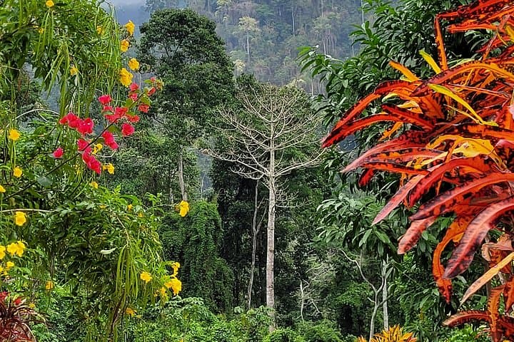
From there the forest takes over. The trail climbs, narrows, and broadens in turns; the Sierra Nevada de Santa Marta rises in stages from Caribbean coast to a summit that scrapes glaciers. Here you feel that vertical leap in miniature: every ridge reveals another tier of green, and the ocean shows itself on the horizon like an afterthought. Rivers push at the path with confident currents, daring you to splash a little and keep going. Butterflies, impossibly ornate, mark the air like punctuation, and the guides point out birds with quick fingers and softer Portuguese-like names.
This is not a manicured national-park experience. It is working farmland, village pathways, and wild jungle threaded together. The route moves through coffee and cacao plots, shaded lanes planted by families whose farms—fincas—provide both sustenance and welcome. On day three you'll cross rivers and find a waterfall whose pool is mercifully cool; on another morning you'll step into an indigenous settlement and feel local rhythms reassert what the land has always known: this is home.
Geology here has theater. The Sierra Nevada is the world's highest coastal range, lifting from sea level to nearly 5,800 meters over a short distance. That tectonic drama has created steep valleys and clear streams, a concentration of habitats that supports species you won’t easily see elsewhere. Culturally, you move in a landscape that indigenous groups have managed for millennia; the Arhuaco, Kogi, Wiwa, and Kankuamo people still hold deep ties to the mountains and their resources. The finca tour frames your daily miles with conversations about land stewardship, coffee processing techniques, and local agricultural cycles.
Practicalities are straightforward but not trivial. This is a six-day, moderate-to-challenging trek. Expect four to seven hours of walking on most days, with uneven jungle trails, occasional river crossings, and daily elevation changes that can feel significant at the end of a day. You will sleep in simple finca accommodations and basic overnight camps; some nights include hammocks, others a shared dorm setup. One day offers an optional beach trip on the Caribbean for salt and recovery after jungle humidity.
Why go? Because it fuses a real Colombian rural experience with sustained outdoor time. You are not simply hiking to a viewpoint and returning the same day. You move through working landscapes, learn from people who live here, sit by fires that roast cacao, and swim in jungle pools that are naturally chlorinated by the mountain. It’s immersive in the literal sense: sights, smells, and local lives are part of the route.
For planning: start early in the jungle heat, hydrate aggressively, and trust the guides’ rhythm. The finca owners have negotiated access to trails and village visits, so the tour supports local economies directly. Medical help is reachable from Santa Marta but not immediate in the field—bring a small personal first-aid kit and any prescription meds. Cash is handy for tips and small purchases in villages; ATMs are in the larger towns only.
This trip suits hikers who want more than a postcard photo. It favors curiosity over speed, conversation over solo endurance. If you like birdwatching, waterfall swims, and conversations about seedlings and soil as much as you like climbing, you will come away satisfied. And if you want to end your week barefoot on a Caribbean beach with salt drying on your legs, that option is waiting—another reminder that this corner of Colombia stacks the wild and the civilized in close quarters.
The finca adventure is both connective and practical: it asks you to be present, to move at the land's own tempo, and to come prepared. The reward is proportional to the effort—long days that shrink in memory to vivid scenes: a storm over the ridgeline, a guide handing you a plate of plantain, the hush of a village that knows you will leave and remembers you by the coffee beans you helped sort.
If you go, do it with curiosity and respect. Learn one new plant name, ask where the water is safest to swim, and leave lighter than you arrived. The Sierra Nevada will keep your footprints in perspective and give you a week that is as much a cultural exchange as it is an outdoor challenge.
Trail wisdom
Small choices, better day.
Start early each day
Morning starts avoid mid-day heat and increase wildlife sightings; be on the trail by first light when possible.
Bring water treatment
Filtered water or tablets make river refills safe and save weight from carrying all your water at once.
Wear grippy, broken-in boots
Trails are often muddy and rocky; ankle support and traction reduce slips and blisters.
Respect village customs
Ask before photographing people and follow your guide's lead when visiting indigenous settlements.
Local knowledge
Read the place, not just the route.
Watch for native species including Toucans, Colorful butterfly species including Blue Morphos.
Keep an eye out for wildlife during the transition between areas and habitats. Respect distance guidelines.
Tours support local landowners and community guides—stick to trails, avoid single-use plastics, and follow guides' instructions to minimize impact.
Follow the guide's instructions on size limits, ethical handling, and leave-no-trace practices.
A midday waterfall pool on day three that locals use for cooling off. Small coffee-processing demonstrations at participating fincas
Locally recommended viewpoints and quiet spots known best to local operators.
The Sierra Nevada has long been home to indigenous groups such as the Arhuaco and Kogi, who maintain cultural practices tied to mountain stewardship.
Maritime roots and regional tradition shape the waterways and working coasts.
Seasonal guide
Four versions of the same landscape.
Spring
Best forBirdwatching · Waterfall flow · Fewer crowds
ChallengesIntermittent rain showers · Slippery trails
Spring brings frequent afternoon rains that swell waterfalls but make some trails muddy; mornings are usually clear and productive for wildlife.
Summer
Best forDry trail conditions · Beach option · Longer daylight
ChallengesHeat and humidity · Possible afternoon storms in some years
Summer often overlaps the region's drier windows, offering more stable hiking days and a better chance for the optional beach day.
Fall
Best forLush vegetation · Butterfly activity · Quieter trails
ChallengesBimodal rains can return · River crossings higher after storms
Autumn keeps the jungle green and lively but can bring increased rain during peak wet months; prepare for wet gear.
Winter
Best forClear mountain views · Dry trails in early winter · Comfortable nights
ChallengesCooler nights at elevation · Possible rain in late winter months
Early winter months often have clearer skies and stable hiking, but pack a warm layer for cooler high-elevation evenings.
Operator details
What the booking data adds.
Included
- ✓Lunch
- ✓Dinner
- ✓Breakfast
Not included
- —Alcoholic beverages
Good to know
- ✓Service animals allowed
- ✓Public transportation options are available nearby
- ✓Not recommended for travelers with spinal injuries
- ✓Not recommended for pregnant travelers
- ✓Not recommended for travelers with poor cardiovascular health
- ✓Travelers should have a high level of physical fitness
Pack with intention
What to bring.
Good to know
Common questions.
You should be comfortable hiking multi-hour days on uneven terrain; regular cardio and several long training hikes beforehand are recommended.
Plan the edges
The details that make the day easier.
The Sierra Nevada de Santa Marta is the highest coastal mountain range in the world, rising from sea level to nearly 5,800 meters within a short distance.
After a day on the trail, head to a small eatery in Minca or Santa Marta for fresh seafood, arepas, and locally roasted coffee; many fincas will serve cacao-based drinks and freshly prepared meals—accepting these invitations supports local families and deepens the cultural exchange.
- Closest airport
- Simón Bolívar International Airport (Santa Marta, SMR). Typical drive to finca
- mountain trailhead
- 45–90 minutes from Santa Marta, depending on road and finca location. Cell service: intermittent to none on trail. Permits: No public permits required; tour includes private-access permissions.
This tour runs on private finca access and local guides—pack out trash, avoid single-use plastics, and follow local guidelines to protect waterways and agricultural plots.
Explore by topic
Follow the threads.
Keep exploring
Make the story part of the trip.
In four hours you can move from shaded canyon ferns to wind-scoured coastal ridgelines, guided by someone who knows where the light—and the hidden views—live. This private half-day hike on the Monterey Peninsula or Big Sur is compact, curated, and perfect for travelers who want depth without a multiday commitment.
 Related story
Beneath a sky of shifting light, Skaftafell’s ice reads like a map of time. This three-hour guided glacier hike mixes technical instruction with geology and culture: compact, safe, and unforgettable.
 Related story
Lose the city for a few hours without leaving it: this 5-mile, 900-foot-gain Forest Park loop threads old-growth pockets, city viewpoints, and cultural landmarks for a compact taste of Portland’s wild side. Expect moss, roots, and stories.