
What the day feels like
Morning comes slow in Sri Lanka’s southwest, and the rainforest likes it that way. The canopy lifts its eyelids one leaf at a time, cicadas warm their engines, and mist pads silently across the Hiyare hills as if it were taking attendance. Eighteen kilometers inland from Unawatuna’s surf, a narrow footpath slips between cinnamon shrubs and rubber trees, the soil red and tacky underfoot. It’s here that the Hiking Day Tour begins—part village walk, part jungle ramble, and a steady conversation with water that ends in a plunge beneath a local-loved waterfall few outsiders ever see.
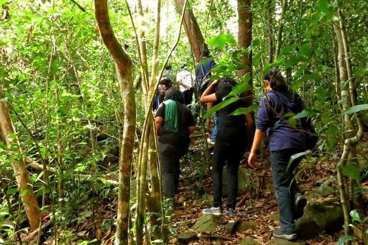
The trail wastes no time reminding you who’s in charge. Roots grope for your ankles. Vines lean in for a closer look. The air turns warm and damp, a living thing that presses forward, urging you to match its rhythm. You pass home gardens stitched with pepper vines, little plots of bananas, and the familiar gloss of cinnamon leaves—the spice that lured empires and still perfumes kitchens across the island. A few dogs nap in the shade. Somewhere ahead, a myna calls the hour.
The path climbs in short, punchy intervals, then settles into gentle traverses along the contour of the hill. Underfoot, laterite soil stains your boots and the odd slick rock demands a careful step. You’ll cross trickles that grow into creeks, hop stones that carry the cool of the morning, and slip through fern-dark sections where sunlight breaks into spears and the forest plays cards with its own shadows. A kingfisher needles the air. A purple-faced langur watches like a stern uncle from a high branch and then vanishes, satisfied you mean no harm.
Hiyare Reservoir sits not far away, a century-old water supply for Galle built by British engineers in the early 1900s. That bit of history is a good reminder: the green that surrounds you is not parkland in the Western sense but a mosaic of conservation areas, village lands, and smallholdings that overlap and interlock. It’s living forest—a place where people collect cinnamon, tap rubber, and carry stories as readily as baskets. The trails exist because feet have used them for years.
Geologically, these folds of the lowland wet zone are granite at heart, their surfaces weathered into rounded shoulders that shrug off rain and grow a felt of moss. When the southwest monsoon drapes itself over the coast (May through September), every groove becomes a runnel and every runnel becomes a song. The waterfall, your three-hour goal, owes its shape to this relentless sculpting—water testing the rock’s defenses, season after season, until it found its voice.
You reach it with a small scramble, your palms on cool rock, your pulse tracking the volume of the cascade. The forest opens, and there it is: a clear chute dropping into a tea-colored pool ringed by boulders. The fall doesn’t thunder; it talks firmly, daring you toward its mist. Slip into the water and it bites first, then loosens its grip, then welcomes you like a friend who never asks where you’ve been. Dragonflies helicopter, curious and territorial. The current shoulders you gently, reminding you to stay where the eddies soften.
This is not a trail of grand vistas or switchbacks cut to perfect grade. It’s intimate, humid, and endlessly alive. It rewards patience, a steady pace, and a willingness to listen—to guides who know where the leeches wait in ambush, to the forest’s hints about weather, to local etiquette that keeps hikers and villagers in good standing. Expect mud, because mud is the rainforest’s signature. Expect to get your shoes dirty, and feel good about it.
Practicalities keep this day grounded. The route typically runs six to seven hours round-trip, with the waterfall as the midpoint rest and swim. Elevation gains come in friendly spurts—enough to raise your heart rate without turning the walk into a slog. The heat and humidity add the true challenge, especially from late morning onward. Two liters of water and electrolytes are smart; three liters if you tend to sweat heavily. Lightweight, grippy footwear saves ankles on wet roots. Long, breathable layers and leech socks help you make friends with the undergrowth. Pack a small towel and a dry shirt for lunch; you’ll thank yourself on the hike out.
Culturally, don’t rush the edges of this experience. A stop for a sweet black tea near the village, a word with someone tending cinnamon peels on a mat, a glance at the reservoir’s glassy face if your guide diverts that way—these are the stitches that hold the day together. Guides often share how community forestry and conservation groups in Galle district work to protect corridors of habitat around Hiyare and Sinharaja. You’ll see why it matters when a trogon ghosts across the path or a cascade of butterflies tilts like confetti in a patch of sun.
On the return, the forest loosens its grip. Afternoon wind brushes the canopy and the light goes soft, a photographer’s friend. The trail you learned on the way in becomes comfortable muscle memory, and the surprises move from hazards to delights: a spice-scented breeze, a gecko slaloming up bark, a glimpse through palms toward terraced greens. By the time the path widens back into the village lane, bare feet have outpaced you, a rooster has declared victory over nothing in particular, and the day has emptied you just enough to feel light.
Who’s it for? Hikers who like tactile, sensory trails and don’t mind mud. Travelers who value access to a genuine corner of Sri Lanka without the crush of a crowd. Anyone curious about how water, rock, and people strike a balance in the wet zone. It’s adventure laced with pragmatism—a rainforest that takes your measure but sends you home with a grin and a story that smells faintly of cinnamon.
Plan to start early, travel light, and move with respect. The forest is an elder here; it sets the tempo, and it remembers every footstep. Keep yours careful, and it will invite you back.
Trail wisdom
Small choices, better day.
Start Early, Beat the Heat
Aim to hit the trail by 7–8 a.m. to make the most of cooler temps and calmer forest activity.
Leech Defense
Wear leech socks or snug, high socks and carry a small salt packet; leeches are common in wet sections year-round.
Grip Matters
Muddy roots and wet rock are standard—trail shoes with sticky soles make the day safer and more enjoyable.
Swim Smart
At the waterfall, stay within the calm eddies and avoid the direct base of the fall where currents can be deceptively strong.
Local knowledge
Read the place, not just the route.
Watch for native species including Purple-faced langur, Common kingfisher.
Keep an eye out for wildlife during the transition between areas and habitats. Respect distance guidelines.
Local groups support habitat corridors and research around Hiyare. Stay on established paths, pack out all waste, and avoid soaps or detergents in stream and waterfall areas.
Follow the guide's instructions on size limits, ethical handling, and leave-no-trace practices.
Hiyare Reservoir Conservation Centre lookout, often quiet and birdy in early mornings. A tiny village tea stall near the trailhead—perfect for a post-hike sweet black tea
Locally recommended viewpoints and quiet spots known best to local operators.
Hiyare Reservoir was constructed in the early 20th century to supply water to Galle, and the surrounding lowland rainforest reflects a mosaic of village lands, spice plots, and conserved habitat.
Maritime roots and regional tradition shape the waterways and working coasts.
Seasonal guide
Four versions of the same landscape.
Spring
Best forWildflowers and butterflies · Cooler early mornings
ChallengesIntermittent thunderstorms · Leeches active after rain
March–May brings warm, humid days with pop-up storms. Trails are lush, with lively insect and bird activity.
Summer
Best forFull, photogenic waterfalls · Birding under dense canopy
ChallengesSouthwest monsoon rains · Slippery, muddy footing
June–August is the wettest stretch on the southwest coast. Expect frequent showers and saturated trails with rewarding flows at the falls.
Fall
Best forPhotography in softer light · Quieter trails
ChallengesStormy inter-monsoon bursts · High humidity
September–November sees variable weather—sunbreaks mixed with sudden squalls. Carry rain layers and protect electronics.
Winter
Best forDrier skies · Comfortable hiking temps
ChallengesOccasional showers · Midday heat still builds
December–February is generally the driest, most stable time on the southwest, with clearer mornings and manageable mud.
Operator details
What the booking data adds.
Included
- ✓Pick up and drop off will be provided from most closely located hotels in Galle and Unawatuna.
- ✓Well experienced English speaking local guide.
- ✓All government taxes.
- ✓Local lunch.
- ✓Local Traditional snacks and Refreshments.
- ✓Hotel pick up and drop off will be provided from a TUK TUK or a car.
Not included
- —Gratuities.
- —Anything that not mentioned in inclusions.
Good to know
- ✓Infants are required to sit on an adult’s lap
- ✓Not recommended for travelers with spinal injuries
- ✓Not recommended for pregnant travelers
- ✓Not recommended for travelers with poor cardiovascular health
- ✓Travelers should have at least a moderate level of physical fitness
- ✓Please be ready at the hotel lobby 15 minutes before the pick up time.
- ✓Please wear comfortable clothing for the hiking.
- ✓The liberal use of sunscreen is also highly encouraged.
- ✓Don’t forget to bring your personal medicine and camera.
Pack with intention
What to bring.
Good to know
Common questions.
Plan for 6–7 hours round-trip with moderate difficulty—expect humid conditions, muddy sections, and some short, steep pitches.
Plan the edges
The details that make the day easier.
Sri Lanka’s southwest wet zone hosts one of the highest rates of amphibian endemism in Asia, with over 80% of amphibian species found nowhere else.
Back in Galle, refuel with a crab curry and pol sambol at a family-run kade, then find a lime soda on Pedlar Street inside Galle Fort. If you’ve got room, hunt down fresh hoppers with a runny egg for a simple, perfect finish to a rainforest day.
- Closest airport
- Bandaranaike International (CMB). Trailhead: ~18 km inland from Unawatuna. Drive time: Galle to trailhead ~45–60 minutes, Colombo to Galle 2–2.5 hours via expressway. Cell service: Spotty under canopy. Permits: None typically required for guided day hikes; bring cash for local stops.
This rainforest sits within community-managed landscapes—walk single-file on established paths, avoid chemical repellents in the water, and support local guides who help keep access respectful and sustainable.
Explore by topic
Follow the threads.
Keep exploring
Make the story part of the trip.
 Related story
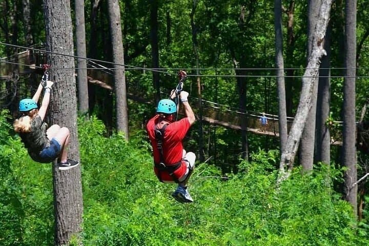
Less than two hours from Nairobi, Kereita Forest pairs hands-on canopy adventure with quiet montane trails and a sobering colonial history—perfect for families, teams, and curious travelers seeking a full-day pulse of nature.
Set out from Bass Harbor for a private, customizable day on Blue Hill Bay — lighthouses, puffins, seals, and the chance to feel Acadia from the water. Small groups, local captains, unforgettable views.
In four hours you can move from shaded canyon ferns to wind-scoured coastal ridgelines, guided by someone who knows where the light—and the hidden views—live. This private half-day hike on the Monterey Peninsula or Big Sur is compact, curated, and perfect for travelers who want depth without a multiday commitment.