
What the day feels like
By the time the bus peels away from Colombo’s humid bustle, the coastline recedes and a softer Sri Lanka appears: paddy fields unfolding like patchwork, small temples catching the late light, and a steady rise toward the island’s central spine. On day one you stand beneath Sigiriya’s sheer pink face, a monolith that dared kings to carve a palace into its peak five centuries ago; by day three you’re sloshing through teak-shadowed rapids at Kitulgala, and by the final night you dampen to the smell of campfire and mountain mist at the Knuckles Range. This is not a sightseeing blitz—it’s a measured, physical traverse of the island’s geological and cultural spine, where camping, trekking, and a short stretch of whitewater stitch the story together.
The itinerary reads like a cross-section of Sri Lanka’s highlight reel. Sigiriya Rock Fortress forces a particular kind of awe: an engineered summit garden, frescoed galleries, and terraces that still map the ambitions of King Kasyapa (5th century AD). The climb itself is short but vertical; iron staircases and carved steps replace the need for mountaineering skill. Kandy’s bowl of hills follows, a city of tea-tinged air and the sacred Temple of the Tooth—an intimate stop for anyone interested in the island’s living Buddhist traditions. The Knuckles Range, a compact but rugged arc of peaks and plateaux, offers the trip’s core trekking: moor-like grasslands at Pitawala Pathana, the narrow drop of Small World’s End, and shaded cloud-forest corridors that harbor endemic birds and orchids. Kitulgala supplies contrast—fast water, splash, and the chance to watch kingfishers and river otters from a rubber raft.
Geology and history are constant companions. Sigiriya is precast in ancient hydraulics and basalt bedrock; the Knuckles began as uplifted Precambrian rock folded into a maze of valleys and escarpments that trap the rain and feed crystalline rivers. Tea terraces in Kandy’s satellite estates explain a colonial-era economy that still colors the island’s cultural identity: the rhythmic plucking of leaves persists, and roadside sellers offer a quick cup that tastes of altitude and sun. Local communities—Tamil and Sinhalese neighbors—have traded rice, spices, and stories here for generations; guides you’ll meet are often second- or third-generation porters and naturalists who see the landscape as both livelihood and inheritance.
On the practical side, expect active days. Treks in the Knuckles vary between 6 and 12 kilometers with intermittent ascents totaling 300–800 meters of elevation gain on the harder segments; paths switch from stamped earth to loose rock and damp roots, so a sturdy tread and a measured pace matter more than speed. Rafting on the Kelani River at Kitulgala typically runs Class II–III rapids—splashy and fun, not technical—making it approachable for fit beginners after a short safety briefing. Nights are a study in contrasts: lodge comfort in Kandy gives way to small, nature-friendly camps in the Knuckles where the sky is a map of constellations and the river’s voice lulls you to sleep.
Timing is everything. The tour runs year-round, but the clearest windows for mixed-terrain travel—sharp trails, manageable rivers, and drier campgrounds—are the island’s drier months (roughly December through March). The mornings are best for trekking and photography, both for light and for avoiding the heat and humidity that builds by midday. Carry water and a lightweight filtration option; local water supplies can vary, and dehydration is the most common preventable challenge on a multi-day loop like this.
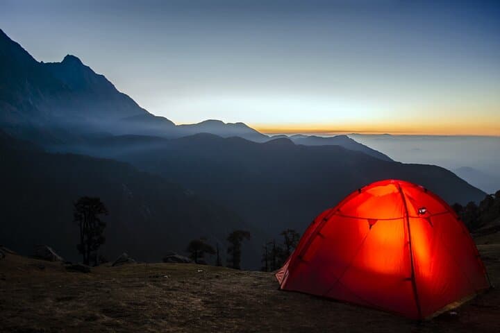
Gear and preparation skew pragmatic. Pack breathable layers for the hills, a rain shell just in case, quick-dry clothing for rafting, and a pair of trail shoes with predictable grip. If you’re prone to ankle trouble, bring ankle-supporting boots; otherwise, a confident pair of hikers is sufficient. Expect guided camping with simple but comfortable tents and communal meals—barbecue under the stars is part of the ritual here, but so is an early turn-in when mosquitoes and mountain cold demand it.
Culture and conservation thread through the trip. Guides will point out endemic species—purple-faced langurs and Sri Lanka spurfowl among them—and explain how community-led conservation has helped protect watershed areas in the Knuckles. You’ll pass small tea factories where leftover leaf is composted rather than burned, and rivers where guides insist on pack-in/pack-out ethics. These are small gestures with big local impact: preserving trails, protecting bird habitats, and supporting village economies that welcome travelers.
Why do this trip? It’s compact but generous: a single route that samples rock fortress history, colonial-era tea country, cloud-forest biodiversity, and playful river rapids. For travelers who want to move—hike, paddle, eat simple food, sleep under a tent—and emerge with a layered sense of place rather than a checklist of photos, this is smartly pitched. It’s not the island’s only journey, but it’s the one that connects Sri Lanka’s many selves—the ancient and the wild, the cultivated and the communal—into a week that feels both active and restorative.
Practical last word: be ready for heat, sudden rain, and unpaved roads; respect temple rules (modest dress and shoes off inside sanctuaries); tip guides and drivers in local currency; and bring curiosity. The landscape here will test your lungs and reward your attention. Rivers will dare you to paddle harder, peaks will invite you to pause, and the night sky will insist you listen to what the island has to say.
Trail wisdom
Small choices, better day.
Start early for the best light
Begin treks at dawn to avoid midday heat and catch dramatic morning light on Sigiriya and the Knuckles ridges.
Bring a water filter or purification tablets
Tap water availability varies; filtering reduces single-use plastic and keeps you hydrated safely on trail.
Wear good-grip trail shoes
Knuckles trails move between slick roots and loose scree—ankle support and tread matter more than style.
Follow local temple etiquette
Modest dress and removing shoes are standard at Kandy’s religious sites—keep a scarf or wrap handy.
Local knowledge
Read the place, not just the route.
Watch for native species including Purple-faced langur, Sri Lanka white-eye and various kingfishers.
Keep an eye out for wildlife during the transition between areas and habitats. Respect distance guidelines.
Community-driven conservation in the Knuckles supports watershed protection and eco-guiding; visitors are encouraged to stick to trails and avoid single-use plastics.
Follow the guide's instructions on size limits, ethical handling, and leave-no-trace practices.
Hike at Pitawala Pathana’s lesser-used loops for a lunch spot with panoramic grassland views. A morning birdwatching walk along the Thelgamu Oya upstream of the main rafting points
Locally recommended viewpoints and quiet spots known best to local operators.
Sigiriya was established in the 5th century AD as a fortified royal complex by King Kasyapa and remains one of Sri Lanka’s most important archaeological sites.
Maritime roots and regional tradition shape the waterways and working coasts.
Seasonal guide
Four versions of the same landscape.
Spring
Best forLush greenery in the Knuckles · Fewer crowds at cultural sites
ChallengesUnpredictable showers · Damp trail sections
Spring (March–May) brings fresh growth and dramatic cloud cover—expect soft trails and occasional rain bursts that sharpen the landscape.
Summer
Best forWarm river conditions for rafting · Vibrant lowland birdlife
ChallengesHigher humidity · Afternoon storms in some areas
Summer favors water activities—river levels are dependable for rafting—but heat and humidity rise, so pace yourself.
Fall
Best forClear mountain views · Comfortable trekking temperatures
ChallengesIntermittent rains in elevated patches · Variable road conditions
Fall offers crisp mornings and clearer vistas, making ridge walks in the Knuckles especially rewarding.
Winter
Best forDry trails and stable weather · Peak visibility for photography
ChallengesCooler nights in the hills · Higher demand from tourists
Winter (December–March) is the most reliable period for mixed-terrain travel—drier trails and pleasant days, though camps get chilly overnight.
Operator details
What the booking data adds.
Included
- ✓Transportation in a Comfortable A/C Vehicle
- ✓Accommodation at 3* Hotels and Campsites
- ✓Dinner
- ✓Breakfast
- ✓All Government Tax & Charges
- ✓Experience English Speaking Guide
- ✓Mineral Water Bottle
Not included
- —Entrance Fees
- —Any Other Tour or Service Not Mentioned Above
Good to know
- ✓Not recommended for travelers with spinal injuries
- ✓Not recommended for pregnant travelers
- ✓Not recommended for travelers with poor cardiovascular health
- ✓Travelers should have a high level of physical fitness
Pack with intention
What to bring.
Good to know
Common questions.
Expect active days with walks of 6–12 km and intermittent elevation; a moderate to good fitness level makes the trip more enjoyable.
Plan the edges
The details that make the day easier.
Sigiriya’s rock fortress features remarkably advanced 5th-century hydraulic gardens, including fountains that still function in high season, reflecting sophisticated ancient engineering.
After a day on the trail, head to Kandy for a cup of highland tea at a small factory or try kottu roti from a local stall; finish an active day with a cold Lion beer and a simple seafood curry in Negombo if your route returns via the coast.
- Closest airport
- Bandaranaike International Airport (CMB); Typical starting point: Colombo (approx. 3–4 hour drive to Sigiriya); Driving distances: Colombo–Sigiriya ~170 km; Cell service: Patchy in Knuckles, good in cities; Permits: Entry fee for Sigiriya Rock and local park fees may apply
Support local guides and village-run campsites, avoid single-use plastics, and respect temple and wildlife regulations to minimize footprint on fragile watershed and cultural sites.
Explore by topic
Follow the threads.
Keep exploring
Make the story part of the trip.
In four hours you can move from shaded canyon ferns to wind-scoured coastal ridgelines, guided by someone who knows where the light—and the hidden views—live. This private half-day hike on the Monterey Peninsula or Big Sur is compact, curated, and perfect for travelers who want depth without a multiday commitment.
 Related story
Beneath a sky of shifting light, Skaftafell’s ice reads like a map of time. This three-hour guided glacier hike mixes technical instruction with geology and culture: compact, safe, and unforgettable.
 Related story
Lose the city for a few hours without leaving it: this 5-mile, 900-foot-gain Forest Park loop threads old-growth pockets, city viewpoints, and cultural landmarks for a compact taste of Portland’s wild side. Expect moss, roots, and stories.