
What the day feels like
The gangway drops and the humid air feels like a welcome. Belize’s coastline melts behind you as a van eases away from the port; palms and low limestone ridges stitch the horizon. By the time the road narrows into village lane, the pace has changed from cruise-ship schedule to something older: the hand-cranked ferry that shuttles cars and passengers across the Mopan River, a small ritual you won't find on any map of big-city travel. On the far bank, a low plaza opens beneath a stand of ceiba trees and the stones of Xunantunich rise in silhouette — a skyline that belonged to another era but still feels insistently present.
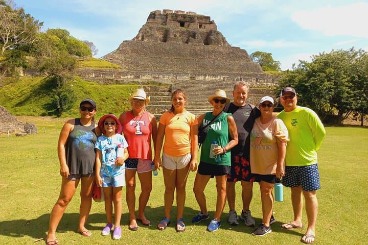
Xunantunich is the sort of place where time behaves differently. The site was a major Maya center during the Late Classic period (roughly A.D. 600–900), a hub of politics and ritual where carved stelae and stucco friezes once narrated dynastic power. Today, El Castillo — the site's dominant pyramid — imposes itself across the plaza, a 130-foot-high stack of limestone steps and terraces topped by a weathered frieze. Climbing it feels like ascending a city’s memory: each step is compacted with centuries of foot traffic, modern and ancient.
Geologically, the Cayo District is a karst landscape—limestone bedrock riddled with caves, sinkholes and subterranean waterways. That limestone is what the Maya quarried and sculpted into plazas and temples; it’s also what gives the trails a particular texture underfoot and the air a certain density during the rainy season. The Mopan River through San Jose Succotz, which acts as both border and lifeline, still moves with the same patient force it always has, daring visitors to slow down and notice the details: the way light lances through tree canopy, the nervous twitch of a lizard on a low wall, the chatter of a guide translating glyphs into local legend.
Culture here is layered. The modern village of San Jose Succotz, on the riverbank just below the site, hosts mestizo and Maya families whose lives are entwined with tourism, farming and cross-border trade with Guatemala. Guides are frequently locals who grew up studying the stones underfoot. They bring the site alive not only with archaeological facts — the significance of the ball court, the political reach of Xunantunich in the Classic era — but with folklore: the story of the “stone woman” that gives the site its name in Kekchi Maya as much as the dry cataloguing of dates and restoration projects.
A private shore excursion to Xunantunich is compact in ambition but generous in experience. The drive from Belize City or a nearby cruise port is roughly 1.5–2 hours depending on traffic and the ferry queue, making this a doable half-day trip that still leaves room in a shore itinerary for a market stop or a quick riverside lunch. At the site, the loop through plazas, the ball court, and small museum covers about 1–2 miles of walking on packed earth and stone; the only real climb is El Castillo itself, where metal handrails and worn stone steps reward the ascent with a panorama that stretches into Guatemala and across Belizean farmland.
Practicalities are straightforward. Wear closed, comfortable shoes — the steps are uneven and can be slick in rain — and plan for sun. Belize’s sun is blunt. A brimmed hat and sunscreen are essential. Carry at least one liter of water per person for the visit, more if you’re prone to heat fatigue. Guides typically include an entrance fee to the archaeological reserve in a private tour, and because this is a private experience the pace is yours: linger at a frieze, ask for a guided reading of the stelae, or duck into town to sample a traveler’s lunch from the market.
Sustainability is a live concern here. Preservation is ongoing: much of what you see has been restored carefully by the Belize Institute of Archaeology with community cooperation. Visitors should stay on designated paths, refrain from touching fragile carvings, and consider buying crafts from local artisans to support the village economy. Small gestures — packing out trash, not feeding wildlife, following your guide’s route — collectively matter to places that balance tourism and tradition.
For travelers, Xunantunich is appealing precisely because it lands between things: it's an accessible archaeology experience for families and casual tourists but it still rewards people with a curiosity for stonework, political history and the sensual pleasures of tropical light. It's a site that reads well from below, on a careful rooftop climb, and in conversation with a guide who points out an ancient plaster fragment or explains how causeways once linked this center to the countryside. For those arriving on a private shore excursion, the trip marries convenience with intimacy: the guide tailors the visit; the ferry crossing and the village visits offer texture; and the climb to El Castillo gives you a literal and figurative vantage point on Belize’s layered history.
If your itinerary allows, combine Xunantunich with a visit to nearby Cahal Pech or a stop at the bustling San Ignacio Market. The latter is a useful place to decompress afterward — to sit under a tin awning with a plate of stewed beans, tortillas and a Belikin beer, and let the present-day rhythms of Cayo reassert themselves after an hour spent in conversation with the past. On a private excursion, everything is calibrated to your time and interest: the thrill isn't simply in seeing stone, but in being allowed to touch place in a way that respects both its age and its people.
Trail wisdom
Small choices, better day.
Bring a refillable water bottle
Carry at least 1 liter for the visit; water stations are limited and the sun is strong.
Wear closed, grippy shoes
Stone steps and packed-earth trails can be uneven and slippery after rain.
Protect against sun and insects
A wide-brim hat, sunscreen and insect repellent make plaza time more comfortable.
Carry small local cash
Small Belize dollars or USD are handy for market buys, tips and ferry tokens.
Local knowledge
Read the place, not just the route.
Watch for native species including Howler monkeys, Toucans and motmots.
Keep an eye out for wildlife during the transition between areas and habitats. Respect distance guidelines.
Site conservation is overseen by Belizean authorities with community partnerships; staying on trails and supporting local artisans helps preserve both ruins and livelihoods.
Follow the guide's instructions on size limits, ethical handling, and leave-no-trace practices.
Hand-cranked ferry crossing at San Jose Succotz — a brief, authentic pause between road and ruin. San Ignacio Market stalls — a place to taste local staples like stewed beans, cassava tortillas and fresh fruit
Locally recommended viewpoints and quiet spots known best to local operators.
Xunantunich was a major Late Classic Maya center (circa A.D. 600–900) whose architectural peaks reflect political power in the western Maya lowlands.
Maritime roots and regional tradition shape the waterways and working coasts.
Seasonal guide
Four versions of the same landscape.
Spring
Best fordrier trails · fewer storms · clearer rooftop views
Challengesheat from March–May · intense sun mid-day
Spring (March–May) is hot and mostly dry—good for clear views but pack sun protection and water.
Summer
Best forlusher jungle scenery · fewer crowds on some days
Challengesafternoon showers · higher humidity · hurricane season risk
Summer brings greener surroundings but expect quick, heavy rains and humidity—plan around storms.
Fall
Best forlower shoulder-season crowds · market produce
Challengesresidual rainy days · possible hurricane impacts early fall
Fall can offer quieter mornings and good light for photos, but keep an eye on weather forecasts.
Winter
Best forcooler temperatures · dry trails · crisp air for photos
Challengespopular cruise season (crowds) · cooler mornings
Winter (Nov–Feb) is dry and comfortable—ideal for climbing El Castillo, though it’s the busiest time for shore excursions.
Operator details
What the booking data adds.
Included
- ✓Transportation, entrance fee, tour guide and driver.
Not included
- —Lunch
Good to know
- ✓Wheelchair accessible
- ✓Infants and small children can ride in a pram or stroller
- ✓Public transportation options are available nearby
- ✓Infants are required to sit on an adult’s lap
- ✓Not recommended for travelers with poor cardiovascular health
- ✓Suitable for all physical fitness levels
Pack with intention
What to bring.
Good to know
Common questions.
Private shore excursions typically last 3–5 hours including transport time from the port, the hand-cranked ferry crossing, and a guided site visit.
Plan the edges
The details that make the day easier.
El Castillo at Xunantunich rises roughly 130 feet (about 40 meters) and preserves a rare stucco frieze that was an important political statement in the Late Classic Maya period.
After the visit, head to San Ignacio Market for fresh tortillas, stewed beans, and tropical fruit; sip a cold Belikin beer at a sidewalk café and browse stalls for woven textiles and jade replicas crafted by local artisans.
- Closest airport
- Philip S. W. Goldson International Airport (BZE)
- Closest town
- San Ignacio (approx. 1.5–2 hours from Belize City
- Driving distance from nearest major port
- ~80–100 km
- Cell service
- spotty at the site, better in San Ignacio
- Permits
- entrance fee to archaeological reserve required; private tour usually includes it
Xunantunich sits within a managed archaeological reserve—respect barricades, avoid touching ancient masonry, pack out all trash, and support local guides and artisans to keep tourism sustainable.
Explore by topic
Follow the threads.
Keep exploring
Make the story part of the trip.
Set out from Bass Harbor for a private, customizable day on Blue Hill Bay — lighthouses, puffins, seals, and the chance to feel Acadia from the water. Small groups, local captains, unforgettable views.
In four hours you can move from shaded canyon ferns to wind-scoured coastal ridgelines, guided by someone who knows where the light—and the hidden views—live. This private half-day hike on the Monterey Peninsula or Big Sur is compact, curated, and perfect for travelers who want depth without a multiday commitment.
 Related story
Beneath a sky of shifting light, Skaftafell’s ice reads like a map of time. This three-hour guided glacier hike mixes technical instruction with geology and culture: compact, safe, and unforgettable.